
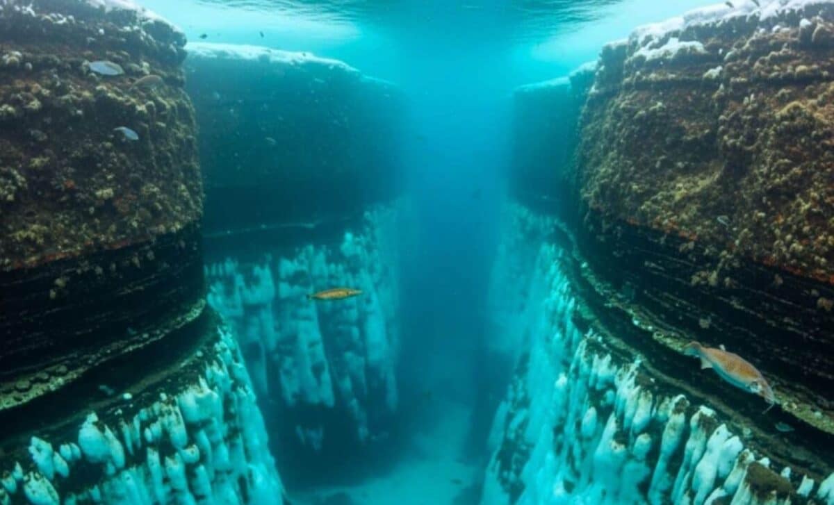
A new map of Antarctica’s seafloor reveals a vast and previously overlooked network of 332 submarine canyons, some plunging more than 4,000 meters. The findings provide an unprecedented view into how the continent’s underwater topography shapes ice dynamics, ocean circulation, and global climate behavior.
Published in Marine Geology, the study is the most complete analysis of Antarctic submarine canyon systems to date. Researchers from the University of Barcelona and University College Cork used high-resolution bathymetric data and advanced geomorphometric techniques to document a hidden landscape that is five times more complex than previously thought.
These canyon systems are not dormant relics of past glaciation. They serve as active conduits for heat, sediment, and nutrient transport, and they critically influence where and how ice shelves melt, especially from below. The findings also call into question the accuracy of current sea-level rise projections, many of which rely on models that treat the Antarctic seafloor as relatively flat and undifferentiated.
According to study co-author David Amblàs, “Some of the submarine canyons we analysed reach depths of over 4,000 metres. The most spectacular of these are in East Antarctica, which is characterized by complex, branching canyon systems”.
East and West Antarctica Reveal Diverging Geological Histories
The research identifies a clear structural contrast between East and West Antarctica. In the east, the canyon networks are longer, branched, and feature U-shaped cross sections—indicators of long-term stability under persistent ice-sheet coverage. These systems are thought to have developed through prolonged glacial activity and high sediment accumulation.
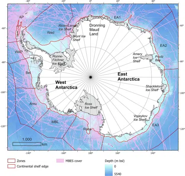 Overview of the study area, with zone subdivision and extent of the MBES cover. Credit: Marine Geology
By contrast, West Antarctic canyons are steeper, shorter, and more linear, with V-shaped profiles pointing to more recent and episodic glacial behavior. This geomorphological difference offers support for the theory that the East Antarctic Ice Sheet formed earlier and has experienced more stable development over geological timescales.
“It was particularly interesting to see the differences between canyons in the two major Antarctic regions, as this hadn’t been described before,” said Riccardo Arosio, the study’s co-author.
This east-west divide aligns with observational data showing greater vulnerability in West Antarctica, where rapid ice loss has been documented in sectors like the Amundsen Sea and Thwaites Glacier.
Seafloor Canyons Accelerate Melting From Below
The canyons are more than static features—they’re part of a live exchange system between Antarctica and the global ocean. These deep valleys act as vertical corridors, allowing cold, dense shelf water to descend into the Southern Ocean, while enabling warmer, deeper waters—such as Circumpolar Deep Water—to travel upward beneath floating ice shelves.
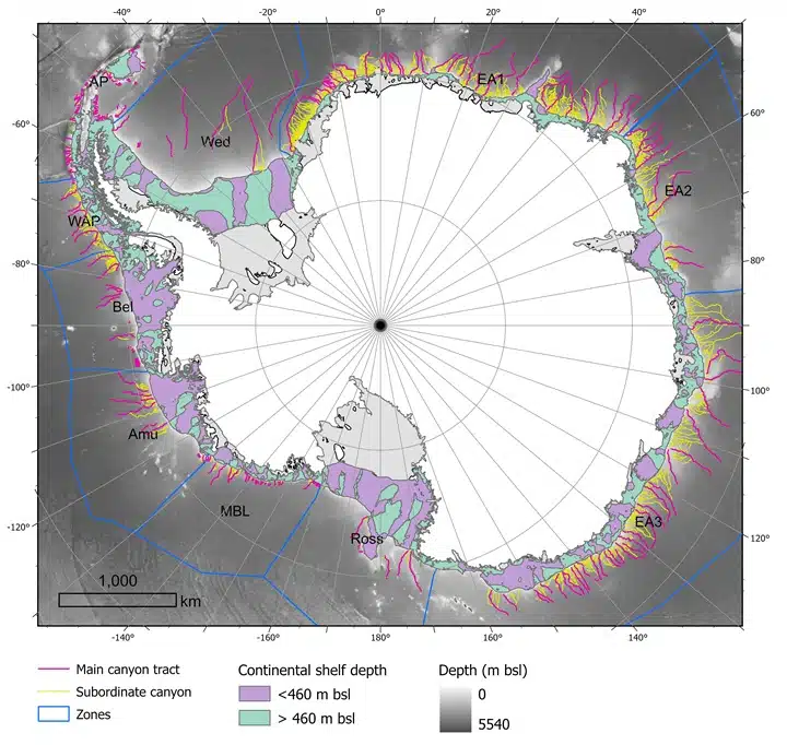 Overview of the results of the drainage mapping for this study. Credit: Marine Geology
This two-way circulation fuels basal melting, a major mechanism behind the destabilization of ice shelves. According to the University of Barcelona, “This process is one of the main mechanisms that drives the basal melting and thinning of floating ice shelves, which are themselves critical for maintaining the stability of Antarctica’s interior glaciers.”
Once these ice shelves weaken or collapse, glaciers behind them flow more quickly into the ocean, directly contributing to global sea-level rise. The configuration and slope of the submarine canyons determine how much warm water reaches vulnerable shelf bases—and how rapidly that heat is delivered.
These dynamics also govern the formation of Antarctic Bottom Water, a cold, dense water mass that drives global thermohaline circulation and plays a central role in stabilizing the Earth’s climate system.
Missing From Models, but Central to Climate Outcomes
Despite their significance, these canyon systems have been almost entirely absent from climate models used to forecast ice-sheet behavior and global sea-level change. Many models treat the Antarctic continental margin as a smooth slope, omitting key processes such as current channelling, vertical water mixing, and deep-ocean ventilation.
The study argues that this omission is not a small oversight. These canyon structures may control whether meltwater from inland glaciers quickly escapes into the ocean—or remains trapped behind ice shelves, slowing the rate of sea-level rise. The new data is especially relevant for improving regional and global simulations.
“These processes… are essential for the formation and transformation of cold, dense water masses like Antarctic Bottom Water,” Amblàs explains.
The bathymetric model used in the study, based on IBCSO v2, achieves a resolution of 500 meters per pixel, significantly finer than previous versions that averaged between 1–2 kilometers. This higher resolution allowed researchers to apply a semi-automated GIS protocol that measured 15 morphometric parameters for each canyon system.
Only 27 Percent of the Seafloor Is Mapped
While the new data reshapes what we know about Antarctic geography, it also exposes how much remains unknown. According to the Seabed 2030 Project, just 27% of the world’s ocean floor has been mapped in high resolution—and polar regions are among the least covered.
In Antarctica, much of the continental shelf remains obscured beneath floating ice, where sonar mapping is difficult and expensive. To address this, the researchers developed scalable tools that can automate the identification and classification of submarine features using limited data, with potential applications in other glaciated regions like the Arctic and South Georgia.
Arosio emphasized the broader scientific implications: “Thanks to the high resolution of the new bathymetric database… we could apply semi-automated techniques more reliably to identify, profile and analyse submarine canyons”.
The study’s authors argue that ongoing improvements in bathymetric mapping—combined with in situ observation and updated modeling—are essential to refining predictions about ice-sheet retreat, ocean circulation, and climate thresholds.