
While Michigan’s Upper Peninsula will start feeling the effects of our strong Thanksgiving Week storm system on Tuesday, most of the Lower Peninsula won’t see the temperatures plunge and the winds pick up until Wednesday. That’s when the lake effect snow will move in, too.
The forecast shows this incoming snow and Wednesday’s strong winds – some gusts could hit 60 mph – will impact holiday travel across West Michigan, Mid-Michigan and Southeast Michigan.
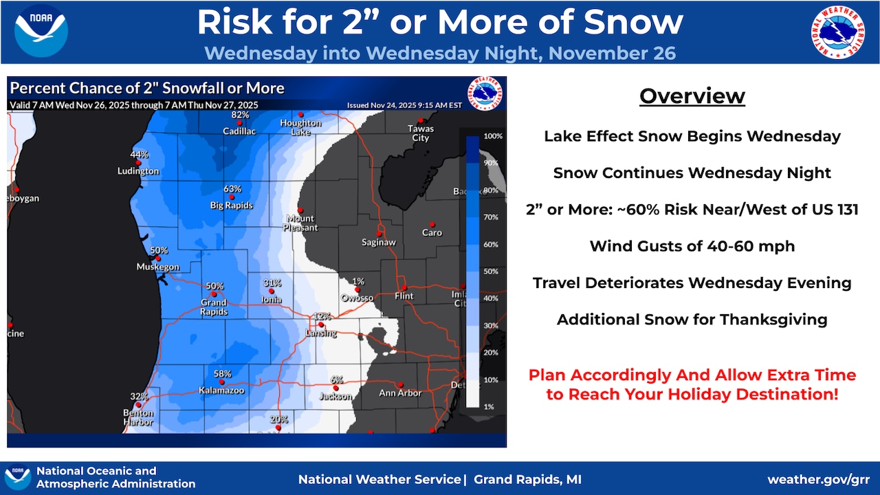
Here are some of the forecast highlights for the Lower Peninsula, shared by the National Weather Service offices in Grand Rapids and Detroit:
Rain early Wednesday morning will quickly change over to snow by midday.Lake effect snow will develop and be blown well inland by afternoon and into the evening.Temperatures that start out in the 40s early Wednesday morning are forecast to fall to 32 degrees by late afternoon. After that, temps will stay in the upper 20s.Wind gusts are expected in the 40 to 50 mph range on Wednesday. Gusts up to 60 mph are possible along the Lakeshore. Wind gusts this high can lead to power outages.The snow and high wind gusts will combine to lead to worsening travel conditions by Wednesday evening and into the overnight hours. Areas near and west of U.S. 131 could see more than 2 inches of snow on Wednesday and into early Thursday.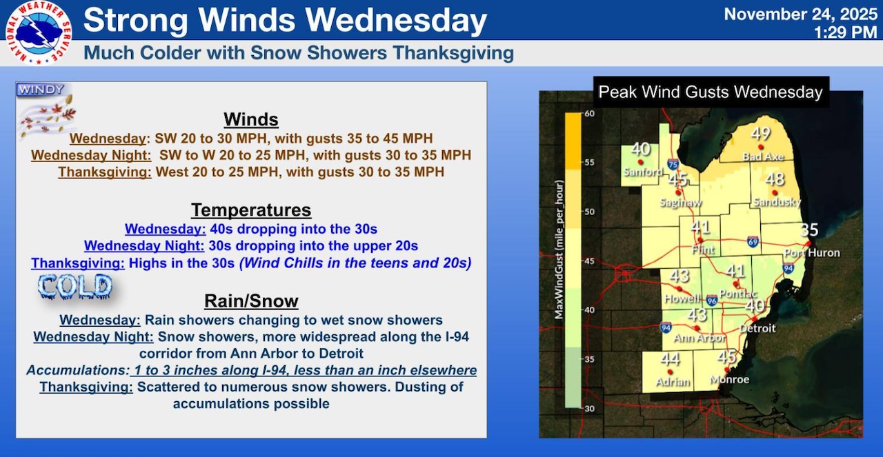 High wind gusts will kick in on Wednesday and snow will start to accumulate in some areas across the Lower Peninsula.Graphic provided by the National Weather Service
In Southeast Michigan and The Thumb, rain is expected to change to heavy, wet snow on Wednesday. On Wednesday night, these show showers could become more widespread, especially along I-94 from Ann Arbor to Detroit. This area could see up to 3 inches of snow by Thursday.
Across the Lower Peninsula, the snow is expected to continue on Thursday.