
NASA is set to launch a groundbreaking satellite next week as part of a mission that’s more than a decade in the making.The NASA Indian Space Research Organization (NASA-ISRO) NISAR Mission is scheduled to launch from Sriharikota, India, on July 30.Shanna McClain, disasters program manager for NASA’s Earth Sciences Division, told 11 News that NISAR will be able to help inform about a variety of issues, from floods to fires to food security.”NASA and the Indian Space Research Organization have been working for over 10 years together to build this collective mission. So, two sides of the world, two partners, one single idea,” McClain told 11 News.The radar mission has a satellite with two eyes that are critical for understanding changes on Earth.”What we are doing is sending beams of light, photons down to the Earth. These photons, they hit different things on the Earth — surface, trees, buildings, roads — and they bounce back and at different levels,” McClain told 11 News.The technology can even see floods through thunderstorms.”One of the eyes is the S-band radar, a short band; this helps us see through cloud cover and tree cover and really understand what’s happening on the ground,” McClain told 11 News.The other eye is the L-band, or long-band radar, that helps understand changes happening underground.”We can get insights on soil moisture, which is critical for crop production, right? Is there enough water in the soil? Or, are we in a water-scarce environment? But it can also answer questions about landslides, earthquakes and a lot of other hazards,” McClain told 11 News.This is the largest data-collection mission that NASA has ever pursued. It involves multiple petabytes of data; for reference, one petabyte is 1,024 terabytes.Entire teams have been dedicated to answering the question: How do you comb through all that data?”There are a number of science teams that are working to build products, like information turning the data into actual insights and information that can be used,” McClain told 11 News.McClain told 11 News that all the data will be openly available on NASA’s data-archive systems, helping to gain insights on how to recover after disasters and make communities more resilient.”I’m really excited about the opportunity to better understand the risk to natural hazards across the United States before we end up in a situation of disaster,” McClain told 11 News.The satellite launch can be seen from India on NASA+.
WASHINGTON —
NASA is set to launch a groundbreaking satellite next week as part of a mission that’s more than a decade in the making.
(We’ll) better understand risks to natural hazards … before we end up in a situation of disaster.
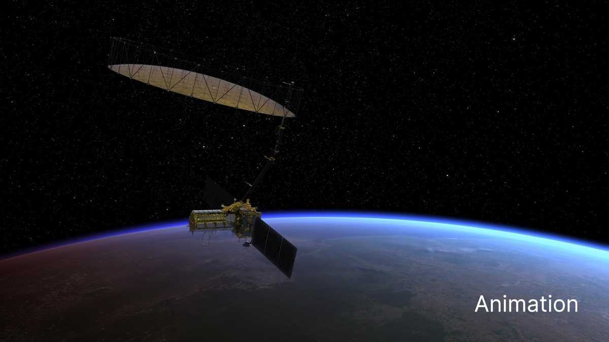
The NASA Indian Space Research Organization (NASA-ISRO) NISAR Mission is scheduled to launch from Sriharikota, India, on July 30.
Shanna McClain, disasters program manager for NASA’s Earth Sciences Division, told 11 News that NISAR will be able to help inform about a variety of issues, from floods to fires to food security.
“NASA and the Indian Space Research Organization have been working for over 10 years together to build this collective mission. So, two sides of the world, two partners, one single idea,” McClain told 11 News.
The radar mission has a satellite with two eyes that are critical for understanding changes on Earth.
“What we are doing is sending beams of light, photons down to the Earth. These photons, they hit different things on the Earth — surface, trees, buildings, roads — and they bounce back and at different levels,” McClain told 11 News.
The technology can even see floods through thunderstorms.
“One of the eyes is the S-band radar, a short band; this helps us see through cloud cover and tree cover and really understand what’s happening on the ground,” McClain told 11 News.
The other eye is the L-band, or long-band radar, that helps understand changes happening underground.
“We can get insights on soil moisture, which is critical for crop production, right? Is there enough water in the soil? Or, are we in a water-scarce environment? But it can also answer questions about landslides, earthquakes and a lot of other hazards,” McClain told 11 News.
This is the largest data-collection mission that NASA has ever pursued. It involves multiple petabytes of data; for reference, one petabyte is 1,024 terabytes.

NASA Animation
This is the largest data-collection mission that NASA has ever pursued. The radar mission has a satellite with two eyes that are critical for understanding changes on Earth.
Entire teams have been dedicated to answering the question: How do you comb through all that data?
“There are a number of science teams that are working to build products, like information turning the data into actual insights and information that can be used,” McClain told 11 News.
McClain told 11 News that all the data will be openly available on NASA’s data-archive systems, helping to gain insights on how to recover after disasters and make communities more resilient.
“I’m really excited about the opportunity to better understand the risk to natural hazards across the United States before we end up in a situation of disaster,” McClain told 11 News.
The satellite launch can be seen from India on NASA+.