
Here’s a look at how and when the snowstorm winds down. There is a small, important travel area in Michigan that will remain dangerous.
The snowstorm and the area of widespread snow will rapidly shrink in coverage between 9 a.m. and noon today. While this wind-down is the widespread “system snow,” a small and intense lake-effect snow area will develop at the very southwest corner of Lake Michigan. The data shows what we meteorologists call a “lake-induced, mesoscale vortex” will develop along Michigan’s Lake Michigan shoreline and blast the far southwest corner with localized heavy snow after most of you assume the snowstorm is over.
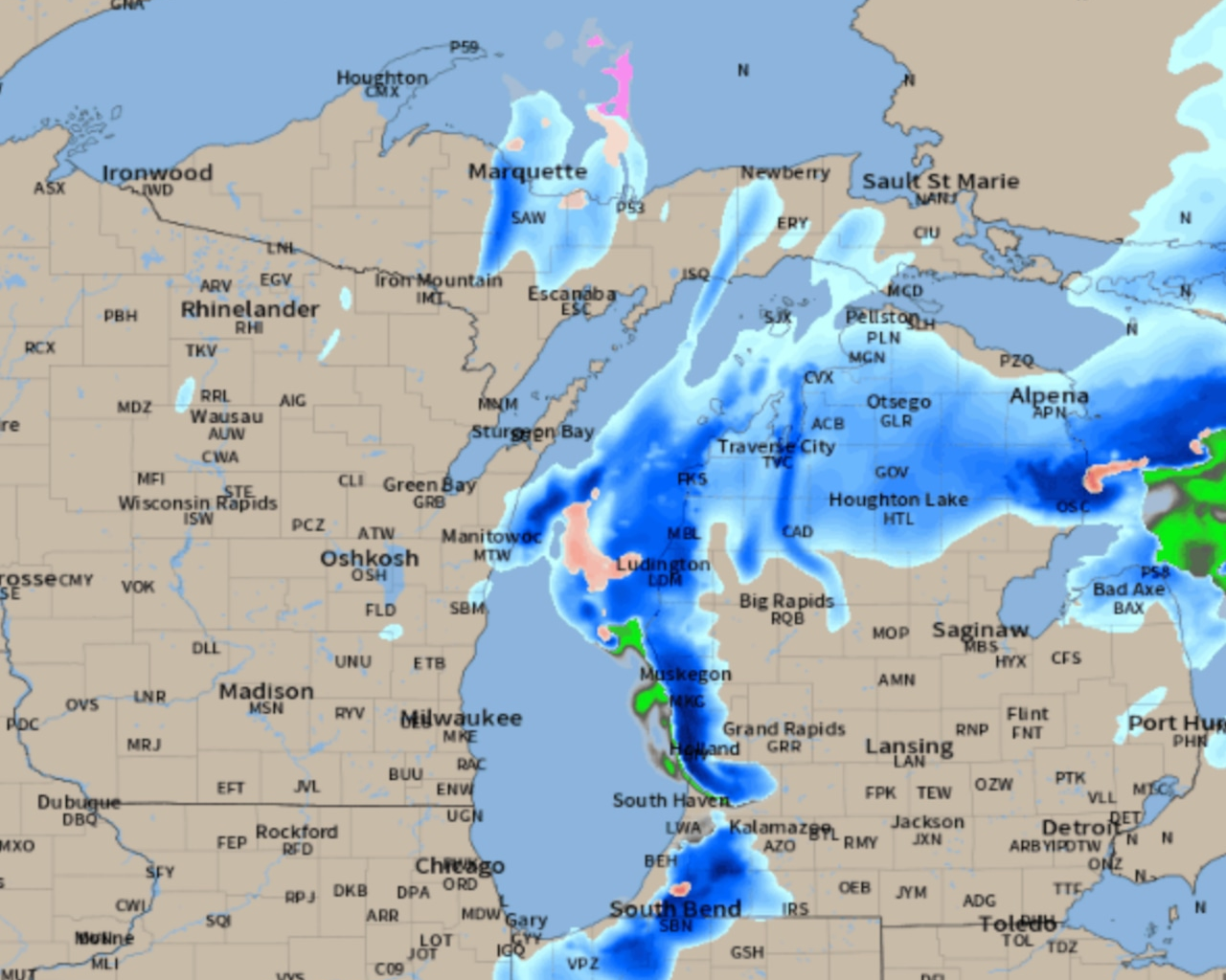
Let’s handle this in two parts. The first part is the winding down of the widespread snow. Here is the radar forecast from 7 a.m. to noon today. You should get the idea that waiting to drive until late morning for the snow to end in most areas is a good idea.
 Radar forecast from 7 a.m. to noon today, November 30.NOAA
Here is the additional snowfall expected from 7 a.m. to the end of ALL of the snow. This includes a 4″-8″ burst of snow in an isolated, heavy, dangerously placed lake-effect snow at the southwest corner of Lower Michigan. There is also going to be another 3″-5″ in the Traverse City area today. Otherwise the rest of us have less than 2″ more snow to go, and it’s over for most of us between 9 a.m. and 11 a.m.
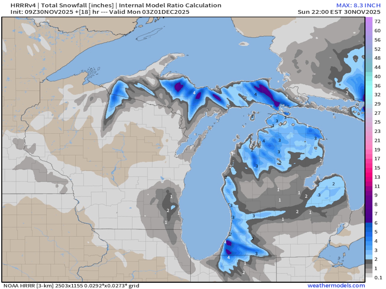 Total additional snowfall from 7 a.m. through 10 p.m. today, November 30.NOAA
Here is what I feel is the most important map I can show you for driving safety- the temperature forecast at 1 p.m. The southern half of Michigan should warm to freezing or a degree or two above freezing around noon to 1 p.m. Snow on roads melts very quickly at 33 degrees. Don’t get in a hurry this morning. Let some sun and above-freezing temperatures make the roads much safer for you in the afternoon.
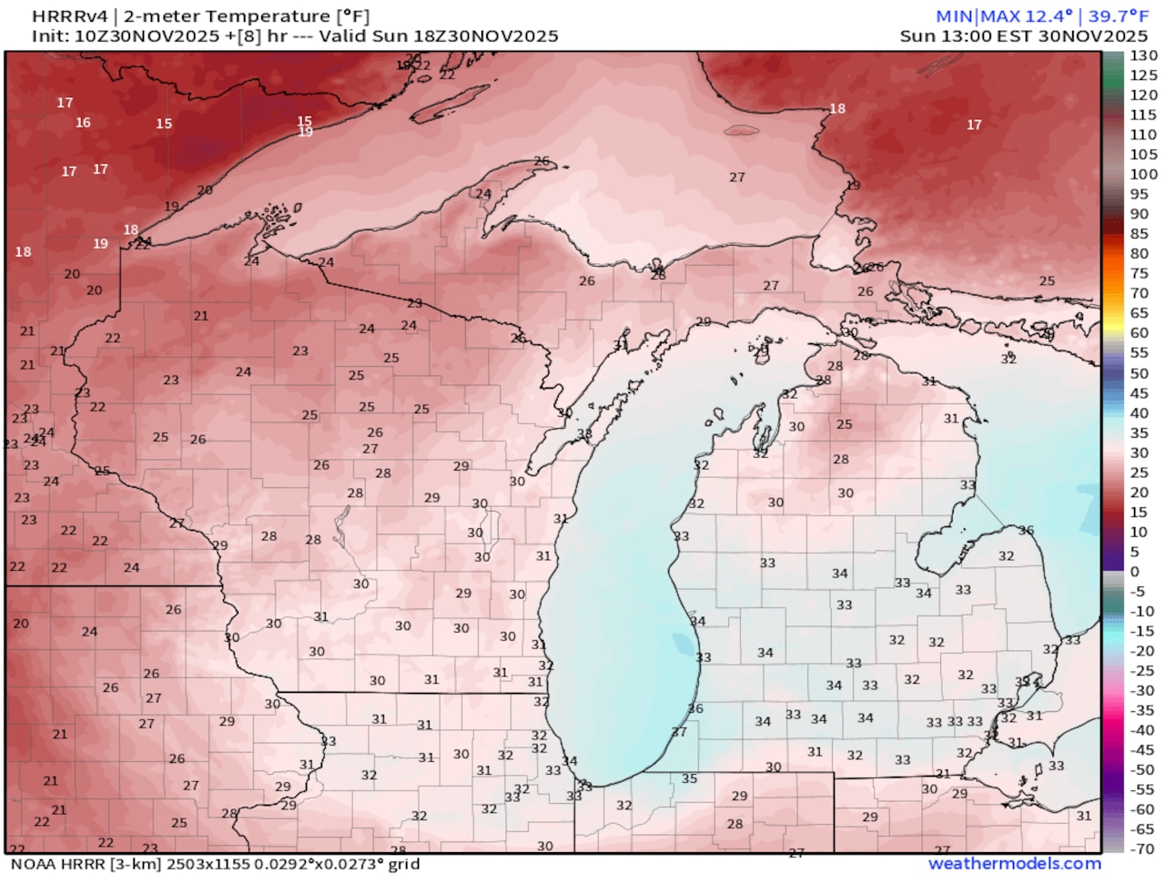 Temperature forecast at 1 p.m. shows much of the southern half of Lower Michigan will warm to 32 to 34 degrees.NOAA
The exception is far southwest Lower Michigan as you head into Indiana. In the late afternoon, a circular area of heavy snow will move off Lake Michigan and into that very southwest corner. To avoid this short, but dangerous stretch, take any route more inland instead of I-196 and I-94 in the last 30 miles of Michigan. If you are heading toward Chicago, drop south to I-90 using U.S. 131 or I-69.
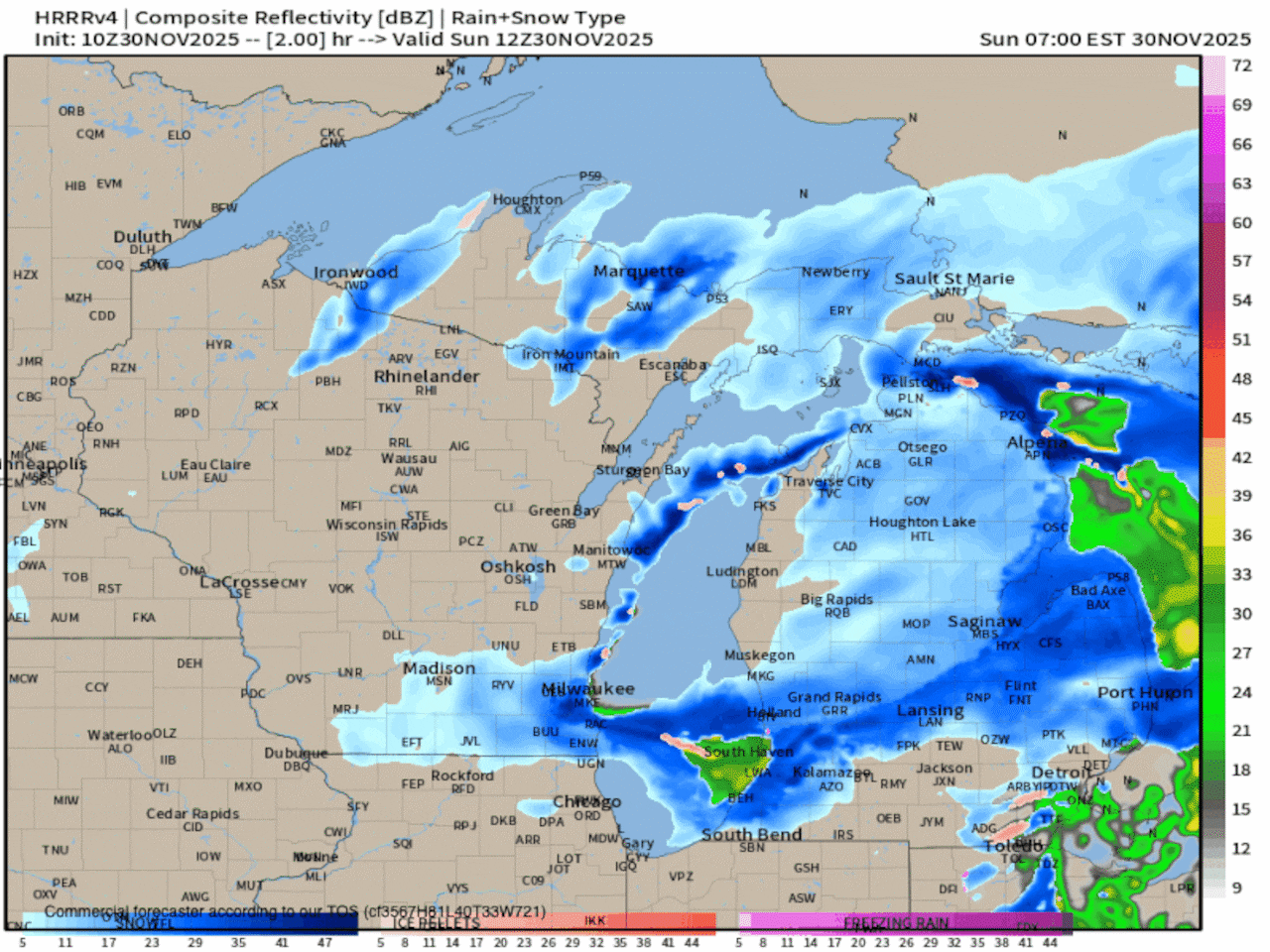
Here’s the radar forecast, focusing on that swirling burst of lake-effect snow.
 Radar forecast from 1 p.m. to 10 p.m. today, November 30. This focuses on the heavy lake-effect expected this afternoon.NOAA
You will minimize the drive through that heavy lake-effect burst late this afternoon and evening.
If you wait until the snow is over and the temperature warms up above freezing, the roads shouldn’t be horrible.
Winter is just getting going. Stay updated with Michigan’s sometimes dangerous weather at MLive.com/weather.