
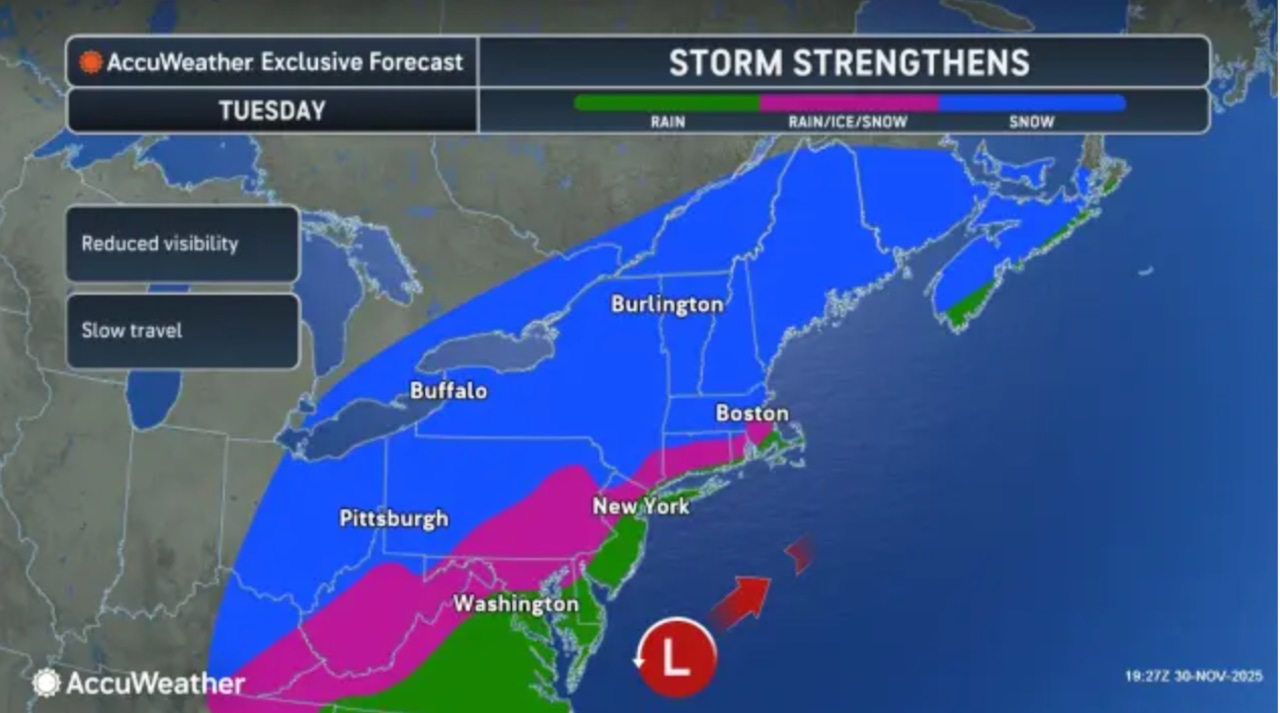
A coastal storm could bring the first accumulating snowfall of the season for much of New Jersey on Tuesday, with northwestern counties getting 2 to 7 inches of snow.
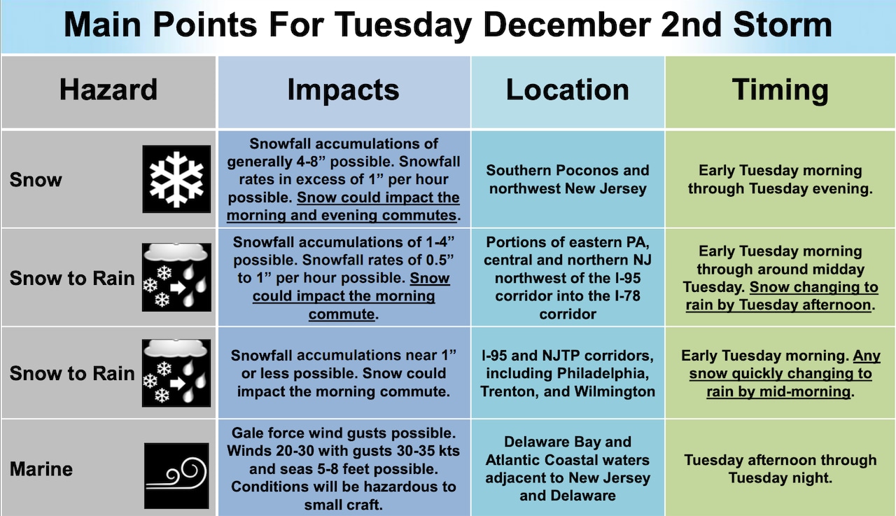
The National Weather Service has issued a winter storm watch for Sussex County from late Monday through Tuesday evening.
“Travel could be very difficult,” the weather service said in the alert. “The hazardous conditions could impact the Tuesday morning and evening commutes.”
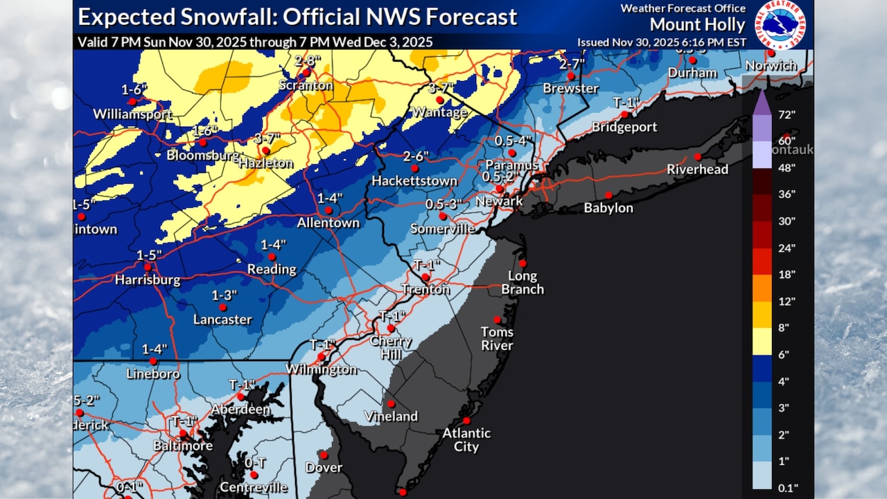
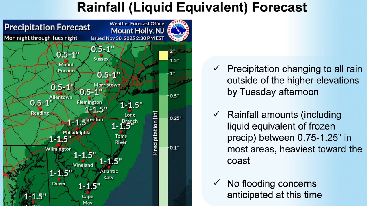
The latest forecast calls for 4 to 7 inches of snow in Sussex County, especially at higher elevations. Snowfall rates of 1 to 2 inches per hour are possible at times.
 Northwestern New Jersey could get 2 to 7 inches of snow on Tuesday, with the highest amounts expected in Sussex County. Much of the state should stay warm enough for heavy rain to fall through the day.AccuWeather.com and National Weather Service
Forecasters said that subtle shifts in the storm track could significantly alter snowfall amounts and the rain-snow line location.
“Confidence in snowfall amounts still remains relatively low at this time,” the weather service said in Sunday evening.
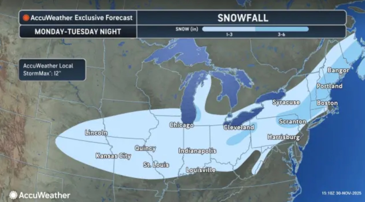
Precipitation will spread across New Jersey from west to east Tuesday morning.
 Northwestern New Jersey could get 2 to 7 inches of snow on Tuesday, with the highest amounts expected in Sussex County. Much of the state should stay warm enough for heavy rain to fall through the day.AccuWeather.com and National Weather Service
Areas just southeast of Interstate 78, including portions of Warren, Hunterdon, and western Morris counties, could see 2 to 5 inches of snow before transitioning to rain, the weather service said.
AccuWeather’s forecast map has a similar outlook with the northwestern corner of the state getting 3 to 6 inches of snow surrounded by a band of 1 to 3 inches.
 Northwestern New Jersey could get 2 to 7 inches of snow on Tuesday, with the highest amounts expected in Sussex County. Much of the state should stay warm enough for heavy rain to fall through the day.AccuWeather.com and National Weather Service
The immediate I-95 corridor and coastal regions will likely receive all rain, with totals of up to 1.5 inches.The heaviest precipitation is expected Tuesday afternoon before the storm moves away Tuesday evening.
Temperatures Tuesday will range from the lower 30s inland to the mid 40s along the Jersey Shore.
 Northwestern New Jersey could get 2 to 7 inches of snow on Tuesday, with the highest amounts expected in Sussex County. Much of the state should stay warm enough for heavy rain to fall through the day.AccuWeather.com and National Weather Service
Ahead of the storm, light rain will end across New Jersey Sunday evening as a cold front passes through, bringing gusty northwest winds of 20 to 25 mph overnight.
Temperatures will drop into the upper 20s to lower 30s by Monday morning.
Monday will be dry and cold with high pressure building in, bringing mostly clear skies and highs in the upper 30s to lower 40s.
After Tuesday’s storm, high pressure returns Wednesday with clearing skies but continued cold temperatures about 10 degrees below normal.
A dry cold front will pass through Thursday, ushering in an even colder airmass Thursday night into Friday.
Lows Thursday night could drop into the single digits across interior sections.
High temperatures will remain in the 30s to lower 40s through the end of the week.
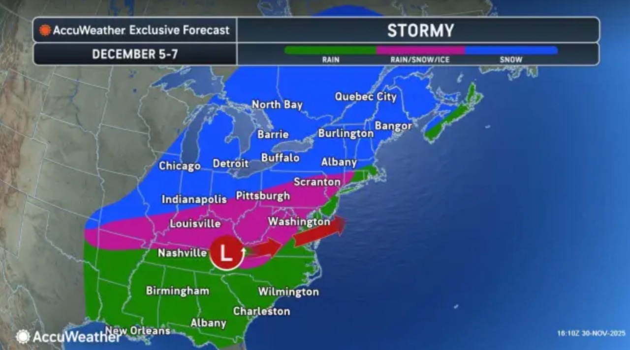
Another storm system may impact New Jersey next weekend, though there remains considerable uncertainty about the track and precipitation type at this time.
 Another winter storm is possible next weekend, forecasters say.AccuWeather.com and National Weather ServiceCurrent weather radar
