
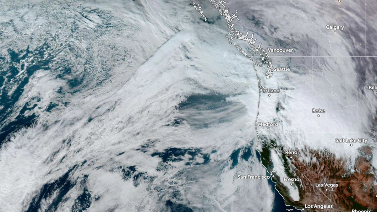
Multiple atmospheric rivers (ARs) are forecast to impact the Pacific Northwest through the middle of next week, with persistent rainfall forecast to lead to widespread riverine flooding, according to the Center for Western Weather and Water Extremes (CW3E).
The first AR began impacting the region on December 5, as it moved over coastal Oregon and the Pacific Northwest.
The second AR, forecast to move onshore early Monday, December 8 (LT), is expected to be much stronger and sustain AR conditions for more than 72 hours, creating the highest flood potential on December 9–10.
Model analyses show a robust subtropical moisture plume directed toward the region along the northern edge of a persistent offshore high-pressure ridge.
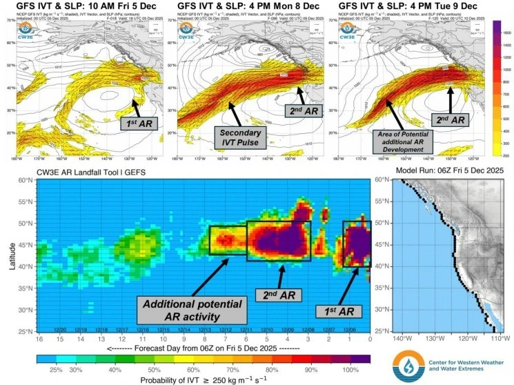 Image credit: CW3E
The second AR includes two pulses of moisture, with the second pulse potentially exceeding 1 000 kg m⁻¹ s⁻¹ early on Wednesday, December 10.
GEFS and ECMWF ensemble control members forecast AR4 to AR5 conditions (based on the Ralph et al. 2019 AR Scale) for parts of Washington. In southern coastal Washington, ~70–80% of both GEFS and EPS members are forecasting at least AR4 conditions, while ~20–30% of both GEFS and EPS members are forecasting AR5 conditions.
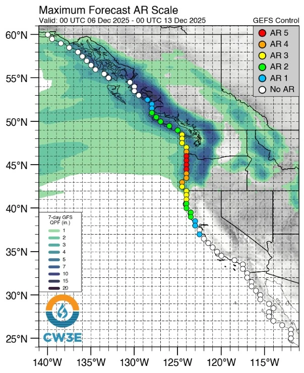 Image credit: CW3E
Rainfall totals of 100–180 mm (4–7 inches) are forecast across much of western Washington and Oregon. Totals of over 250 mm (10 inches) are forecast in the Olympic Peninsula, coastal ranges, and windward slopes of the Washington Cascades, where westerly IVT will enhance orographic precipitation.
Ensemble mean precipitation for the Duwamish watershed is forecast at around 210 mm (8.4 inches), which is more than 10% of its normal annual total.
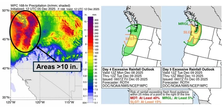 Image credit: CW3E
At least two river gages are forecast to exceed major flood stage, five moderate, eight minor, and twenty-six at action or bankfull stages across Washington and Oregon.
Freezing levels are forecast to fall to approximately 1 200 m (4 000 feet) on December 6 with the first system, then rise toward 1 800 m (6 000 feet) during the second AR beginning on December 8. Precipitation below these elevations is expected to be mostly liquid, limiting substantial snowpack to the highest elevations of the Cascades and Olympics.
Probabilistic guidance from CW3E shows a 60–80% chance of additional AR activity over the Pacific Northwest between December 11 and 13. Ensemble trends indicate somewhat higher precipitation potential from the ECMWF system compared with the GEFS along the coast and northern Cascades.
The Weather Prediction Center (WPC) has issued marginal (≥5%) and slight (≥15%) excessive rainfall outlooks for portions of western Washington and Oregon for December 8–10.
The soil of much of the affected region is saturated from previous storms and will give rise to rapid runoff and flash floods in some areas.
References:
1 Quick Look at the Upcoming AR Activity over the Pacific Northwest – CW3E – December 5, 2025