
I’ve always taken an unnatural liking to maps. History class consisted of me looking around the classroom, observing the maps, the entire time. Whenever I’m at antique stores, I keep an eye out for old-world maps. Honestly, I think it comes from living in Michigan, where our state’s outline is one of the few that stand out on its own.

So imagine my surprise when I found out there was a massive map of the United States mowed into the lawn just around the corner from me in Hagar Park in Jenison. However, you wouldn’t be able to fault me for not knowing it was there, considering it’s not exactly in its prime.
Ottawa County Parks Foundation via Facebook
Ottawa County Parks Foundation via Facebook
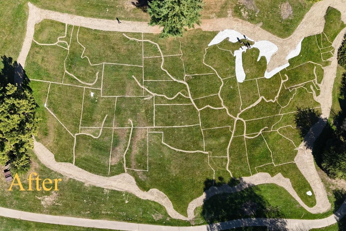
Over the years, the map went from detailed, with distinct borders for the 48 states, to a large field shaped like the country. There’s a good chance it would have stayed that way, too, were it not for Eagle Scout Wyatt Nance of Troop 354, who took on remaking the map under his jurisdiction.
READ MORE: The Strange Second Life of Greenville’s First Meijer Supermarket
According to the Ottawa County Parks Foundation on Facebook, redoing all the state borders and cutting the grass took over 75 different people and required a surveying company to mark the new outlines and cut the grass away to redefine the park’s unique map.
Ottawa Countv Parks Foundation via Facebook
Ottawa Countv Parks Foundation via Facebook
The new map was completed on September 3rd and is far more detailed, with the major rivers throughout the Midwest distinct from state borders. It’s an impressive project that the community really came together to complete.
This will definitely be something to stop and see next spring.
Ludington State Park Construction Before and After
Gallery Credit: Tommy McNeill
Lyon Square in Downtown Grand Rapids Before and After
Construction on the remodeled Lyon Square has officially been completed after two years, and the $12 million project turned out fantastically. Here’s a side-by-side of the area.
Gallery Credit: Tommy McNeill