
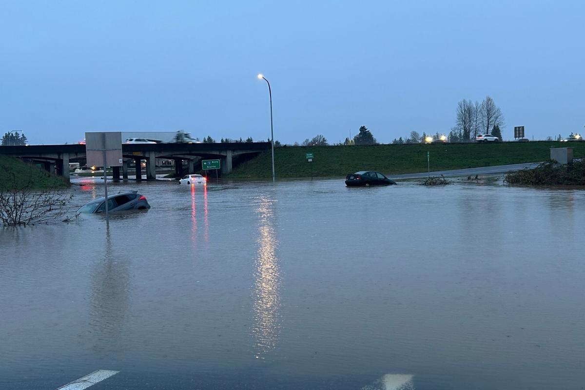
As Washington State experiences severe flooding as a result of atmospheric rivers and abnormally warm December temperatures, NOAA is predicting another atmospheric river to hit Washington.
NOAA: Atmospheric River Expected Early Next Week
READ MORE: Chelan County Declares State of Emergency
NOAA says there is a chance for another atmospheric river to hit the Pacific Northwest starting Monday. Forecast maps show a significant amount of rain tapering off on Tuesday, returning on Wednesday.
State Emergency and Evacuation Orders100,000immediate evacuation orders78,000 of them coming in Skagit County
Even across the mountains in Central Washington, Chelan County declared a state of emergency. U.S. 2 Stevens Pass remains closed due to multiple mudslides. The village of Stehekin has experienced damage that officials are still trying to grasp the extent of.
Flood Risks and River Levels
NOAA says the upcoming atmospheric rivers won’t quite be as potent as this week’s, but they could renew flood danger and will complicate cleanup efforts.
Soaked ground struggles to absorb heavy rain, so flash flooding and rapid river rises are more likely with new bouts of rain.
Light rain will move into the state Sunday, but it will be an appetizer for the Atmospheric River hitting Washington Monday.
CNN reports that a Level 2 of 4 risk of flooding rainfall is already in place for much of western Washington on Monday.
Preparing for Recovery Amid Ongoing Storms
Rivers in the region that rose over the weekend could quickly surge back to dangerous levels as rain falls, including portions of the Snohomish and Skagit rivers.
As the state continues to deal with the fallout of this week’s atmospheric river, the punches just keep coming from Mother Nature. Hopefully, this time, it won’t be as severe. Forecasts are subject to change, and we’ll continue to follow this story as it develops.