
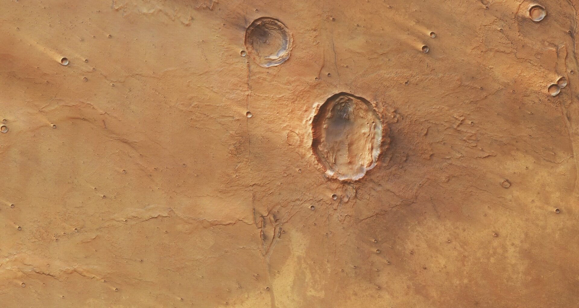
The crater, located in Idaeus Fossae within Mars’s northern lowlands, was formed by a shallow-angle impact that spread debris in two main directions instead of all around.
Unlike most Martian craters, which are circular and symmetrical, this one features two uneven wings and a rounded center. The odd shape was caused by a space rock that hit the surface at a low angle, creating what scientists refer to as a “butterfly crater.”
Rare Impact Formation Captured by Mars Express
The main pit of the crater stretches approximately 12 miles from east to west and around 9 miles from north to south. Two lobes of debris extend toward the lower left and upper right of the image. These wings appear rough, uneven, and poorly defined.
As reported by Earth.com, the texture of the surrounding material is unusually smooth in places, appearing rounded and softened. This suggests that the debris may have mixed with water or ice located beneath the surface. The heat from the impact likely melted this ice, briefly turning solid ground into fluidized material, a kind of flow that occurs frequently on Mars and points to the presence of frozen water underground.
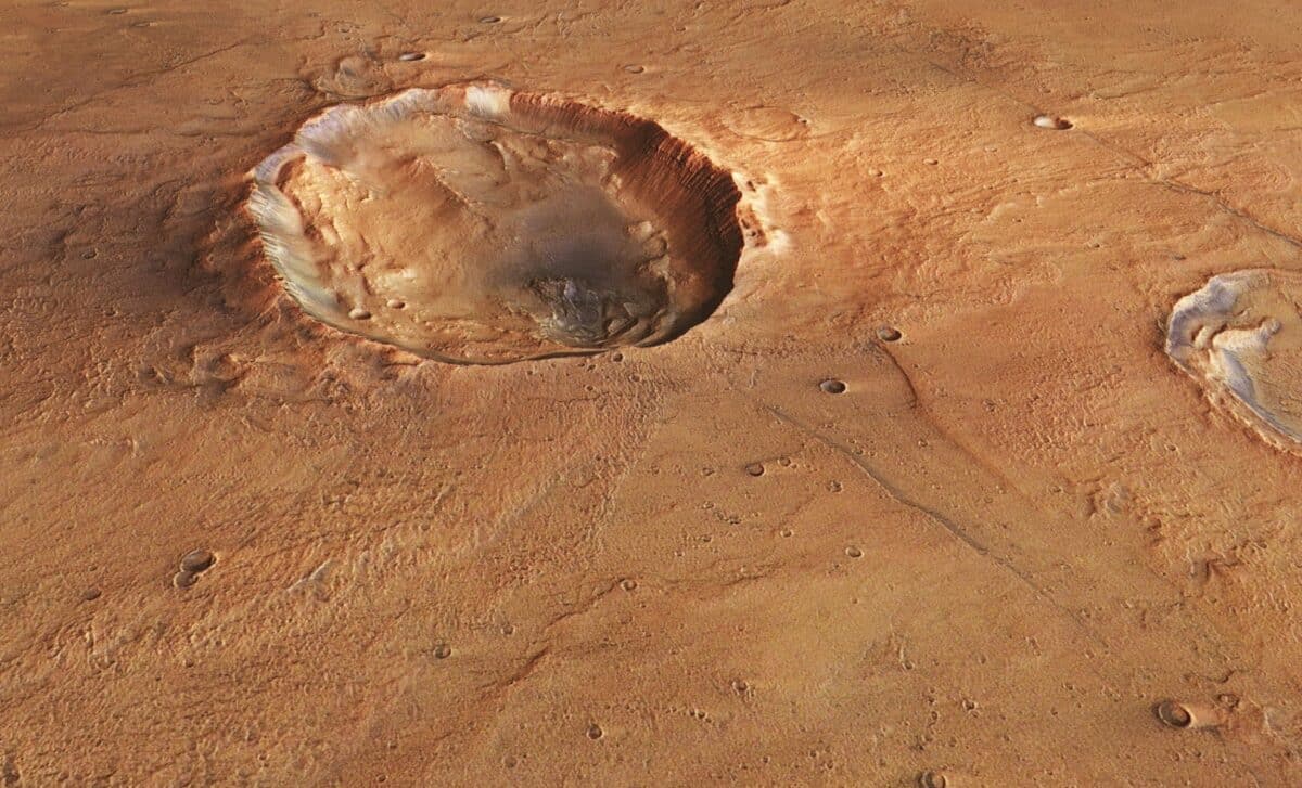 Computer generated images of a “butterfly” crater on Mars, which were created using data collected by the Mars Express orbiter – © ESA/DLR/FU Berlin
Volcanic History Visible in Surrounding Terrain
While the butterfly crater draws immediate attention, the surrounding region reveals evidence of Mars’s volcanic past. On one side of the scene, a group of steep, flat-topped hills, called mesas, stand out from the generally flat terrain. These mesas are the remnants of more extensive rock formations, with softer material around them having eroded over time.
Dark layers seen along the edges of the mesas resemble volcanic rock formations found on Earth, often composed of iron and magnesium. This indicates that the region likely experienced volcanic activity in the past. Lava and ash built up and were later buried, only to be exposed again through natural erosion.
The surface also shows long, folded features known as wrinkle ridges. These are formed when lava cools and contracts, causing the surface to crumple. Such features are evidence that volcanic processes shaped the region’s current landscape.
Fractured Landscape Shaped by Erosion and Collapse
The butterfly crater is part of a broader fractured landscape. The Idaeus Fossae region gets its name from a nearby system of valleys located just a few miles west of the crater. One large valley crosses the terrain clearly, while smaller ridges and channels are scattered across the area.
Nearby, a cliff about 1.2 miles high marks the edge of the Tempe Terra plateau. The combination of valleys, ridges, and steep escarpments gives the area a fractured and unsettled appearance, shaped by stress, collapse, and long-term erosion. These features provide context for the butterfly crater, framing it within a landscape that has been reshaped over millions of years.
A similar butterfly-shaped crater can be found in Hesperia Planum, a region far to the south. The presence of comparable craters in different areas supports the theory that these shapes are caused by the angle of impact rather than local surface characteristics. The images were taken by the Mars Express spacecraft, which has been orbiting Mars since 2003, mapping the surface in color and 3D.