
LOS ANGELES (KABC) — Record-setting rain this season has pushed California completely out of the “abnormally dry” category on the U.S. Drought Monitor for the first time in 25 years, as a series of storms delivered one of the wettest starts to the water year across the state.
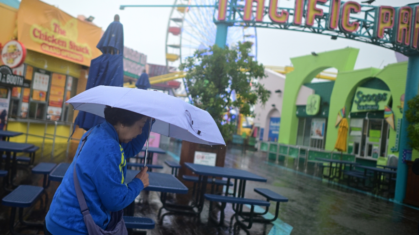
Southern California saw a notably soggy holiday period, with rain on Christmas Eve and Christmas marking the fourth-wettest two-day holiday stretch on record.
Recent storms have helped drive the region into one of its wettest openings to a water year.
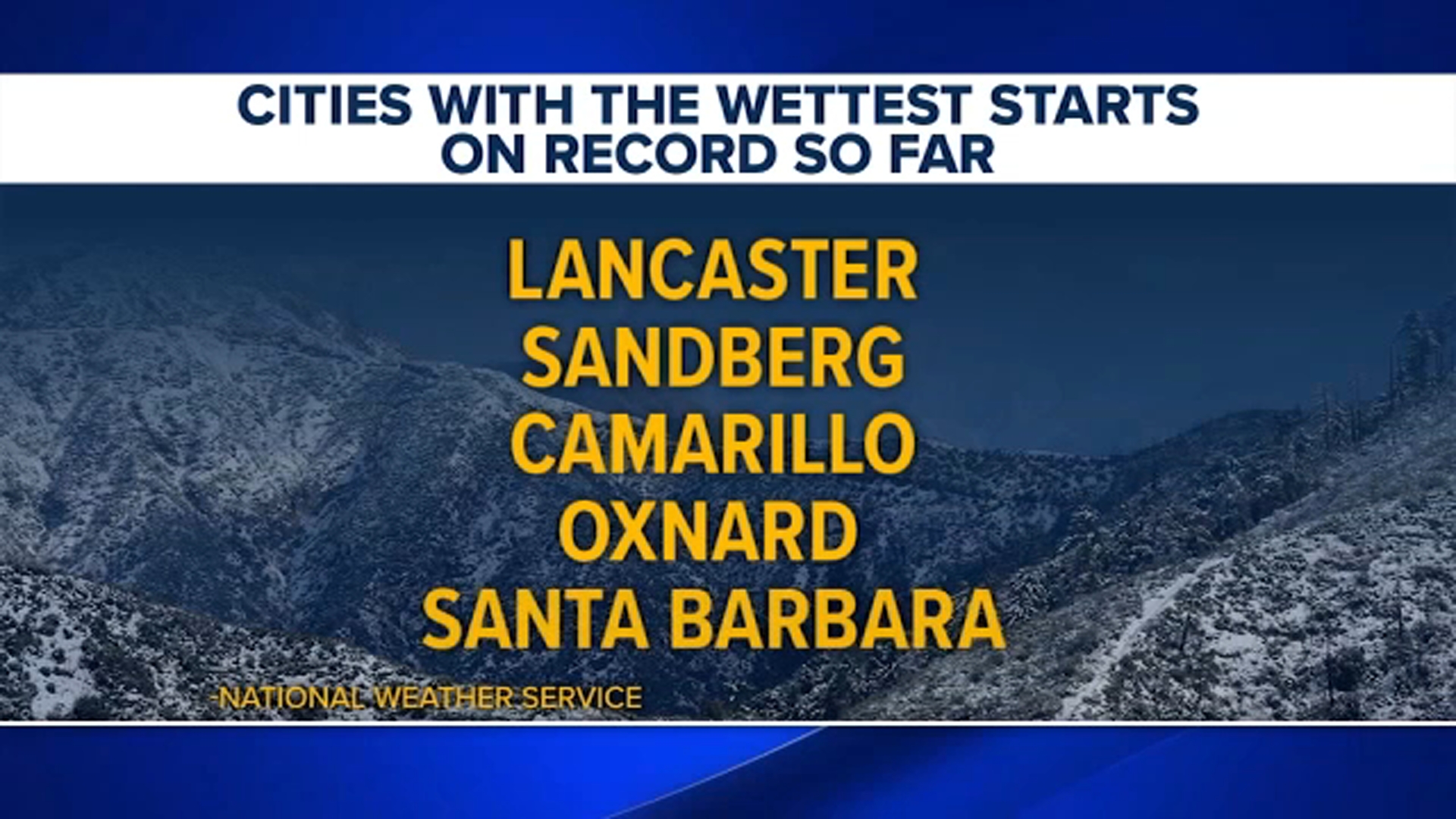
Data from the National Weather Service in Oxnard shows that, as of last week, all official climate sites were within the top five wettest starts to a water year. For several cities – including Lancaster, Sandberg, Camarillo, Oxnard and Santa Barbara – it has been the wettest start on record.
All climate sites have already received more than 70% of their normal full-season rainfall totals. Some mountain areas have seen close to two feet of rain in recent months, with isolated locations recording even more.
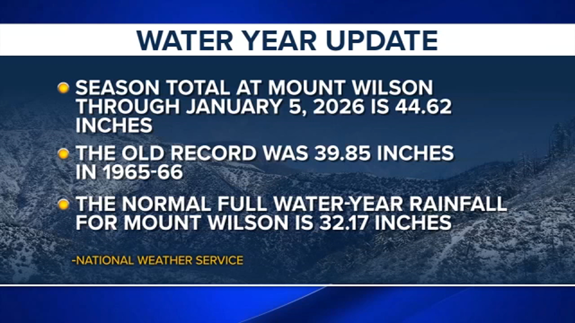
Mount Wilson experienced one of the most dramatic surges. As of Jan. 5, it had received nearly 45 inches of rain – the most ever recorded at the site through that date since recordkeeping began in 1949. The previous record, set in the 1960s, was about five inches lower.
With a normal full water-year total just over 32 inches, Mount Wilson has already reached 139% of its typical seasonal rainfall.
Many areas have either matched or surpassed their average full-season rainfall totals, despite months remaining in the wet season. January is typically one of the region’s rainiest months, with February and March also contributing to yearly precipitation.
With the wettest months still ahead, the season’s already exceptional rainfall totals may continue to climb.
Copyright © 2026 KABC Television, LLC. All rights reserved.