
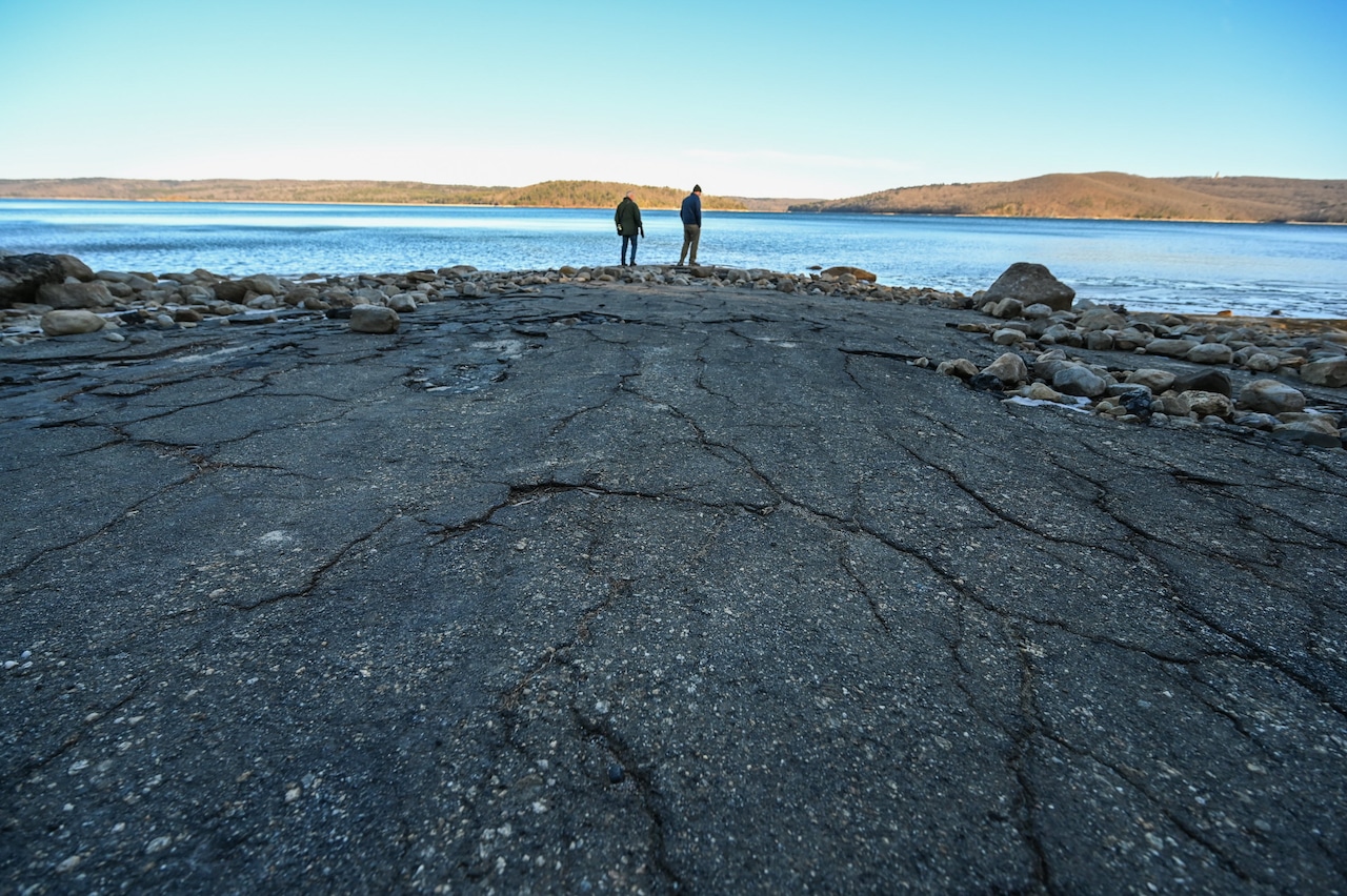
BELCHERTOWN — Old Enfield Road once took travelers to Enfield, Massachusetts, one of four towns that disappeared in the 1930s, making way for Quabbin Reservoir.
Today, a stretch of Old Enfield Road has reappeared, its Depression-era blacktop leading across a mudflat with water lapping a dozen yards downhill from where the shoreline normally is.
Water in Quabbin measures about 520 feet above sea level, this despite a little recent snowfall, according to measurements posted daily at the Quabbin’s Visitor Center. Normal lake levels are generally 10 feet higher, at 530 feet.
 Belchertown’s Ed Comeau shows a reporter how far the shoreline has receded at the Quabbin Reservoir. This section of Old Enfield Road used to be under water. (Steven E. Nanton / Special to The Republican)The Republican
That’s the lowest the water has been since 2017, according to figures posted online and as illustrated by a line chart on the Visitor Center’s wall.
But state officials say there’s no need for alarm. The reservoir is at about 81% of its capacity and within normal operating parameters, according to Massachusetts Water Resources Authority.
Demand averages about 208.82 million gallons per day. The reservoir has 334 billion gallons of water, according to the authority.
Now, the reservoir’s 181 miles of shoreline are ringed with brown.
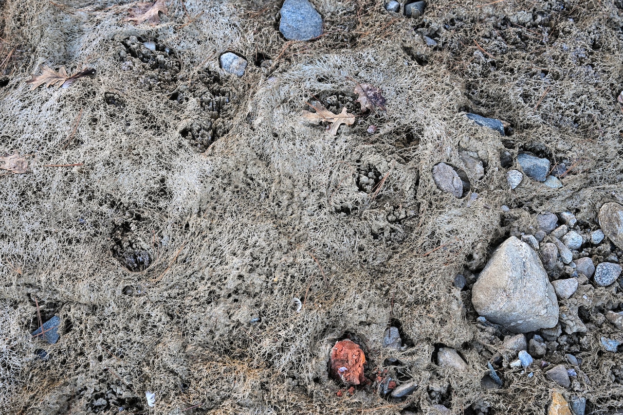
Neighbor Ed Comeau, of Belchertown, pointed out animal tracks and long-discarded bricks in the mudflat on Old Enfield Road, a popular spot for walks near Quabbin Park’s Gate 5, within sight of the Windsor Dam.
 This is exposed shoreline of the Quabbin Reservoir that formerly was under water. (Steven E. Nanton / Special to The Republican)The Republican
After an abnormally dry 2025, most of the area to the west of the Quabbin is in a mild drought, according to the state’s Executive Office of Energy and Environmental Affairs. But to the east, the drought status remains significant Level 2. To the north, the drought status is even more severe, at Level 4, considered an emergency.
There are other places on the reservoir, normally under water, where visitors can walk out to what used to be islands.
At Quabbin Park, the water at the spillway is below the numbered ruler-like sign visitors would use to gauge it.
Communities ringing the Quabbin now are questioning water use and stewardship of the reservoir.
“As far as I know, (there are) no water restrictions on users, unlike what has happened in many places out here. Amherst and Northampton were under drought restrictions,” said Bob Agoglia, chairman of the Pelham Select Board.
Pelham, like other Quabbin communities, is pushing for more support from the state water authority. Twelve communities — calling themselves the Quabbin Watershed Stewards — are beseeching the state and their Massachusetts neighbors to the east for more money from water users to compensate for the lost ability to grow.
“We believe that fellow community members in eastern Massachusetts would be willing to pay a few pennies more each month so that our children could have equitable access to public education, our residents could access public safety protections, and our families could drink water free of contaminants, the letter says. Agoglia is one of the signers.
He added that, “We are not asking for water from the Quabbin,” Agoglia said. “It doesn’t seem that they are all that worried about it. In fact, they’d like to sell more water.”
But he’d like to see more conservation. So would the other communities.
“When we face water restrictions during drought conditions, those restrictions are rarely matched by conservation measures in MWRA system communities,” the letter reads. “It would seem fair that when we are under drought conditions, water users should also be taking steps to safeguard the water we are sending east.”
And the authority’s drought response protocols are outdated, said state Rep. Aaron Saunders, D-Belchertown.
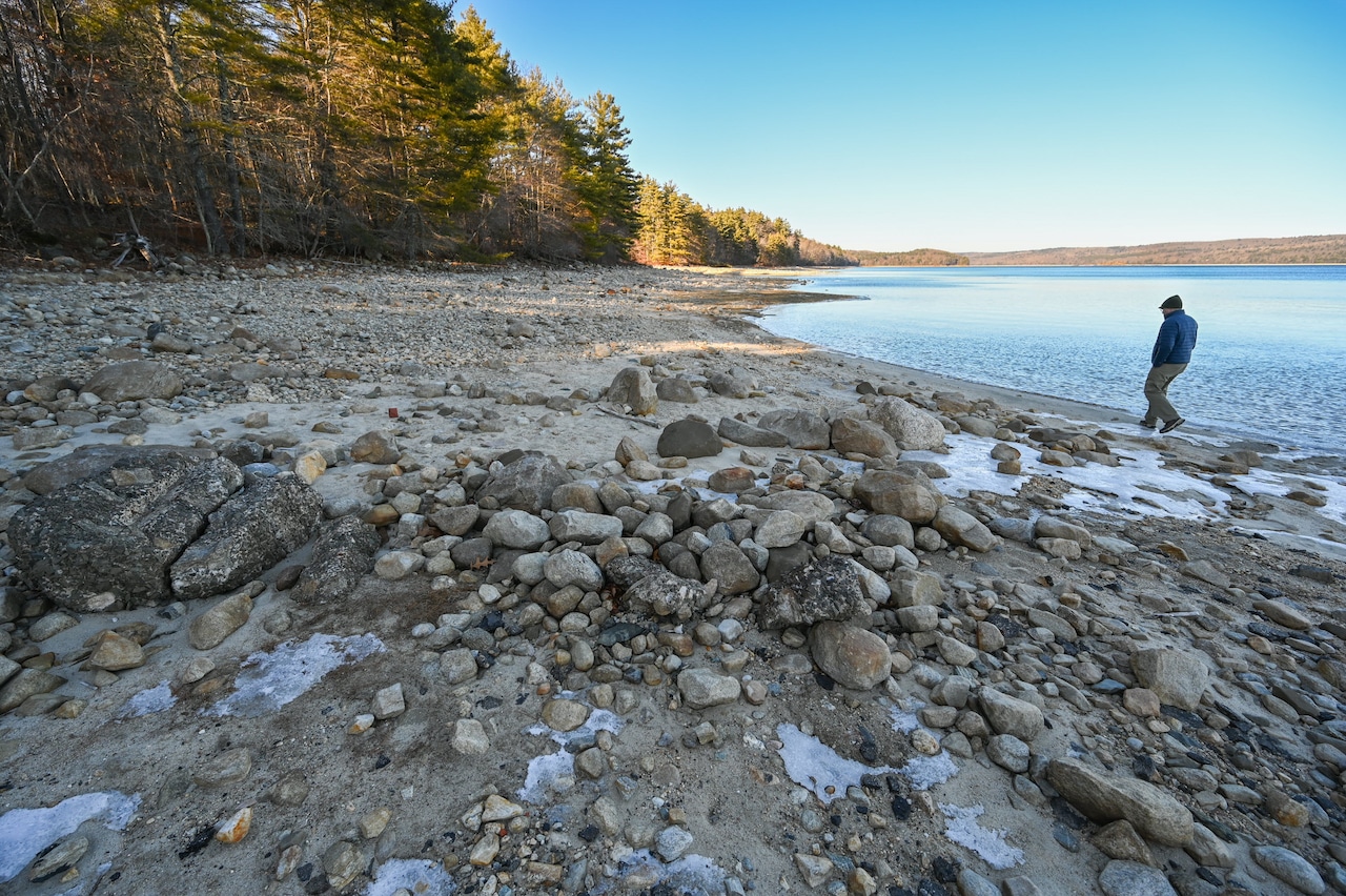 Ed Comeau walks along the bank of the Quabbin Reservoir, where the water has receded, leaving a rocky shore. (Steven E. Nanton / Special to The Republican)The Republican
“There is always an overarching concern that MWRA drought plan has outdated standards,” Saunders said.
The current protocols call for voluntary water use restrictions when the reservoir is at 40% capacity. Involuntary cutbacks on water use occur when the reservoir hits 30% capacity.
And it’s not without precedent. Old-timers recall a drought in the 1960s that drained the Quabbin to about half full.
“(The MWRA) have done extraordinary work in reducing daily usage,” Saunders said. “That being said, we just have to ensure that we are not exhausting a resource like this.”
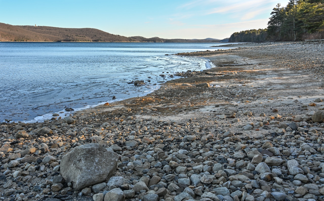 The rocky shore of the Quabbin Reservoir used to be under water. (Steven E. Nanton / Special to The Republican)The Republican
Authority planning documents do call for expanding the number of towns and cities served by the Quabbin.
“We have to be very careful about large expansions for usage,” he said.
As of now, only a few Western Massachusetts communities use the Quabbin. They are Chicopee, Wilbraham and half of South Hadley.
To read the full letter from the Quabbin Watershed Stewards, visit this story online.