The ice storm is not over yet for South Carolina and North Carolina. The sleet began falling overnight and quickly blanketed the area. Chief Meteorologist Chris Justus said the storm will continue through 5 p.m. Sunday and as of Sunday afternoon we are once again transitioning to freezing rain. “Think of it as a sandwich — freezing rain, sleet, then freezing rain again — and that combination can create serious impacts,” Chris said.From this point forward, more of the ice will cling to trees and power lines. The good news, he says, is we spent about four hours in sleet overnight, which helped cut down overall ice accretion. Instead of a worst-case inch of ice, many areas may end up closer to 0.25”–0.50” total.The trade-off? What’s better for trees is worse for roads. Sleet and ice will be slow to melt this week — but most would agree bad roads are better than no power.Still, a quarter to a half inch of ice is no joke, especially with winds picking up this evening. Power outages remain a concern.Active alerts: Live radar: Ice storm impactsIce storm tips About the WYFF News 4 weather team:The WYFF News 4 weather team has been independently certified for having the most accurate forecast in the Greenville-Spartanburg-Asheville-Anderson market for the second year in a row.“Our goal every day, in every forecast is accuracy,” said WYFF 4 President and General Manager Blake Bridges. “Our expert weather team is dedicated to giving viewers a forecast they can trust to be right. We are also the only station in the market with our own 24/7 live radar, Live Super Doppler 4. It’s clear that WYFF News 4 is the weather leader in this market.”The certification comes from WeatheRate, an independent research firm that tracks forecasts from every station in multiple markets across the country.“Everyone knows that forecasting the weather around here is difficult with the Upstate and mountains,” said WeatheRate President Bruce Fixman. “The station that gets the forecast right more than anyone else is Chief Meteorologist Chris Justus and the WYFF News 4 weather team.”Meet the Team: Chief Meteorologist Chris Justus Meteorologist Victoria Kokinos Meteorologist Bradford Ambrose Meteorologist Grace Lowe
GREENVILLE, S.C. —
The ice storm is not over yet for South Carolina and North Carolina.
The sleet began falling overnight and quickly blanketed the area.
Chief Meteorologist Chris Justus said the storm will continue through 5 p.m. Sunday and as of Sunday afternoon we are once again transitioning to freezing rain.
“Think of it as a sandwich — freezing rain, sleet, then freezing rain again — and that combination can create serious impacts,” Chris said.
From this point forward, more of the ice will cling to trees and power lines.
The good news, he says, is we spent about four hours in sleet overnight, which helped cut down overall ice accretion. Instead of a worst-case inch of ice, many areas may end up closer to 0.25”–0.50” total.
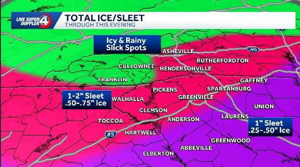
The trade-off? What’s better for trees is worse for roads. Sleet and ice will be slow to melt this week — but most would agree bad roads are better than no power.
Still, a quarter to a half inch of ice is no joke, especially with winds picking up this evening.
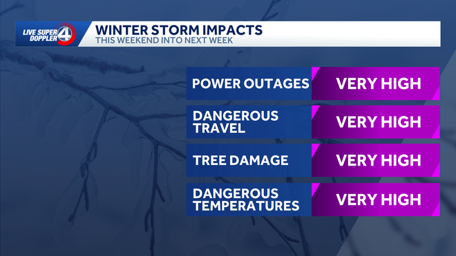
Power outages remain a concern.
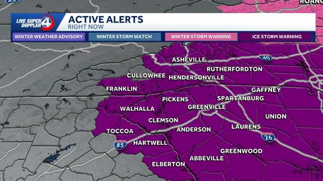
Active alerts:
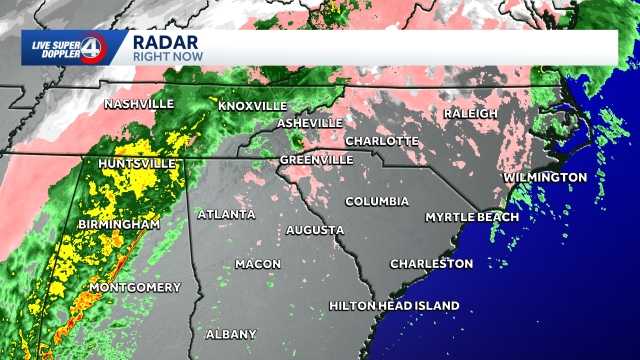
Live radar:
Ice storm impacts
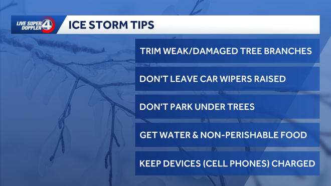
Ice storm tips
About the WYFF News 4 weather team:
The WYFF News 4 weather team has been independently certified for having the most accurate forecast in the Greenville-Spartanburg-Asheville-Anderson market for the second year in a row.
“Our goal every day, in every forecast is accuracy,” said WYFF 4 President and General Manager Blake Bridges. “Our expert weather team is dedicated to giving viewers a forecast they can trust to be right. We are also the only station in the market with our own 24/7 live radar, Live Super Doppler 4. It’s clear that WYFF News 4 is the weather leader in this market.”
The certification comes from WeatheRate, an independent research firm that tracks forecasts from every station in multiple markets across the country.
“Everyone knows that forecasting the weather around here is difficult with the Upstate and mountains,” said WeatheRate President Bruce Fixman. “The station that gets the forecast right more than anyone else is Chief Meteorologist Chris Justus and the WYFF News 4 weather team.”
Meet the Team:
