

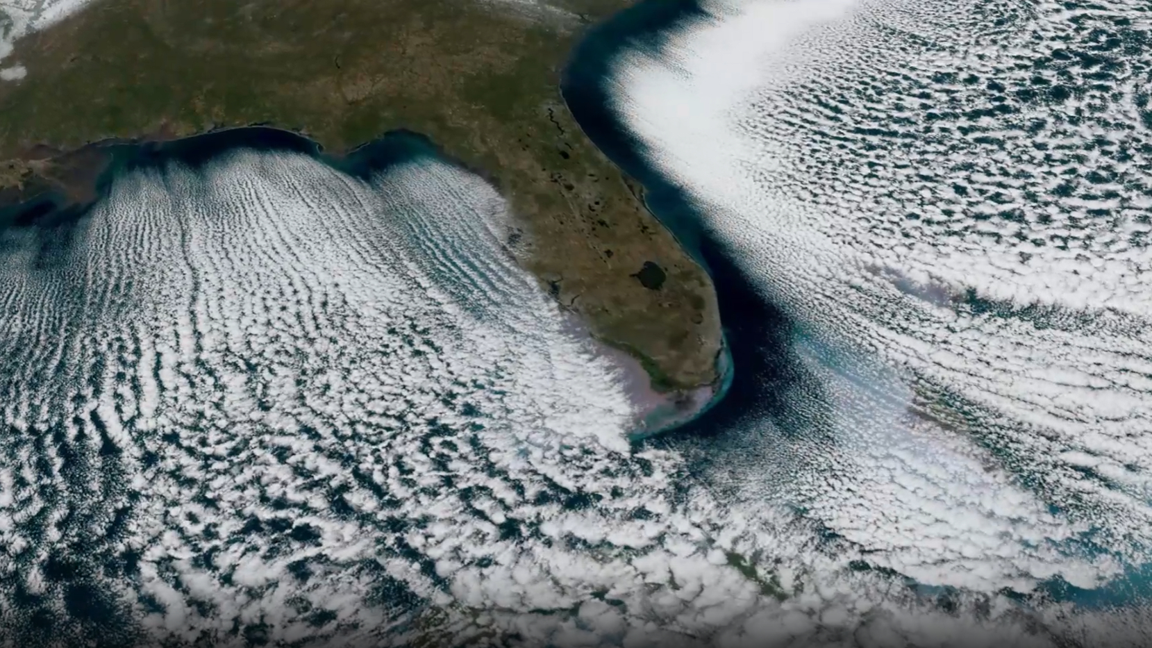
“Cloud streets” form off the Florida coast. (Image credit: NOAA)
The National Oceanic and Atmospheric Administration (NOAA) has released an entrancing orbital view of “cloud streets” streaming away from the south Florida coast on Feb. 1, as freezing air surged southwards into the Gulf of Mexico and the Atlantic ocean.
What am I seeing?
Cloud streets have been known to form when cold air passes over warmer water, absorbing moisture from the waves below to create parallel belts of low-level clouds, which often align with the prevailing wind, according to NOAA.
The mesmerizing cloud formations occurred as Floridians endured some of the coldest temperatures of recent years, with the city of Tampa on the western coast of the peninsula reporting a freezing 30 degrees Fahrenheit (-1 degrees Celsius).
An orbital timelapse of the cloud streets (above) gives the impression of water churning in the wake of a speeding boat. A clear stretch of water can also be seen following the line of the coast, indicating regions of dry air that had yet to absorb enough moisture to manifest the spectacular clouds.
What captured the picture?
The cloud streets were captured by the Advanced Baseline Imager instrument mounted on NOAA’s GOES-19 weather satellite, as it orbited 22,236 miles (35,785 kilometers) above Earth‘s equator.
GOES-19 launched on June 25, 2024 atop a SpaceX Falcon Heavy rocket from NASA’s Kennedy Space Center in Florida before establishing itself in a geostationary orbit, where it travels at a height and velocity that perfectly matches Earth’s rate of rotation. As a result, it always has the same view of Earth, which encompasses the Americas and Canada, along with a host of other nations.
The satellite is equipped with instruments that allow it to track terrestrial weather and potential environmental hazards, including the oceanic conditions that give rise to powerful hurricanes. GOES-19 is also armed with tools geared towards monitoring the sun and the space weather environment, which can impact life on Earth and the health of orbiting spacecraft.
Check out our explainer article on the different kinds of clouds and how they form to find out more!