
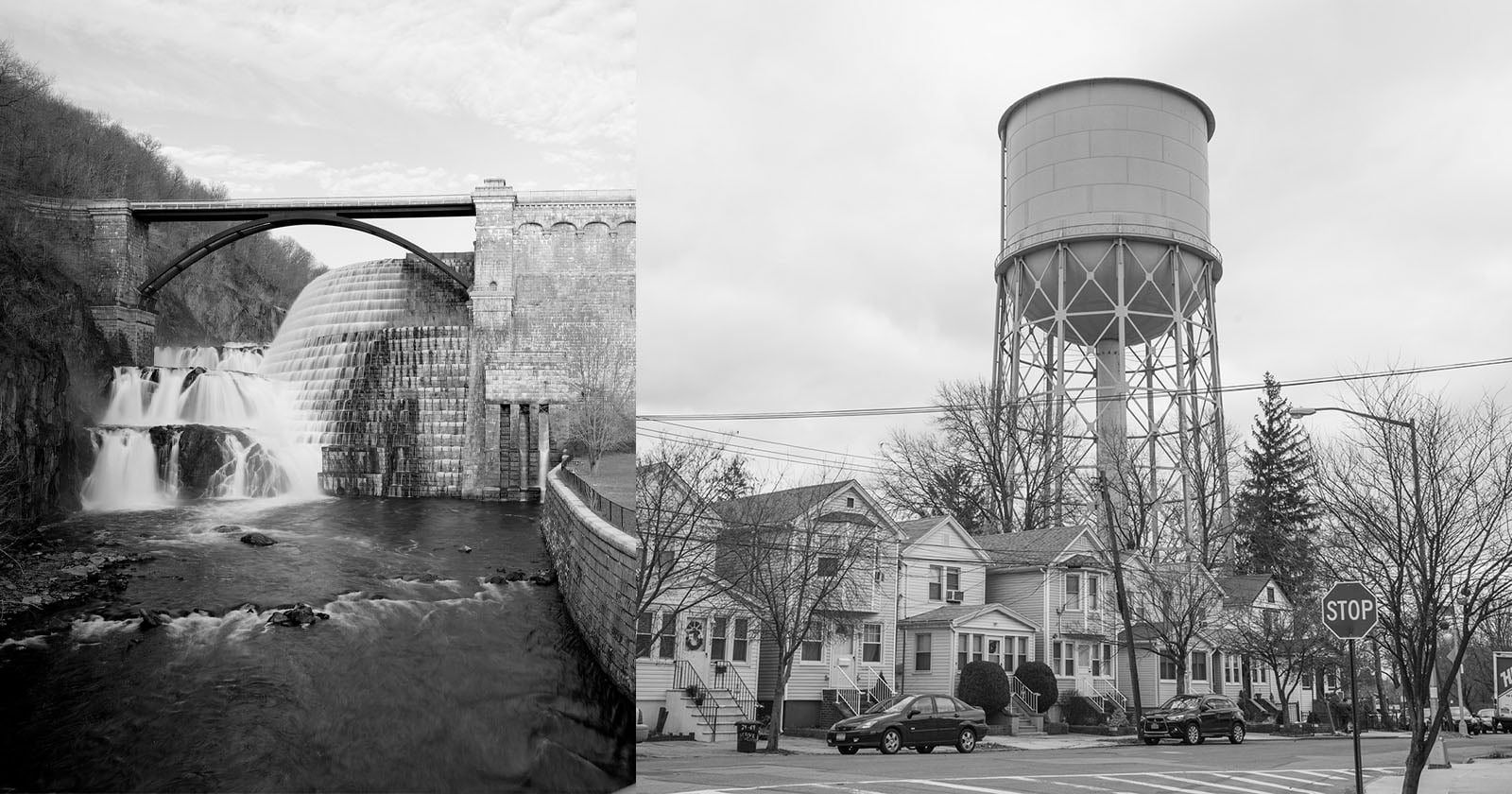
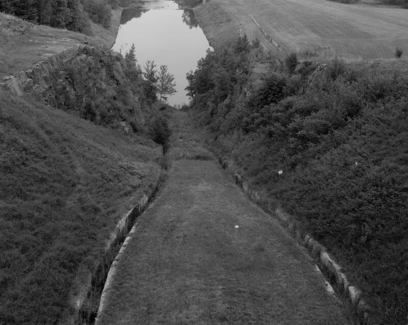
 High Bridge, Bronx and Manhattan, 2000. | Stanley Greenberg
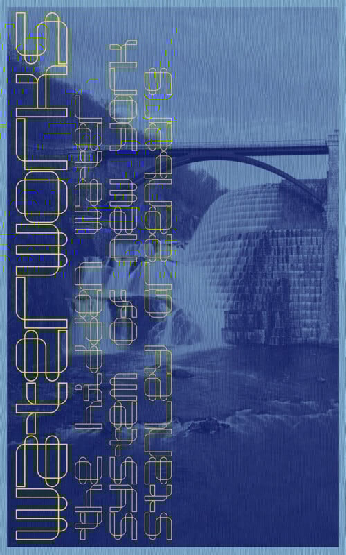
Waterworks by Stanley Greenberg is a sweeping photographic portrait of New York City’s water system, featuring 362 black and white images made between 1992 and 2024.
Over three decades in the making, the book traces the often-invisible infrastructure that brings water into and out of the city: reservoirs, aqueducts, tunnels, gatehouses, pumping stations, water tanks, wastewater treatment plants, stormwater facilities, and maintenance covers. A fold-out map charts more than 400 locations from upstate to the outer boroughs, grounding the work in geography and scale.
 Pumping Station No. 22, Jamaica Water Supply, Queens, 2014.
 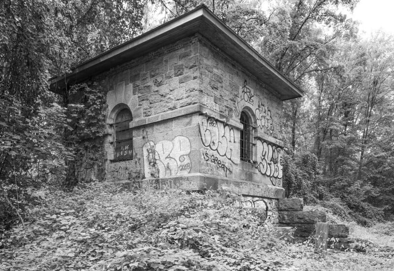 Weir Structure, Old Croton Aqueduct, Tibbetts Brook, 2023.
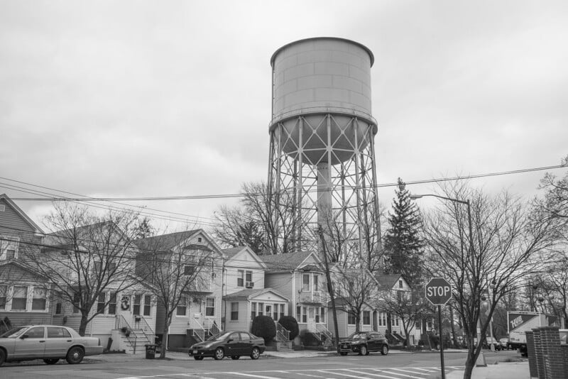
 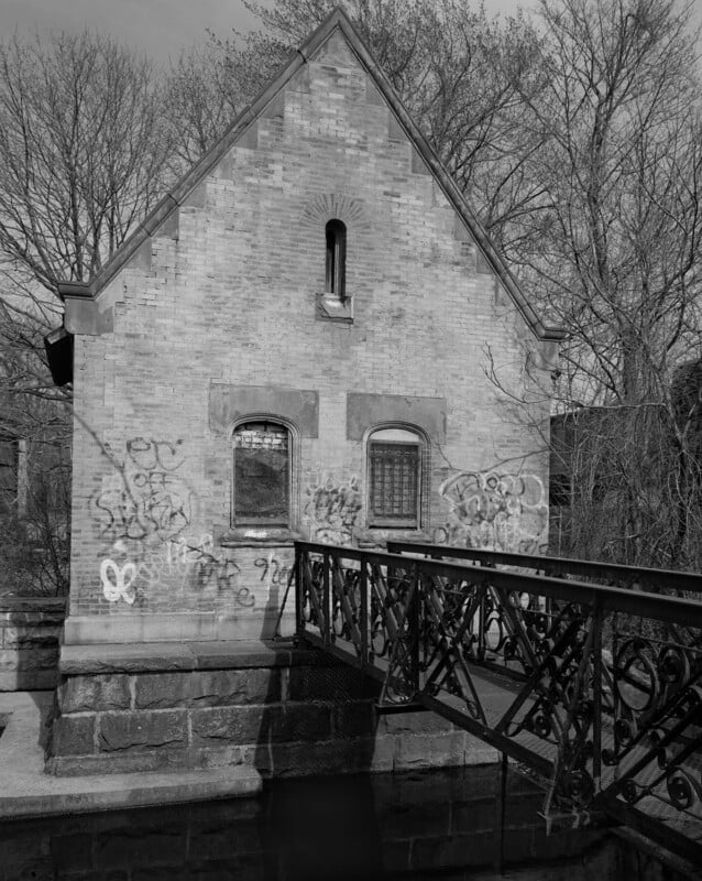 Wantagh Gatehouse, Brooklyn Water Supply, Nassau County, 1997.
While working at the Department of Environmental Protection (DEP), Greenberg saw the city’s water systems up close and later returned to help catalog the agency’s long-neglected archives — an extensive collection of 10,000 photographs and drawings dating back to 1840. Around that time, he began working on Invisible New York, a book that featured some of the city’s concealed water structures. Greenberg asked repeatedly for permission to photograph the city’s water system but was denied for years. Access was finally granted in 1997, and he completed the work in 2001 — just months before the 9/11 attacks shut down access to City infrastructure for good. Waterworks was first published in 2003. DEP tried to block its release but later purchased 200 copies.
 Stilling Basin, Neversink Reservoir, Sullivan County, 1999.
  South Reservoir Gatehouse, Central Park, Manhattan, 1996.
 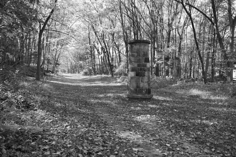 Ventilator 5, Old Croton Aqueduct, Croton, 2023.
 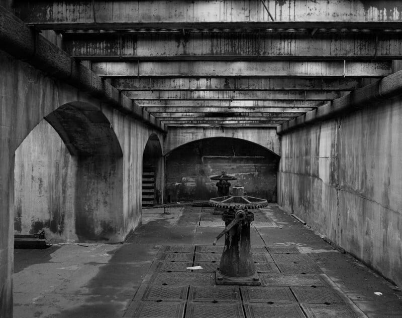 Interior New Croton Dam, Westchester County, 1999.
Though Waterworks was published in 2003, Greenberg’s exploration of the system didn’t end there. After publishing several other books he returned to photographing water infrastructure around the city, looking for above-ground signs of the water system hidden in plain sight; invisible to the casual observer. Studying city planning documents, property records, old and new maps, he walked the routes of the three water distribution tunnels and biked some of the upstate aqueducts.
 Lower Gatehouse, New Croton Dam, Westchester County, 2000.
 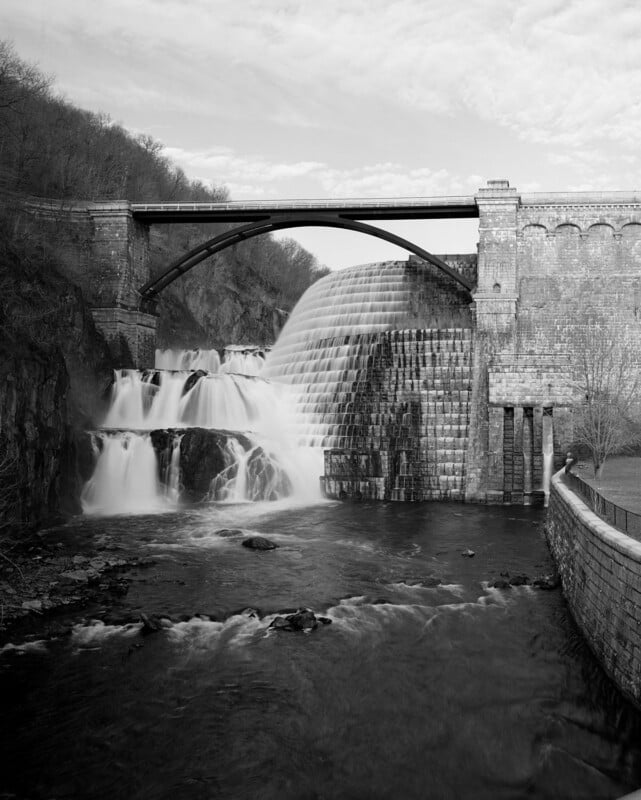 New Croton Dam, Westchester County, 1999.
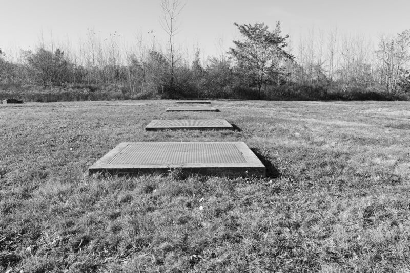 Douglaston Bay Stormwater Retention, Queens, 2021.
 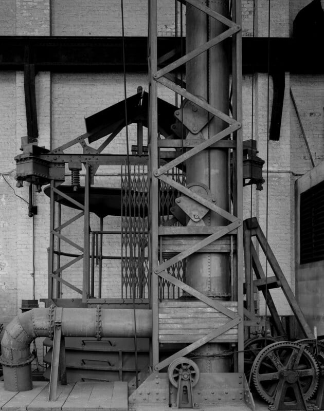 Dewatering Apparatus, Shaft 21, City Tunnel No. 1, Manhattan, 2000.
The photographs themselves are a mammoth undertaking — an endeavor that matches the scale of the system they depict. Rendered in crisp, large-format black and white, the images reveal the majesty of monumental sites like the Croton Dam, High Bridge Tower, Neversink Stilling Basin, and Shandaken Tunnel, alongside soaring conduits, vast chambers, and the elegant geometry of giant pipes. Greenberg’s style is at once rigorous and reverent, offering a visual language that honors the ambition and beauty of these man-made structures.
Accompanying the book is a printed map, designed by Larry Buchanan, that charts more than 400 sites across the city and upstate. A more detailed version is available online, serving as a free, public field guide to the system. While the printed map offers refined design and visual clarity, the online map includes greater location detail. Together, they reflect Greenberg’s decades-long effort to document the full reach of New York’s water infrastructure — like the water system itself, it is a work in progress.
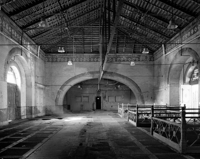
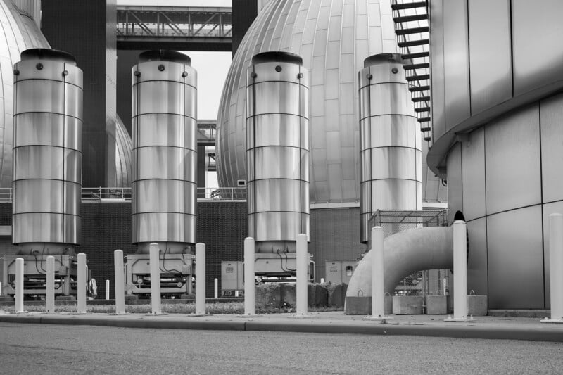 Newtown Creek Wastewater Treatment Plant, Brooklyn, 2023.
 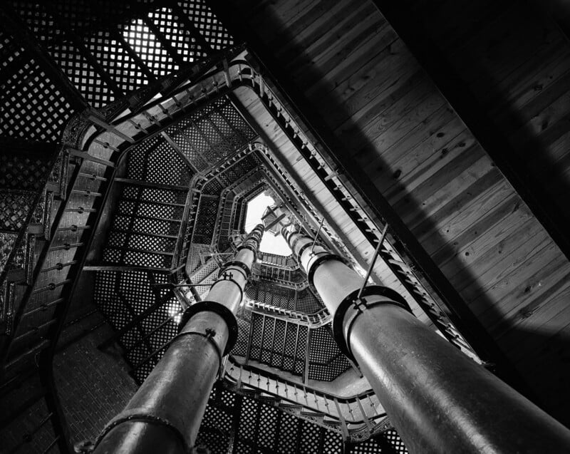 High Bridge Tower, Manhattan, 1995.
 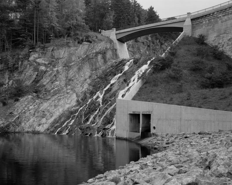 Dam and Spillway, Cross River Reservoir, Westchester County, 2000.
 135th Street Gatehouse, New Croton Aqueduct, Manhattan, 2001.
“New York City’s water system is vast and complex,” Greenberg writes, “But it can be divided into just a few functions: collection, conveyance and distribution, and treatment.”
The water collects in 18 reservoirs from rain and snowmelt, travels to the city through aqueducts, and is stored in three large reservoirs before reaching the city. There, it is distributed via three tunnels to water mains, smaller pipes, and eventually into every city building. Wastewater, along with rainwater, travels through sewers to treatment plants, and then reenters the waterways around the city, evaporating back into the atmosphere.
 Catskill Aqueduct, Orange County, 2018.
 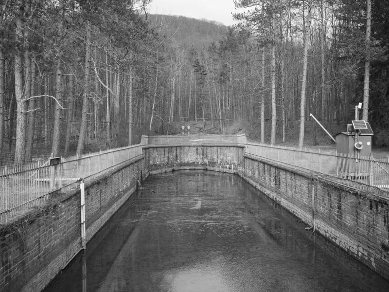 Shandaken Tunnel Outlet, Allaben, Ulster County, 2024.
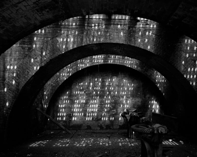
 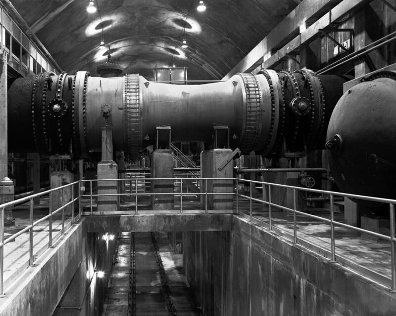 Shaft 2b, City Tunnel No. 3, Bronx, 1992.
New York City’s drinking water is collected in two upstate systems: the smaller Croton system, begun in 1837 and located in Westchester and Putnam Counties. This water is filtered at an underground facility in Van Cortlandt Park. The much larger Catskill/Delaware system is unfiltered and generally considered to be of very high quality. Many towns and valleys were flooded to create the reservoirs, and the city is still often regarded as a bully to the people who live in the watershed.
What flows in must also flow out. The city’s combined sewer system carries both sewage and stormwater runoff, a design increasingly challenged by climate change. When rainfall overwhelms the system, combined sewers often overflow into the waterways, bypassing wastewater treatment plants (WWTPs). In response, the city has started building rain gardens and large underground storage tanks to retain stormwater, alongside more ecologically integrated solutions like the Bluebelt in Staten Island, which manages runoff naturally while preserving vital habitat.
Though rooted in documentary practice, Waterworks also offers a meditation on access, labor, and the often-hidden systems that undergird civic life. Greenberg invites us to see infrastructure not just as a physical system, but as a reflection of political will, public investment, and collective memory. The book is a record of a system and a city, both in constant flux.
Waterwork is published by KGP.