
UPDATED: 12:30 p.m.
The National Weather Service has issued a flash flood warning for Oahu until 3:30 p.m.
“At 12:22 p.m., radar indicated heavy rain over Oahu,” the warning said. “Rain was falling at a rate of 1 to 3 inches per hour. Significant rises have been observed on area streams and additional heavy rain is moving into the area. Flash flooding is ongoing or expected to begin shortly.”
Forecasters warned of possible flooding in drainages, streams, rivers, roads, properties, and other low-lying areas; public road closures; and landslides in steep terrain.
11:30 a.m.
The National Weather Service has posted a flood advisory for Hawaii island until 2:30 p.m. today.
Don’t miss out on what’s happening!
Stay in touch with breaking news, as it happens, conveniently in your email inbox. It’s FREE!
“At 11:09 a.m., radar indicated heavy rain over the Puna and Kau Districts of the Big Island. Rain was falling at a rate of 0.5 to 1.5 inches per hour,” the advisory said.
10:35 a.m.
The flood advisory for the island of Kauai has been extended to 2 p.m.
“At 10:26 a.m., radar indicated a temporary lull in rainfall across Kauai with additional showers advancing toward the island from the west. These showers will produce rain rates up to 1.5 inches per hour,” the advisory says.
A high wind warning remains in effect for Oahu and for Kauai and Maui counties, with south to southwest winds of 30 to 40 mph and gusts up to 70. The National Weather Service reports that a wind gust of 58 mph was recorded this morning at Schofield Barracks.
10:20 a.m.
Hawaiian Electric Co. is reporting that the number of customers without power on Oahu has grown to 14,326.
The area including the neighborhoods of Enchanted Lake, Kailua, Kaneohe, Keolu, Lanikai, Maunawili and Waimanalo is showing 3,068 customers without power, according to HECO’s outage map for Oahu.
“Customers across Oahu, Maui County and Hawaii island are asked to continue to plan for possible extended outages, potentially overnight, as the powerful storm system is expected to make its way across the island chain throughout the weekend,” HECO said in a statement.
“Hawaiian Electric’s response may be delayed as crews will not be able to make repairs in dangerous weather conditions. Damage to the electrical infrastructure could be extensive.”
10 a.m.
The flood advisories for Oahu, Maui and Molokai have been extended to 1 p.m., 1 p.m. and 11:15 a.m., respectively.
“At 9:35 a.m., radar indicated heavy rain continuing to move over the island. Rain was falling at a rate of 1 to 2 inches per hour,” the Molokai advisory says.
The Maui advisory said, “At 9:50 a.m., radar indicated areas of heavy rain continuing to move over Maui from the southwest, falling at a rate of 1 to 2 inches per hour.”
The Oahu advisory said, “At 9:51 a.m., radar indicated a small area of heavy rain moving over Oahu with rainfall rates around 0.5 to 1 inch per hour … Additional widespread heavy rain is expected within the next few hours.”
The advisories may need to be extended again if flooding persists, the NWS said.
9:30 a.m.
Although Hawaiian Electric Co. reports that power has been restored to more than 1,500 customers in Kaneohe, at least 9,464 customers on Oahu are now without power.
The neighborhoods most acutely affected, according to HECO’s outage map for Oahu, include the Ewa, Kapolei and Makakilo neighborhoods, with 1,747 customers without power, and the Diamond Head, Kahala, Kaimuki, Kapahulu and Waikiki neighborhoods, with 1,792 customers without power.
None of the Oahu outages are part of a Public Safety Power Shutoff, according to HECO.
8:45 a.m.
Hawaiian Electric Co. this morning reported scattered power outages affecting a total of over 5,000 customers, including in Waikiki, Kailua, Makakilo, Kaneohe, Haleiwa and Waimea.
EARLIER COVERAGE
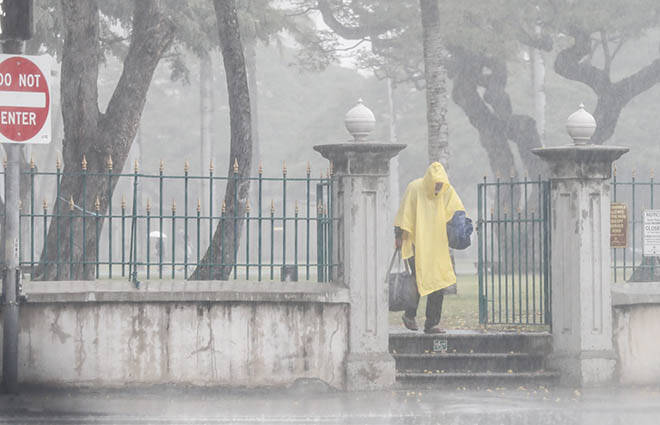
Oahu, Maui and Kauai are under flood advisories this morning as Hawaii begins to feel the worst of this week’s drenching Kona-low storm.
State and county government offices, public schools and the University of Hawaii campuses are all shut today as a precaution, with the islands facing the potential of 15 inches of rain in some areas and gusty, damaging winds.
Although no major damage has been reported, downed trees, scattered power outages and flooded roads have occurred throughout Oahu. Downed power lines were reported this morning in Pearl City and Nanakuli, and a wind gust of 67 mph was recorded at the Mauna Kea Observatory on Hawaii island, according to the National Weather Service.
A city HNL alert at about 7:15 a.m. today said Kalanianaole Highway in both directions between Tinker Road and Aloiloi Street is impassable due to downed trees.
“The alternate route via Hihimanu Street is also closed in both directions due to flooding between Waikupanaha Street and Ahiki Street. There are no open routes from Kailua to Hawaii Kai through Waimanalo until further notice. Avoid the area,” the alert said.
The National Weather Service said, “Considerable flash flooding remains possible as a large and powerful Kona storm northwest of the state draws deep tropical moisture northward across the islands. Persistent bands of heavy rain and thunderstorms may produce intense rainfall rates, leading to rapid rises in streams and flooding of roads and low-lying areas.”
The entire state remains under a flood watch — through Saturday afternoon for Kauai, Saturday night for Oahu and Sunday night for Maui County and Hawaii island — while Oahu is under a flood advisory until 10 a.m., Kauai is under an advisory until 11 a.m., and Maui until 10 a.m.
“At 7:49 a.m., radar indicated a small area of heavy rain moving over Oahu with rainfall rates around 0.5 to 1 inch per hour,” the Oahu advisory says.
The Maui advisory said, “At 6:47 a.m., radar indicated heavy rain moving over the island,” the advisory said. “Rain was falling at a rate of 1 to 2 inches per hour. Landslides are also possible as the ground is already saturated and periods of additional heavy rain are expected through the day today.”
And the Kauai flood advisory said, “At 8:40 a.m., radar indicated a persistent band of showers moving in from the southwest will continue to overspread the island for the hour or so. Embedded heavier showers were producing rainfall rates of up to 2 inches per hour.”
Forecasters expect Kauai and Oahu to be hit by heavy bands of rain throughout today, with sustained winds at up to 45 mph and stronger gusts. The storm system is expected to move from west to east along the island chain through this weekend.
The weather service in Honolulu has also issued a slew of other weather bulletins related to the Kona low, including:
>> A winter storm warning for Hawaii island summits of Mauna Kea and Mauna Loa above 12,000 feet until 6 p.m. Saturday. “Blizzard conditions possible. Total snow accumulation of 12 to 18 inches. Winds could gust as high as 110 mph.”
>> A high wind warning until 6 a.m. Sunday for Oahu and for Kauai and Maui counties, with south to southwest winds of 30 to 40 mph and gusts up to 70. “Island-wide strong gusty winds are possible, but areas most at risk are communities north and east of steep mountains,” the warning says. “Damaging winds may blow down trees and power lines and damage roofs. Power outages are possible. Travel will be difficult, especially for high profile vehicles.”
>> A wind advisory until 6 a.m. Sunday for Hawaii island lower elevations. “Southwest winds 25 to 35 mph with gusts to around 50 mph expected (for) Big Island lower elevations.”
RELATED STORIES
>> Here’s a list of state and county closures, and emergency shelters
>> UH cancels or postpones athletic events Friday due to storm
>> Hawaiian Electric urges customers to prepare for storm-related outages 14,326