
A fast-moving storm ripped northeast across the Louisville region, whipping winds upwards of 80 mph at times.Just after midnight, more than 11,000 were without power.Check power outages: Duke | LG&EDid you experience damage from the storm? Send your videos and picture to our Facebook page or upload them to our website.Below are some updates about how the storm unfolded. TIMELINE:12:54 p.m. – Most warnings are done in the Louisville region as storm races off toward north and east – Lexington and northern Kentucky. But still be aware of strong winds to our south.12:35 p.m. – 11,000+ now without power across the WLKY region.12:18 a.m. – West of I-65 is pretty much in the clear now. About 5,000 without power across the region.11:50 p.m. – Several areas off to the west are already done with storms. But they’re just getting stronger in Louisville. Be safe.11:35 p.m. – Storms make way toward Shepherdsville and Radcliff. Take shelter!11:15 p.m. – Storm headed into Hardin County, KY. Winds moving at 75 mph.11:06 p.m. – Potential tornado near Leitchfield. Storm racing off to northeast.10:55 p.m. – Quick-moving storm prompts tornado warnings in our western counties.Here’s what to do if you lose power during severe weatherLIVE WEATHER RADAR | WEATHER ALERTS Download the WLKY app for up-to-date weather alertsStream weather from WLKY anytime on Very Local Once the front moves through our temperatures will crash and turn sharply colder as we will drop into the 30s, with wind chills in the 20s on Monday.Plunging temperaturesThere is even the chance for some passing flurries on Monday as the cold air rushes into the region.📲 Get alerts any time with the free WLKY mobile app📺 Stream weather any time on Very Local💻 Subscribe to our YouTube channel for the latest forecast videosThe WLKY Weather Team – Jay Cardosi, Matt Milosevich, Susanne Horgan, Mo Rose and Eric Zernich – is dedicated to keeping Louisville, Kentucky and Indiana informed with accurate, up-to-the-minute forecasts across WLKY-TV, WLKY.com, and the WLKY Weather App.
LOUISVILLE, Ky. —
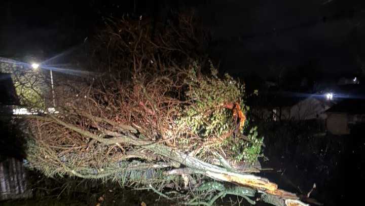
A fast-moving storm ripped northeast across the Louisville region, whipping winds upwards of 80 mph at times.
Just after midnight, more than 11,000 were without power.
Check power outages: Duke | LG&E
Did you experience damage from the storm? Send your videos and picture to our Facebook page or upload them to our website.
Below are some updates about how the storm unfolded.
TIMELINE:
12:54 p.m. – Most warnings are done in the Louisville region as storm races off toward north and east – Lexington and northern Kentucky. But still be aware of strong winds to our south.
12:35 p.m. – 11,000+ now without power across the WLKY region.
12:18 a.m. – West of I-65 is pretty much in the clear now. About 5,000 without power across the region.
11:50 p.m. – Several areas off to the west are already done with storms. But they’re just getting stronger in Louisville. Be safe.
11:35 p.m. – Storms make way toward Shepherdsville and Radcliff. Take shelter!
11:15 p.m. – Storm headed into Hardin County, KY. Winds moving at 75 mph.
11:06 p.m. – Potential tornado near Leitchfield. Storm racing off to northeast.
10:55 p.m. – Quick-moving storm prompts tornado warnings in our western counties.
Here’s what to do if you lose power during severe weather
LIVE WEATHER RADAR | WEATHER ALERTS
Once the front moves through our temperatures will crash and turn sharply colder as we will drop into the 30s, with wind chills in the 20s on Monday.
Plunging temperatures


There is even the chance for some passing flurries on Monday as the cold air rushes into the region.

Hearst Owned
Passing flurries Monday
The WLKY Weather Team – Jay Cardosi, Matt Milosevich, Susanne Horgan, Mo Rose and Eric Zernich – is dedicated to keeping Louisville, Kentucky and Indiana informed with accurate, up-to-the-minute forecasts across WLKY-TV, WLKY.com, and the WLKY Weather App.