
NASHVILLE, Tenn. (WSMV) – This is the time of year when we often see epic temperature battles across the country. It boils down to winter not wanting to let go, while spring and summer do all they can to assert themselves and ultimately take over.
Thursday, March 26, served up a classic example of that.
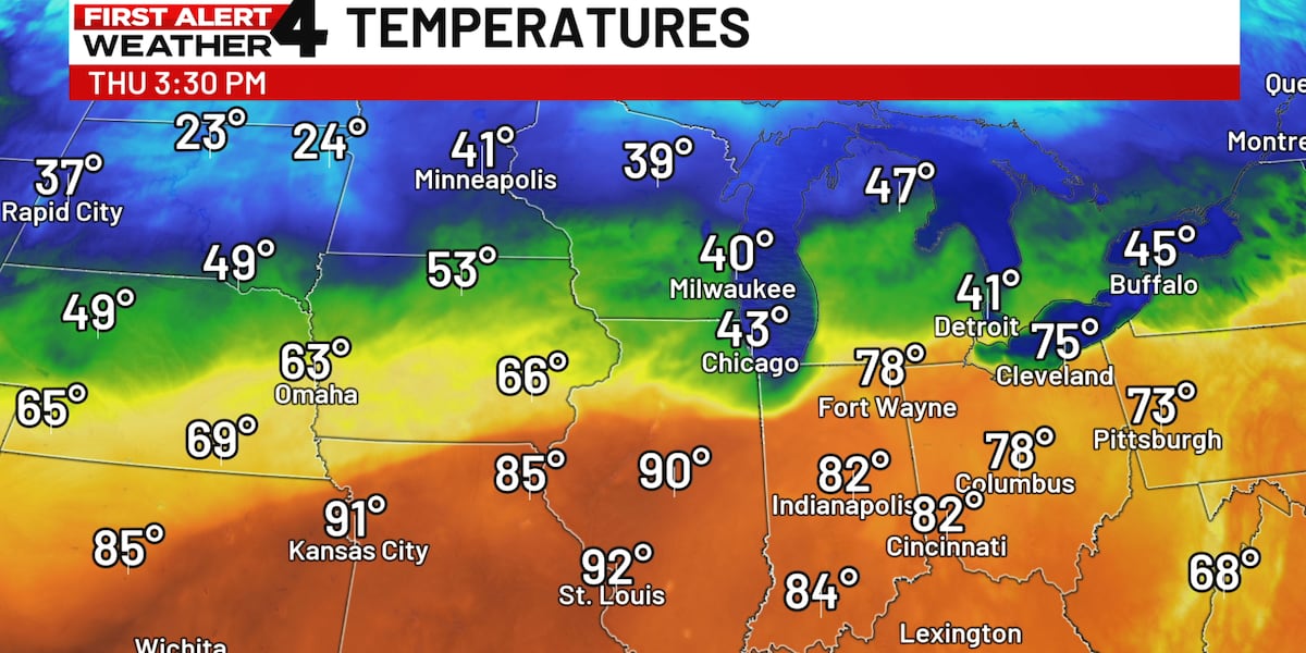
Take a look at the temperature contrast across the Upper Midwest this afternoon.
 A sharp temperature contrast on Thursday over the northern United States(wsmv)
Here’s a look at the same moment, but for wind chill. It was even more jaw-dropping, especially as you notice the Arctic air spilling in from Canada.
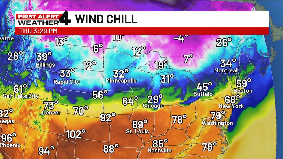 Wind chill Thursday afternoon(wsmv)
This battle zone marked an especially sharp cold front that was headed south.
This front and much colder weather in its wake will overspread the entire Midstate on Friday, leading to frost and patchy freezing weather early Saturday, along with a wind chill for our area in the 20s.
Don’t get used to the chill though. Temperatures in the 80s will return to Middle Tennessee again as soon as early next week.
For life-saving weather alerts, customized messages on conditions and forecasts, and videos detailing upcoming weather events, download the WSMV 4 First Alert Weather app for iPhone or Android. Have weather pictures or videos? Share them here.