
During the first half of February, Petróleos Mexicanos (Pemex), Mexico’s state-owned oil company, repaired a pipeline around which there was a slick of suspected crude oil covering more than 19 square miles (50 km2), running from one of the oil platforms in the Cantarell field to the Dos Bocas facilities. The site of this spill is one of the locations where the Mexican government has placed the origin of an oil spill that has already affected over 370 miles (600 km) of coastline. Public information obtained by EL PAÍS reveals that the ship Árbol Grande, dedicated to the maintenance of oil infrastructure, was anchored from February 9 to 16 of that month on an active pipeline that transports Maya crude. This contradicts the official version maintained since the beginning of the environmental disaster in the Gulf of Mexico by the authorities, who denied that there had been any leak or rupture in Pemex facilities. EL PAÍS asked the oil company what happened to that pipeline during those dates, but had not received a reply by press time.
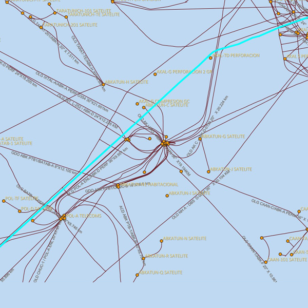
Network of pipelines going through the oil spill area.
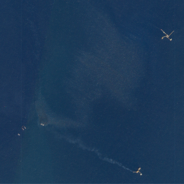
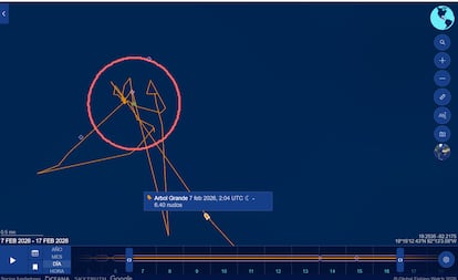
Satellite image from Feb. 15 showing the spill in the area of oil pipes around the vessel Árbol Grande.
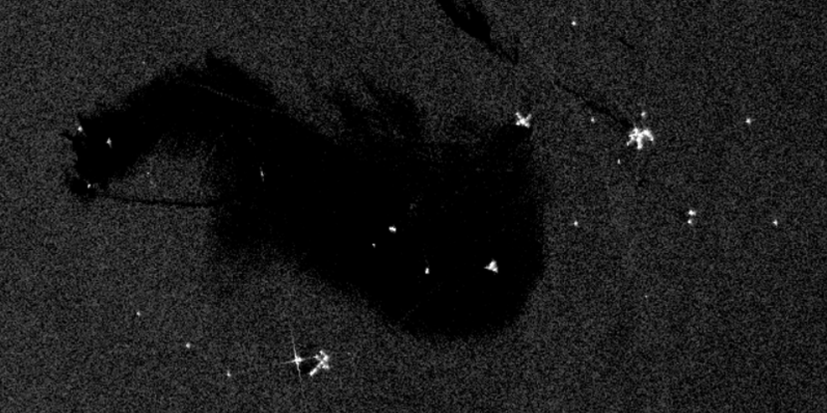
Radar image from Feb. 14 at the same location, showing a stain spanning 21 square miles.Fuente: Elaboración propia. EL PAÍS
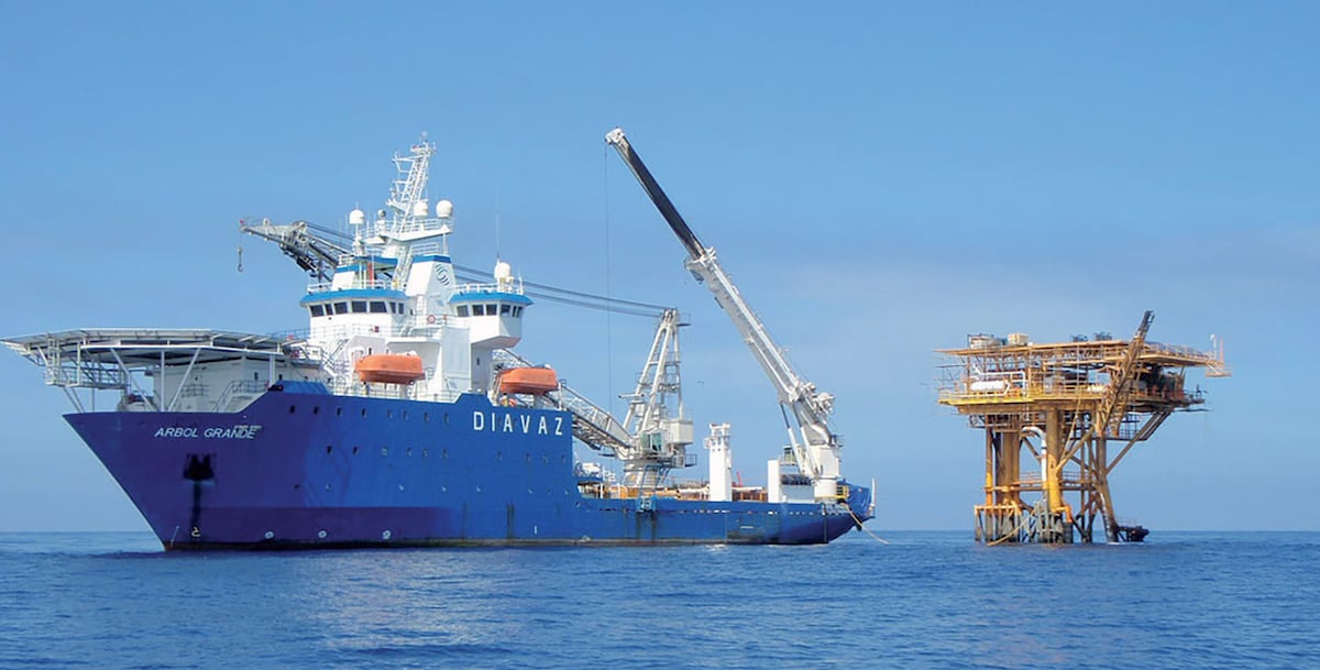
A satellite image taken on February 15 shows a ship, surrounded by smaller vessels, over an oil slick at sea, identified as a possible oil spill by Cerulean, a platform run by the environmental organization SkyTruth that uses satellite imagery and machine learning to detect oil spills. The Global Fishing Watch platform, which monitors global maritime activity, identified that between February 7 and 17, 15 vessels transited within a one-kilometer radius of that exact spot. But only one ship remained stationary there for nearly 200 hours, more than eight days: the Árbol Grande.
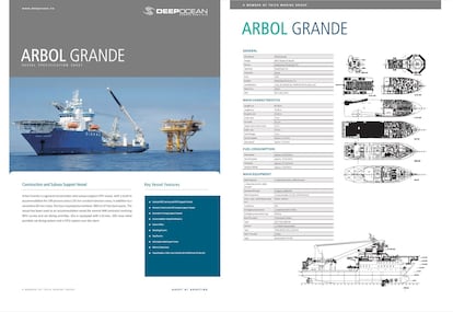
Árbol Grande is a vessel that works for Diavaz, a company founded in 1973 that specializes in the inspection, maintenance, and repair of offshore oil structures and facilties off the coast of Tamaulipas and in the Bay of Campeche. According to the Pemex contracting platform Constructora Subacuática, Diavaz has been a contractor for the state-owned oil company since at least 2018, and in May 2025, the company won a public tender for nearly 11 billion pesos titled “Management of the integrity and reliability of the hydrocarbon transportation system via marine pipelines.” They had previously held similar contracts, and Pemex executives have boasted at public events about the speed with which the Árbol Grande has carried out “replacement work on damaged sections of submarine pipelines; thanks to its deck space and stability, despite swells and strong winds,” in the submarine pipeline network of the Bay of Campeche.
Beneath the spot where the Árbol Grande pipeline repair ship was held for nearly 200 hours, there runs an oil pipeline identified on a map of the now-defunct National Hydrocarbons Commission as Old AK C, which runs from the AKAL-C platform to the Dos Bocas maritime terminal. This 161-kilometer-long pipeline, which transports Maya crude—a more viscous and difficult-to-refine type of oil than light crudes—already suffered a spill almost a year ago, in May 2025.
All this data contradicts the official version maintained by federal and state authorities since the first alerts came in almost a month ago that several beaches in Veracruz and Tabasco were experiencing problems due to oil spills. Pemex stated in early March that the spill did not originate from any of its facilities, a claim supported by Rocío Nahle, the governor of Veracruz, who asserted that the problem was “a private ship belonging to a private oil company that does not work for Pemex.”
Since its detection, the oil slicks have spread over 370 miles (600 km) along the Gulf of Mexico coast, from Tabasco through Veracruz to its northern border with Tamaulipas. Coastal communities that depend on fishing and tourism have reported damage to coastal and marine ecosystems, and dead turtles, fish and dolphins have washed ashore.
The latest statement issued by the interdisciplinary group created to address the Gulf of Mexico oil spill asserts that “the hydrocarbon pollution on the Gulf of Mexico coast remains under control, with clean beaches reported as a result of coordinated efforts in response, containment, and cleanup.” This group is comprised of the Mexican Navy, the Ministry of Environment and Natural Resources, the Ministry of Energy, the Agency for Safety, Energy and the Environment, Petróleos Mexicanos (Pemex), and the Federal Attorney General’s Office for Environmental Protection (PROFEPA).
At the news conference held last Thursday by this newly formed interdisciplinary group, a ship and two natural seeps were identified as the culprits behind the environmental disaster. “Pemex reported that a vessel had illegally dumped oil in an area near the Coatzacoalcos anchorage,” said Raymundo Morales Ángeles, Secretary of the Navy. The second source of the spill, according to the Secretary, are the natural seeps of crude oil and methane gas that rise from the subsoil to the surface—located five miles from the port of Coatzacoalcos in Veracruz, which are currently inactive, and the one located in the Cantarell area in the state of Campeche. In fact, at the press conference, it was stated that the oil slick on the Pemex pipeline was the result of this natural seep.
Sign up for our weekly newsletter to get more English-language news coverage from EL PAÍS USA Edition