
ASHEVILLE, N.C. (WLOS) — As our drought rolls on, it now looks like western North Carolina will add some near-record heat to our dry conditions.
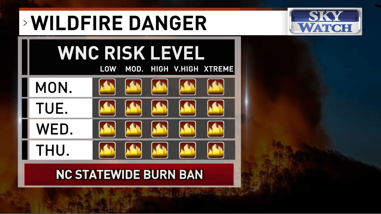
A statewide burn ban continues as the wildfire danger across the region remains extremely high through at least Thursday.
Relative humidity will stay low, dipping into the 20 percent range on Wednesday and Thursday.
Our rainfall deficit continues to grow, with rainfall more than an inch below average for the month of April at the Asheville Regional Airport, and more than a foot below average since September first.
CONTAINMENT IMPROVES FOR MULTIPLE FIRES BURNING IN WESTERN NORTH CAROLINA FORESTS
Meanwhile, Asheville’s high temperatures are expected to warm into the mid 80s on Tuesday and into the upper 80s on Wednesday through Saturday.
Record high temperatures will be in jeopardy in Asheville from Wednesday through Saturday, with the possibility of reaching 90 degrees on any one of those days.
The earliest on record that Asheville has ever reached 90 was April 18, 1896.
Comment with Bubbles
BE THE FIRST TO COMMENT
Since we have not had time to acclimate to the heat, residents are encouraged to stay hydrated, wear light colored, loose-fitting clothing and limit outdoor exercise to early in the morning and after sunset.