
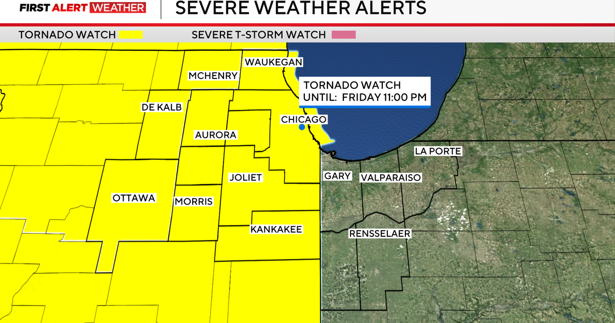
A tornado watch has expanded to the entire Chicago area as two rounds of severe storms that could spawn twisters and bring hail, flooding and straight-line winds up to 70 miles per hour race towards us from the west Friday evening.
A Tornado Watch has been issued for Cook, DuPage, Ford, Kankakee, Iroquois, Livingston and Will counties in Illinois and Benton, Jasper, Lake, Newton, and Porter counties in Indiana until 11 p.m.
A Tornado Warning is in effect until 10:45 p.m. in Kankakee County. Another Tornado Warning has been issued for Cook and Will counties in Illinios and Lake County in Indiana until 11 p.m.
A Severe Thunderstorm Warning has been issued until 10:45 p.m. for Cook and Will counties. Another Severe Thunderstorm Warning is in effect until 10:45 p.m. for Iroquois and Kankakee counties. Another Severe Thunderstorm Warning is in effect until 11:15 p.m. for Benton, Jasper, Lake, Newton, and Porter counties in Indiana.
A ground stop is in effect at O’Hare International Airport until 10:45 p.m. due to the storms.
The first round of storms raced across northwestern Illinois, but curved north before they reached the Chicago area and veered off into Wisconsin instead of into the Chicago area. The second of storms reached the Chicago area Friday evening, prompting multiple tornado warnings that have since expired.
The highest risk for tornadoes is in this later round of storms, in the western suburbs, between 8 p.m. and 10 p.m.
This line of storms could cause severe damage from high winds. Brief spin-up tornados, flash flooding and hail are also risks.
Thunderstorms could drop anywhere from one to three inches of rain, again inundating our already-soaked ground and raising the overall flood risk, as well as creating potential for some flash flooding.
Storms should be tapering off by midnight.
A tornado was reported in Lena, Illinois, on Friday afternoon about 47 miles west of Rockford. That tornado reportedly damaged both the high school and elementary school, passing over while students were still inside. No deaths or major injuries were reported.
In Machesney Park in Winnebago County, people snapped pictures of funnel clouds as the first round of storms raced through.

A Flood Watch is also in effect until 5 a.m. Saturday for the entire Chicago area, as storms will bring 1 to 2 inches of rain for most places, and as high as 3 inches in some areas.
A Flash Flood Warning also is in effect until 2 a.m. Saturday for Boone, Lake, and McHenry counties.

More than 51 million people are under the threat of severe weather tonight from Texas to Wisconsin. In Illinois, the water level of the Des Plaines and Fox rivers are already high and those communities are already dealing with flooding, a situation Friday night’s storms will only worsen.
The National Weather Service has issued a Flood Warning for areas along the Fox River until further notice.
ComEd said it is taking proactive steps ahead of Friday night’s weather, especially with such high winds expected. They said they are assessing conditions and staging crews based on the forecast to respond to reported power outages as quickly as possible.
If you spot a downed power line tonight, immediately call ComEd at 1-800-EDISON1 (1-800-334-7661). Spanish speaking customers can call 1-800-95-luces (1-800-955-8237). Never approach a downed power line and always assume it is live and extremely dangerous.
If the power goes out in your area, report it to ComEd either by texting OUT to 26233, call 1-800-EDISON1, or report outages through the ComEd website.
More from CBS News