
Afternoon showers and thunderstorms expected again Sunday
A PEAK OF THE SEASON. STILL AHEAD, IT IS VERY GOOD. KNOW THAT WE’RE GETTING AS MUCH RAIN AS WE CAN GET TO KIND OF DAMP OR AS MUCH AS WE CAN WITH THE DROUGHT, EVEN IF IT’S RUINING OUR BEACH DAY PLANS. YEAH, NOT BITTER AT ALL. WAS ME VERSUS MERCEDES WHEN IT COMES THE WEATHER BECAUSE IF LAST WEEKEND, I SAID DON’T GO TO THE GROCERY STORE IN THE AFTERNOON. COULD THE RAIN WHAT HAPPENED? I DID. WAS A CHOICE. CAROLINA. YOU BETTER? IF YOU’RE LIKE MERCEDES AND YOU WANT TO GO TO THE BEACH TODAY, LET’S TALK ABOUT THE RAIN CHANCES BECAUSE THERE’S TIMES WHERE I THINK YOU CAN MAKE IT AND YOU SHOULD BE OK TODAY. >> AND EVEN TOMORROW IS STARTING TO TREND A LITTLE BIT DRIER, TOO. SO MAYBE YOUR MONDAY COULD BE YOUR BEACH DAY AS WELL ON MEMORIAL DAY, DEPENDING ON WHAT YOU HAVE PLANNED. >> LET’S TRACK THE RAIN FOR THE SHORT TERM AFTERNOON SHOWERS AND THUNDERSTORMS. THEY’RE NOT GOING ANYWHERE. I HAVE THAT IN THE FORECAST TODAY. I HAVE IT IN THE FORECAST TOMORROW. I HAPPEN IN THE FORECAST ON TUESDAY, TOO, TECHNICALLY HAVE TO THE FORECAST FOR THE REST THE WEEK AS WELL AS JUST MIDWEEK. OUR RAIN CHANCES INCREASE EVEN MORE. WE COULD START TO SEE SOME MORNING RAIN ON TOP OF THOSE AFTERNOON. SHOWERS AND THUNDERSTORMS AND THAT RAIN MIDWEEK TOWARDS NEXT WEEKEND COULD START TO MAYBE TRY AND PUT A DENT IN OUR DROUGHT CONDITIONS. THAT WOULD BE GREAT NEWS FOR US JUST DEPENDING ON HOW MUCH RAIN WE SEE FROM THE SET UP. IT’S TRICKY. SO I WANT TO START WITH THE SHORT TERM JUST BECAUSE I FEEL LIKE THERE’S AN EASIER GRASP ON THAT THINKING IS START SMALL AROUND NOON AND THEN BUILDS IN INLAND TO START WHATEVER FORMS INLAND WILL CREEP ITS WAY TO THE COASTLINE. THE LATER WE GO TONIGHT. SO THE EARLIER THE BETTER FOR ANY COASTAL ACTIVITIES THAT YOU HAVE GOING ON TODAY. AND HERE’S WHY. SO WATCH THIS FUTURE CAST BUILDING INLAND TO START. THEN THAT RAIN PUSHES TO THE COASTLINE. THE LATER WE GO TONIGHT IN TERMS OF ACCUMULATION, WHAT THIS SHOWS AGAIN TODAY, SOME PLACES WILL SEE A LOT OF RAIN. OTHER PLACES WILL SEE ABSOLUTELY NOTHING. THIS MODEL IN PARTICULAR HAS LEE COUNTY RIGHT ALONG THE CALOOSAHATCHEE STAYING DRY VERSUS THE NORTHERN AND SOUTHERN PARTS OF THE GULF COAST. HERE’S ANOTHER VIEW OF THE RAIN AND WHAT WE COULD SEE STICKING WITH THE SAME MODEL HERE. REMEMBER MY THINKING AS WE SEE THAT RAIN FOR INLAND AND THEN WHATEVER FORMS INLAND WILL PUSH ITS WAY TO THE COASTLINE AS WE MOVE THROUGHOUT THE AFTERNOON. SO THIS IS 3.30 IF YOU’RE OUT ANYONE OF ANY OF OUR BEACHES, THIS SHOWS THAT IT WOULD BE DRY, HOWEVER, WITH THE MODELS DON’T REALLY PICKUP HONOR THOSE TINY, TINY, TINY CELLS. AND THAT’S WHAT WE SAW YESTERDAY BUILDING IN EARLIER ON. SO I CAN’T GUARANTEE THAT WILL BE DRY AT THIS TIME. AND I ALSO CAN’T GUARANTEE THAT WILL BE DRY. THE BEACH, THE LATER WE GO THIS AFTERNOON AND EVENING. I THINK THERE’S MORE OF A GUARANTEE THAT WE’LL SEE RAIN. THEY’RE LATER ON TONIGHT. THIS IS BY ABOUT 6 O’CLOCK. AND THEN LOOK, 7 O’CLOCK. WE STILL HAVE HEAVY, HEAVY RAIN SITUATED OVER CHARLOTTE COUNTY DESOTO COUNTY WITH SOME LIGHTER RAIN DOWN TOWARDS COLLIER, HEAVY CELL OVER MARCO AND THEN THAT WILL CONTINUE TO FAN OUT MOVE OFFSHORE. THE LATER WE GO TONIGHT AND THEN OVERNIGHT AND INTO MONDAY, LIKE I SAID, THOSE DAILY RAIN CHANCES, THEY’RE NOT GOING ANYWHERE. BUT SUNDAY, MONDAY TUESDAY, START TO THE AFTERNOON COVERAGE. BUT LOOK AT THE BACK INTO THE 7 DAY FORECAST. WE HAVE NOT SEEN A FORECAST LIKE THIS IN A VERY LONG TIME NOW. WHAT’S THE REASON FOR IT AND INFLUX OF TROPICAL MOISTURE COULD BRING BENEFICIAL RAIN TO THE GULF COAST EACH AND EVERY DAY. BUT IT’S NOT A GUARANTEE JUST YET. THERE’S STILL TIME FOR THINGS TO CHANGE. WHAT I AM LIKING. WHAT I LIKE TO SEE IS THESE RAINFALL TOTALS OVER THE NEXT SEVERAL DAYS. THE POTENTIAL INCREASING 3 INCHES OF RAIN, POSSIBLE 2 AND A HALF INCHES OF RAIN IN THIS. A BLANKET ACROSS THE GULF COAST AS NOT JUST THOSE ISOLATED HIGHER AMOUNTS. BUT WILL IT VERIFY? HERE’S THE THING. A FEW DIFFERENT FACTORS HAVE TO GO INTO PLAY TO MAKE SURE WE GET BENEFICIAL RAINFALL WEDNESDAY, THURSDAY, FRIDAY, SATURDAY, EVEN FOR SOME OF US. SO THAT’S SOMETHING THAT WE’RE REALLY GOING TO KEEP AN EYE ON AS WE MOVE THROUGH THE NEXT SEVERAL DAYS IS HOW MUCH RAIN WILL GET VERSUS WHAT COULD GO WRONG TO KEEP THINGS DRY ACROSS THE GULF COAST. COMING UP IN THE NEXT HALF HOUR, I’M GOING TO TAKE A CLOSER LOOK AT THAT MOISTURE THAT WE COULD BE SEEING NEXT WEEK THAT COULD BRING THE BENEFICIAL RAIN AND MAYBE TRY AND MAKE A DENT
Afternoon showers and thunderstorms expected again Sunday

Updated: 6:50 AM EDT May 24, 2026
More rain is expected again today across Southwest Florida. Your Gulf Coast Weather Most Accurate Forecast calls for showers and thunderstorms to build in this afternoon, starting down in Collier and near the I-75 corridor before expanding to the coastline. Rainfall totals will vary greatly again today, too, with some places seeing over an inch of rain while others stay dry. High temperatures will reach the 90s this afternoon in most places, but the humidity will make it feel closer to 100 degrees. More afternoon showers and thunderstorms are possible again on Memorial Day, but our rain chances will peak at only 30%. Monday will be one of the drier days of the week.By midweek, big changes are coming to our weather pattern as more moisture is set to move in. For now, rain chances Wednesday through Friday have bumped up to 60% coverage, but things can still evolve as we head into this week. Expect it to be cloudier with highs dropping into the 80s as a result late in the week.Count on Gulf Coast News to keep an eye on how this forecast may change.However you watch or scroll, we’re committed to delivering your Gulf Coast Weather Most Accurate Forecast, one you can rely on every day, wherever you are.Live Interactive Radar: Track conditions in real time with the Gulf Coast Live Radar.Watch Gulf Coast Weather: Find the latest weather forecast videos, streaming live or on demand, on TV and online.Stream on the Go: Download the free Gulf Coast News app to watch on your phone or tablet.Your Gulf Coast Weather TeamChief Meteorologist Allyson RaeMeteorologist Caroline CastoraMeteorologist Jim DickeyMeteorologist Lauren HopeMeteorologist Raphael TavernierMeteorologist Rob DunsMeteorologist Sara BlueFollow on Social: Follow, like, and subscribe to Gulf Coast News on social media to share your tips and be part of the conversation with Southwest Florida’s most experienced, trusted weather team: Facebook | Instagram | YouTube | TikTok | Threads | Bluesky | Nextdoor | XDOWNLOAD the free Gulf Coast News app for your latest breaking news and weather alerts. And check out the Very Local Gulf Coast app to stream news, entertainment, and original programming on your TV.
FORT MYERS, Fla. —
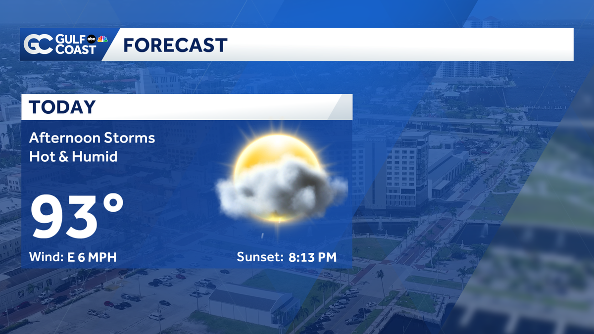
More rain is expected again today across Southwest Florida. Your Gulf Coast Weather Most Accurate Forecast calls for showers and thunderstorms to build in this afternoon, starting down in Collier and near the I-75 corridor before expanding to the coastline. Rainfall totals will vary greatly again today, too, with some places seeing over an inch of rain while others stay dry.
High temperatures will reach the 90s this afternoon in most places, but the humidity will make it feel closer to 100 degrees.
More afternoon showers and thunderstorms are possible again on Memorial Day, but our rain chances will peak at only 30%. Monday will be one of the drier days of the week.
By midweek, big changes are coming to our weather pattern as more moisture is set to move in. For now, rain chances Wednesday through Friday have bumped up to 60% coverage, but things can still evolve as we head into this week. Expect it to be cloudier with highs dropping into the 80s as a result late in the week.
Count on Gulf Coast News to keep an eye on how this forecast may change.
However you watch or scroll, we’re committed to delivering your Gulf Coast Weather Most Accurate Forecast, one you can rely on every day, wherever you are.
Live Interactive Radar: Track conditions in real time with the Gulf Coast Live Radar.
Watch Gulf Coast Weather: Find the latest weather forecast videos, streaming live or on demand, on TV and online.
Stream on the Go: Download the free Gulf Coast News app to watch on your phone or tablet.
Your Gulf Coast Weather Team
Follow on Social: Follow, like, and subscribe to Gulf Coast News on social media to share your tips and be part of the conversation with Southwest Florida’s most experienced, trusted weather team: Facebook | Instagram | YouTube | TikTok | Threads | Bluesky | Nextdoor | X
DOWNLOAD the free Gulf Coast News app for your latest breaking news and weather alerts. And check out the Very Local Gulf Coast app to stream news, entertainment, and original programming on your TV.