
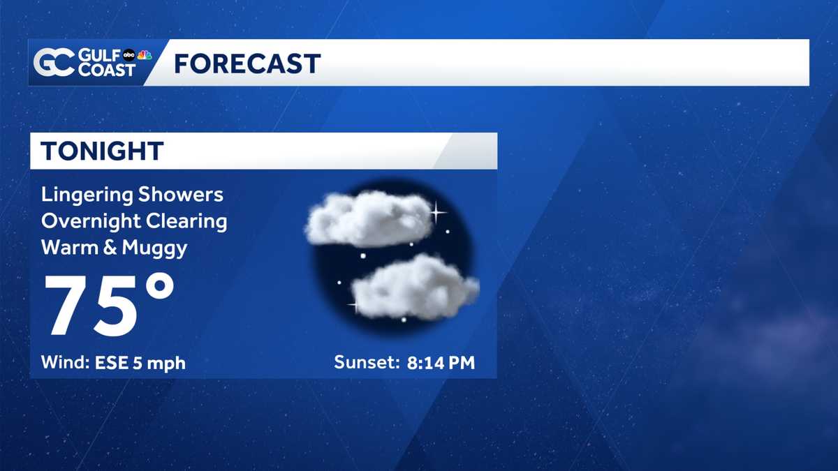
PROTECT FRIDAY NIGHT AT 8 ON GULF COAST. NBC’S >> CHANNING. WELL, WE ARE TRACKING THE RETURN OF SOGGY, SOGGY WEATHER LATER THIS WEEK. THAT’S THE BIG WEATHER STORY. JUST LOOK AT OUR RAIN CHANCES. WE’RE BACK TO 40% SHOT OF RAIN ON YOUR WEDNESDAY. THURSDAY. THINGS ARE LOOKING VERY SOGGY. A 70% CHANCE OF RAIN AND IT STAYS RAINY ALL THE WAY THROUGH THE END OF THE WEEK AND INTO THE WEEKEND. LET ME WALK YOU THROUGH YOUR HIGH RESOLUTION DATA. SO I’M PICKING THIS UP AROUND LUNCH ON THURSDAY. WE’LL START TO SEE THE SHOWERS. SOME THUNDERSTORMS PICK UP JUST AFTER LUNCH. AND AS WE GET TO THE AFTERNOON, I EXPECT SOME BIG THUNDERSTORMS, ESPECIALLY IN OUR INLAND COMMUNITIES WELL, EVERYONE SEE RAIN OUT OF THIS. NO, BUT IF YOU DO GET CAUGHT IN ONE OF THESE DOWNPOURS, BE PREPARED FOR PULLING OF RAIN AND LOTS OF THUNDER. THIS WILL LINGER ON AND OFF THROUGH THE SUNSET HOURS. WE DRY OUT OVERNIGHT AND INTO FRIDAY MORNING FRIDAY AFTERNOON. ROUND 2 IS ON THE WAY MORE DOWNPOURS ARE IN THE FORECAST. A LOT OF THIS STAYING EAST OF I-75 NOT TO SAY THAT WILL STAY COMPLETELY DRY ACROSS THE COAST. BUT STILL I THINK THE BEST RAIN COVERAGE WILL STAY JUST A LITTLE BIT FURTHER EAST. SO WHY IS THIS HAPPENING? WELL, IT ALL HAS TO DO WITH THIS PLUME OF HUMIDITY RIGHT NOW. THAT’S SITTING OFF TO OUR WEST. BUT AS WE START TO SEE THE ATMOSPHERE SHIFT, ALL OF THIS HUMIDITY AND TROPICAL MOISTURE MAKES ITS WAY ACROSS THE GULF COAST THAT THIS IS JUST THE EXTRA BUMP THAT WE NEED TO GET SHOWERS AND THUNDERSTORMS GOING LATER THIS WEEK. MAKE SURE YOU HAVE THE RAIN GEAR IN HAND BECAUSE IT WILL BE SOGGY. ALL RIGHT. WE CENTERING GETTING YOU OUTSIDE RIGHT NOW. A COUPLE OF ISOLATED POCKETS OF RAIN, MAYBE ONE OR 2 RUMBLES OF THUNDER, BUT MOSTLY DRY OUT BY THE GULF COAST AND WATCHING A LITTLE CELL JUST TO THE WEST OF YEAR’S WEST OF 75. THERE OR POCKET OF RAIN OFF OF NAPLES, MOVING OFF INTO THE COAST. ANOTHER LITTLE DOWNPOUR RIGHT ON THE EDGE OF LEE AND CHARLOTTE COUNTY STRETCHING BACK TOWARD THE BURNT STORE. MARINA ALSO MOVING OFF TO THE NORTHWEST. NOT EVERYONE SEEING RAIN. IN FACT, DON’T THINK THAT MANY COMMUNITIES WILL SEE SHOWERS FOR THE REST OF THE EVENING. I DID KEEP A 30% CHANCE OF RAIN IN THERE FOR NOW AFTER SUNSET, MAYBE A LITTLE SHOWER ACTIVITY, BUT MOSTLY DRY AND CENTRAL NOTICE THE LINGERING WARMTH. WE’RE STILL IN THE 80’S BY 11:00PM WAKING UP TOMORROW WILL BE SOMEWHERE IN THE MID 70’S, WARM AND HUMID, PARTLY CLOUDY SKIES OVERNIGHT. TOMORROW WE’RE BACK TO THE HEAT. 92 IN FORT MYERS, CAPE CORAL, TOPPING OUT ABOUT 93. WE’LL SEE SHOWERS AND THUNDERSTORMS IN THE FORECAST AGAIN FOR YOUR WEDNESDAY AFTERNOON. WAKING UP DRY AFTER LUNCH. WE START TO SEE THE SHOWERS GOING. THE OCCASIONAL DOWNPOUR. NOT EVERYONE IS GOING TO SEE RAIN BUT JUST BE PREPARED WITH THE UMBRELLA IN CASE YOU NEED IT. ABOUT A 40% CHANCE OF RAIN FOR YOUR WEDNESDAY. WE START TO SEE THAT INCREASE BY THE END OF THE WEEK. THANKS TO ALL OF THE SHOWERS AND THE SOGGY WEATHER THAT WILL HELP TO KEEP OUR TEMPERATURES CHECK THIS AFTERNOON WAS VERY TOASTY. SLIGHTLY COOLER FOR YOUR WEDNESDAY. BUT THEN LOOK AT THURSDAY WHERE THE 80’S AND WE’LL HANG OUT IN THE UPPER 80’S AND LOW 90’S ALL THE WAY THROUGH THE WEEKEND. AND AT THE BEGINNING OF NEXT WEEK. SO THAT’S THE SILVER LINING WITH ALL OF THIS RAIN. IF YOU’RE NOT A FAN OF THE SOGGY WEATHER BUT PLENTY OF STORM ACTIVITY. ALL RIGHT. THE BIGGEST IMPACT FOR YOU OUT OF THE STORMS AT THE END OF THE WEEK. THAT’S GOING TO BE HEAVY RAIN AND FLOODING. I’M EXPECTING LOTS OF RAIN ACROSS THE GULF COAST. SO REMEMBER TO NEVER DRIVE INTO FLOOD WATERS
Isolated showers Tuesday Evening, Widespread rain later this week

Updated: 7:39 PM EDT May 26, 2026
Expect isolated showers and isolated storms across the Gulf Coast Tuesday evening. Temperatures will drop to the mid-70s by early Wednesday morning. Your Gulf Coast Weather Most Accurate Forecast says rain chances rise starting Wednesday. Scattered showers will fire up in the afternoon Wednesday, but Thursday is the day to watch. Rain chances peak at a 70%. Increased rain chances will linger through the end of the week. Areas across the Gulf Coast could see 2-4 inches of rain over the next seven days. A river of moisture will make its way across the Gulf Coast, promoting rounds of rain. Increasing cloud cover will also help to reduce daytime highs to near-average levels. Most of the week will feature highs in the upper 80s to low 90s. However you watch or scroll, we’re committed to delivering your Gulf Coast Weather Most Accurate Forecast, one you can rely on every day, wherever you are.Live Interactive Radar: Track conditions in real time with the Gulf Coast Live Radar.Watch Gulf Coast Weather: Find the latest weather forecast videos, streaming live or on demand, on TV and online.Stream on the Go: Download the free Gulf Coast News app to watch on your phone or tablet.Your Gulf Coast Weather TeamChief Meteorologist Allyson RaeMeteorologist Caroline CastoraMeteorologist Jim DickeyMeteorologist Lauren HopeMeteorologist Raphael TavernierMeteorologist Rob DunsMeteorologist Sara Blue Follow on Social: Follow, like and subscribe to Gulf Coast News on social media to share your tips and be part of the conversation with Southwest Florida’s most experienced, trusted weather team: Facebook | Instagram | YouTube | TikTok | Threads | Bluesky | Nextdoor | XDOWNLOAD the free Gulf Coast News app for your latest breaking news and weather alerts. And check out the Very Local Gulf Coast app to stream news, entertainment, and original programming on your TV.
FORT MYERS, Fla. —
Expect isolated showers and isolated storms across the Gulf Coast Tuesday evening. Temperatures will drop to the mid-70s by early Wednesday morning.
Your Gulf Coast Weather Most Accurate Forecast says rain chances rise starting Wednesday. Scattered showers will fire up in the afternoon Wednesday, but Thursday is the day to watch. Rain chances peak at a 70%. Increased rain chances will linger through the end of the week.
Areas across the Gulf Coast could see 2-4 inches of rain over the next seven days. A river of moisture will make its way across the Gulf Coast, promoting rounds of rain.
Increasing cloud cover will also help to reduce daytime highs to near-average levels. Most of the week will feature highs in the upper 80s to low 90s.
However you watch or scroll, we’re committed to delivering your Gulf Coast Weather Most Accurate Forecast, one you can rely on every day, wherever you are.
Live Interactive Radar: Track conditions in real time with the Gulf Coast Live Radar.
Watch Gulf Coast Weather: Find the latest weather forecast videos, streaming live or on demand, on TV and online.
Stream on the Go: Download the free Gulf Coast News app to watch on your phone or tablet.
Your Gulf Coast Weather Team
Follow on Social: Follow, like and subscribe to Gulf Coast News on social media to share your tips and be part of the conversation with Southwest Florida’s most experienced, trusted weather team: Facebook | Instagram | YouTube | TikTok | Threads | Bluesky | Nextdoor | X
DOWNLOAD the free Gulf Coast News app for your latest breaking news and weather alerts. And check out the Very Local Gulf Coast app to stream news, entertainment, and original programming on your TV.