
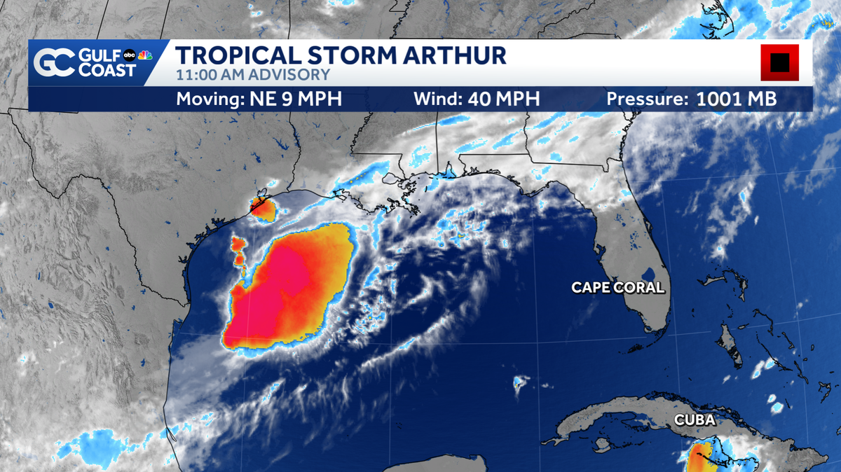
Tropical Storm Arthur formed in the Gulf Wednesday morning, making it the first named storm of the 2026 hurricane season. As of 11 a.m., Tropical Storm Arthur is 300 miles west-southwest of Lake Charles, Louisiana. The storm is tracking northeast at 9 mph and producing 40 mph winds. Arthur will be a short-lived tropical storm, forecast to weaken once it moves onto land overnight. Florida Weather ImpactsWhile this system poses no direct threat to Florida, remnant moisture will work into the Panhandle on Thursday.The western Panhandle could see 5-7″ of rain and a flooding threat over the next 48 hours. The system will also bring a tornado risk for parts of the Panhandle Thursday.Use extreme caution if you’re planning to travel north Thursday and Friday as heavy rain will target many communities across the southeastern U.S. This system poses no threat to the Florida peninsula.Tropical ImpactsThe most impactful threats from this storm will be heavy rain in parts of Texas, Louisiana and Mississippi. Some communities could see 5-10″ of rain, with isolated spots receiving up to 20″. This will heighten the risk of life-threatening flooding over the next several days.Parts of the eastern Texas coast and southwestern Louisiana could see 2-4 feet of storm surge.The system will also bring a tornado threat to southern Texas, southern Louisiana, Mississippi, Alabama and the western Florida Panhandle.A tropical storm warning has been issued for the southwest coast of Louisiana and a tropical storm watch is active for parts of the eastern Gulf Coast of Texas. First Named Storm Arthur became our first named storm of the 2026 hurricane season. Typically, we see our first named storm by June 20, so we are keeping up with seasonal averages. NOAA is forecasting a below-average number of storms this season. They are expecting 8 to 14 named storms. On average, we have 14 named systems.The next name on the list is Bertha.However you watch or scroll, we’re committed to delivering your Gulf Coast Weather Most Accurate Forecast, one you can rely on every day, wherever you are.Live Interactive Radar: Track conditions in real time with the Gulf Coast Live Radar.Watch Gulf Coast Weather: Find the latest weather forecast videos, streaming live or on demand, on TV and online.Stream on the Go: Download the free Gulf Coast News app to watch on your phone or tablet.Your Gulf Coast Weather TeamChief Meteorologist Allyson RaeMeteorologist Caroline CastoraMeteorologist Jim DickeyMeteorologist Lauren HopeMeteorologist Raphael TavernierMeteorologist Rob DunsMeteorologist Sara BlueFollow on Social: Follow, like, and subscribe to Gulf Coast News on social media to share your tips and be part of the conversation with Southwest Florida’s most experienced, trusted weather team: Facebook | Instagram | YouTube | TikTok | Threads | Bluesky | Nextdoor | XDOWNLOAD the free Gulf Coast News app for your latest breaking news and weather alerts. And check out the Very Local Gulf Coast app to stream news, entertainment, and original programming on your TV.
FORT MYERS, Fla. —
Tropical Storm Arthur formed in the Gulf Wednesday morning, making it the first named storm of the 2026 hurricane season.
Gulf Coast News
Tropical Storm Arthur
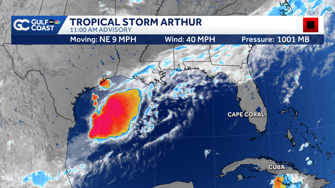
As of 11 a.m., Tropical Storm Arthur is 300 miles west-southwest of Lake Charles, Louisiana. The storm is tracking northeast at 9 mph and producing 40 mph winds.
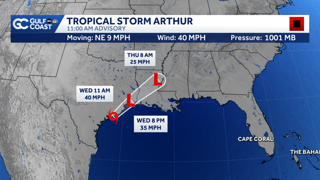
Arthur will be a short-lived tropical storm, forecast to weaken once it moves onto land overnight.
Gulf Coast News
Forecast Cone
Florida Weather Impacts
While this system poses no direct threat to Florida, remnant moisture will work into the Panhandle on Thursday.
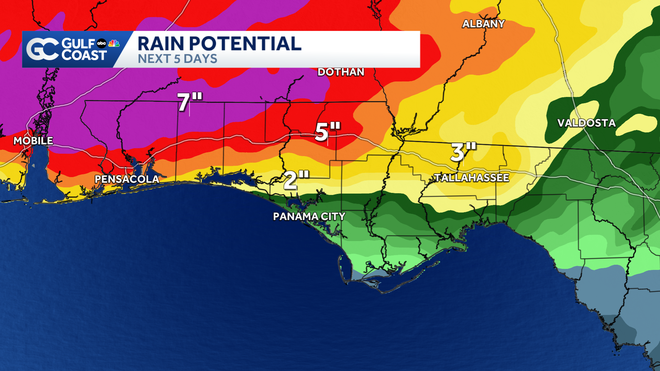
The western Panhandle could see 5-7″ of rain and a flooding threat over the next 48 hours. The system will also bring a tornado risk for parts of the Panhandle Thursday.
Use extreme caution if you’re planning to travel north Thursday and Friday as heavy rain will target many communities across the southeastern U.S. This system poses no threat to the Florida peninsula.
Gulf Coast News
Rainfall Totals
Tropical Impacts
The most impactful threats from this storm will be heavy rain in parts of Texas, Louisiana and Mississippi. Some communities could see 5-10″ of rain, with isolated spots receiving up to 20″. This will heighten the risk of life-threatening flooding over the next several days.
Parts of the eastern Texas coast and southwestern Louisiana could see 2-4 feet of storm surge.
The system will also bring a tornado threat to southern Texas, southern Louisiana, Mississippi, Alabama and the western Florida Panhandle.
A tropical storm warning has been issued for the southwest coast of Louisiana and a tropical storm watch is active for parts of the eastern Gulf Coast of Texas.
First Named Storm
Arthur became our first named storm of the 2026 hurricane season. Typically, we see our first named storm by June 20, so we are keeping up with seasonal averages. NOAA is forecasting a below-average number of storms this season. They are expecting 8 to 14 named storms. On average, we have 14 named systems.
The next name on the list is Bertha.
However you watch or scroll, we’re committed to delivering your Gulf Coast Weather Most Accurate Forecast, one you can rely on every day, wherever you are.
Live Interactive Radar: Track conditions in real time with the Gulf Coast Live Radar.
Watch Gulf Coast Weather: Find the latest weather forecast videos, streaming live or on demand, on TV and online.
Stream on the Go: Download the free Gulf Coast News app to watch on your phone or tablet.
Your Gulf Coast Weather Team
Follow on Social: Follow, like, and subscribe to Gulf Coast News on social media to share your tips and be part of the conversation with Southwest Florida’s most experienced, trusted weather team: Facebook | Instagram | YouTube | TikTok | Threads | Bluesky | Nextdoor | X
DOWNLOAD the free Gulf Coast News app for your latest breaking news and weather alerts. And check out the Very Local Gulf Coast app to stream news, entertainment, and original programming on your TV.