
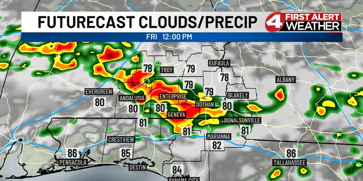
(WTVY) – After a soaking Thursday that brought over 2 inches of rain to Dothan Regional Airport — the most in a single day since mid-August — the Wiregrass will face another round of heavy rain and strong storms Friday morning and into the early afternoon.
A band of organized showers and thunderstorms is expected to develop over central portions of the state early Friday morning, then move southward toward the Gulf Coast throughout the day. While heavy rain is the primary concern, a few pockets of damaging winds are also possible as storms move through the region.
What to Expect Friday
Scattered to widespread showers and thunderstorms will blanket the area with an 80% chance of precipitation. Some storms could be strong, bringing gusty winds and heavy rainfall that could cause isolated flooding — particularly in areas that received Thursday’s downpours.
By Friday night, conditions will improve slightly. Mostly cloudy skies are expected with a few stray showers and thunderstorms lingering. The low will drop to near 73°.
Weekend Outlook
Pop-up showers and thunderstorms will become more of a normal sight through the weekend as moisture remains in place.
Saturday will bring mostly cloudy skies with scattered showers and thunderstorms, with a high near 87° and a 50% chance of rain. Sunday follows a similar pattern with partly sunny skies, scattered storms, and a high near 88°.
Drying Out Next Week
Drier conditions arrive as the first official week of summer begins. Monday through Thursday will see conditions gradually improve with fewer rain chances and warming temperatures. Highs will climb into the lower 90s by early next week, with rain chances dropping to 20% Monday and Tuesday before increasing slightly midweek.
Coastal Impacts
A high rip current risk continues through late Sunday night along coastal areas. Seas offshore will range from 5-7 feet, occasionally reaching 8 feet Friday morning, decreasing to 4-5 feet by Friday afternoon. Coastal lakes and bays will remain choppy.
Tropical Update
The remnant energy of former Tropical Storm Arthur continues tracking eastward and will enter the Atlantic this weekend. The National Hurricane Center is monitoring a low chance of tropical development as that system moves offshore late this weekend and early next week.
Download the WTVY News4 app to get alerts and stories the moment they are published. Available for FREE in the Apple App Store and the Google Play Store!
Copyright 2026 WTVY. All rights reserved.