
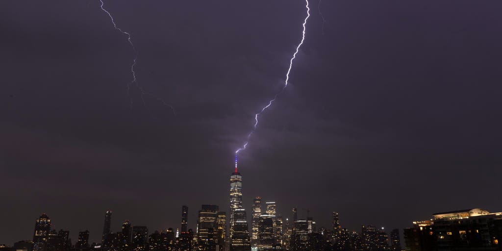
Over 135 million Americans across the Northeast are under a severe weather threat through today. Mayor cities along the I-95 corridor like New York City, and Philadelphia could see a possible tornado throughout the day. Stick with FOX Weather for all the latest:
Strong weekend storms are expected to bring a variety of impacts to the East Coast, including thunderstorms, hail, gusty wind and possibly even a few tornadoes, causing a sense of relief from the recent heat and smoky conditions.
Warm and muggy temperatures are once again plaguing portions of the East Coast, but thick Canadian wildfire smoke could throw a wrench into exactly how hot it gets.
Fortunately, this warm, smoky pattern will break as storms move in this weekend.
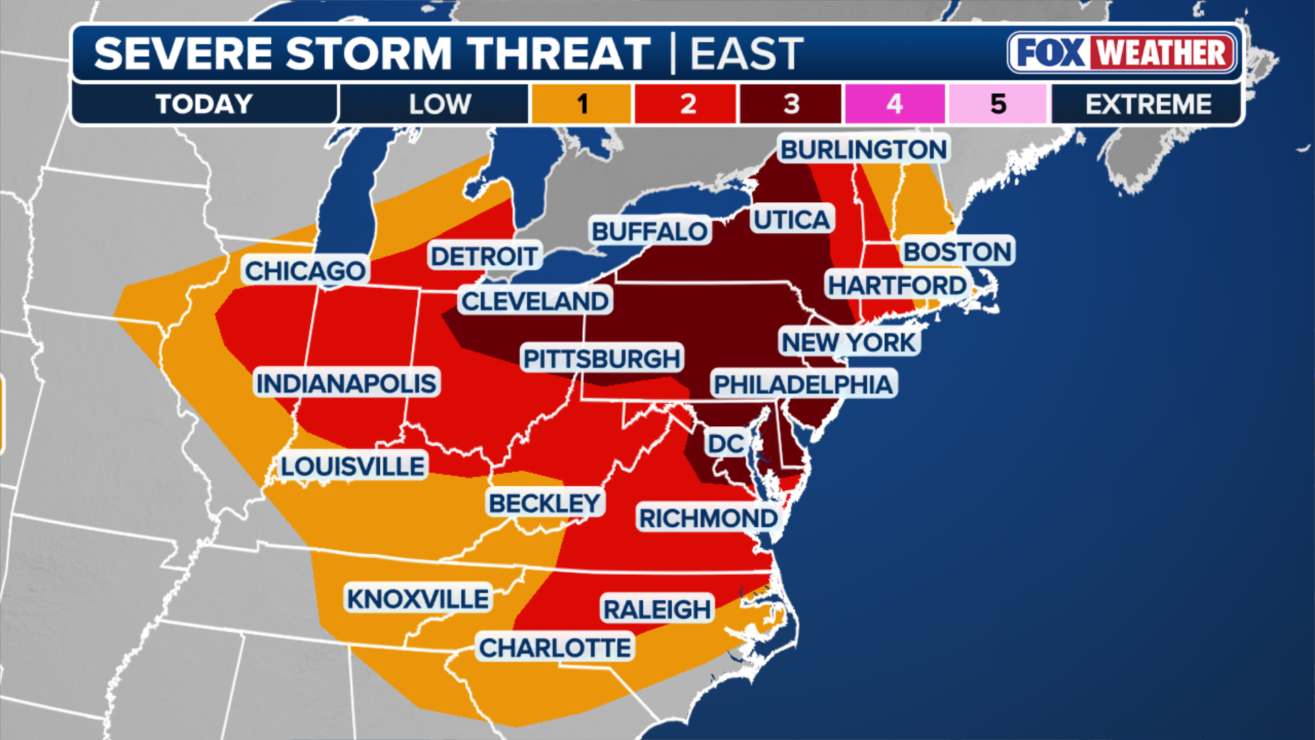 Saturday severe storm threat.
(FOX Weather)
As the weekend begins, a slow-moving cold front will sweep through the East Coast from the Ohio Valley.
This incoming front will trigger widespread, heavy showers and thunderstorms through Sunday across portions of the Mid-Atlantic.
More than 135 million Americans across 20 states are under threat of severe storms.
While these storms will carry a risk of damaging winds, downpours and frequent lightning, the greatest concern will be Saturday. A Level 3 out of 5 severe storm threat extends throughout most of the Northeast and southeastern Great Lakes.
WHAT IS A HEAT DOME AND HOW CAN IT AFFECT YOU DURING THE SUMMER MONTHS?
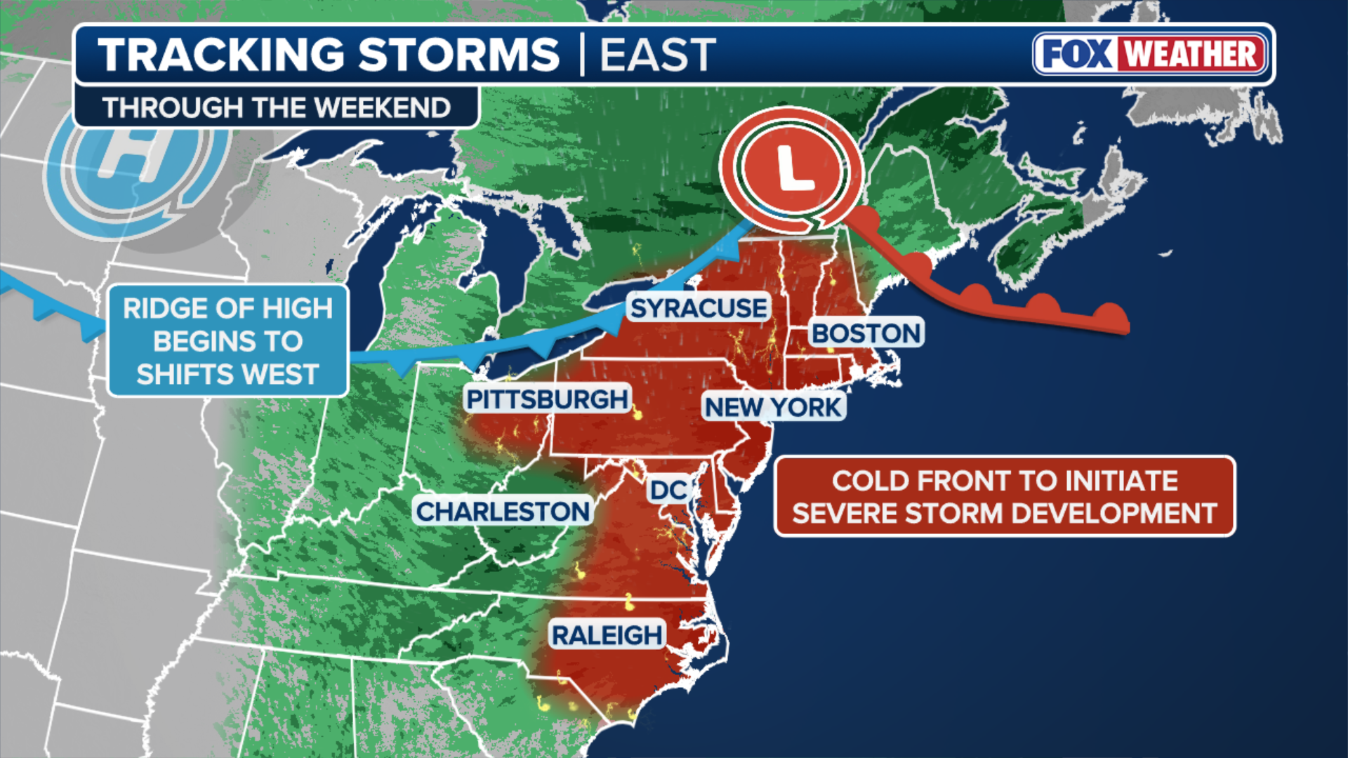 Tracking storms heading into the weekend.
(FOX Weather)
Over 52 million Americans are under this Level 3 threat, which includes major cities like New York City, Philadelphia, Washington, D.C., Pittsburgh and Cleveland.
A broader Level 2 threat is in place as far west as Peoria, Illinois, as far south as Charlotte, North Carolina and as far north as Burlington, Vermont.
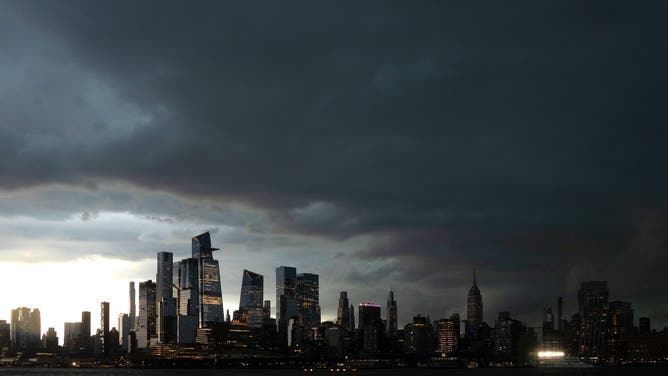
HOBOKEN, NJ – MAY 20: Storm clouds begin to move over the skyline of midtown Manhattan and the Empire State Building in New York City on May 20, 2026, as seen from Hoboken, New Jersey.
(Gary Hershorn / Getty Images)
An intense line of storms will develop across western parts of the Northeast late-evening on Saturday and move eastward through the overnight hours, the FOX Forecast Center said.
Large, damaging hail will be the primary threat early on. However, once the storms transition into a line, damaging wind gusts will become the main hazard. A few tornadoes are also possible.
As the cold front continues its eastward progress farther south, severe storms will also be likely across Western Virginia and North Carolina, where there is a Level 2 out of 5 severe storm threat on Sunday.
 Multi-day severe weather threat.
(FOX Weather)
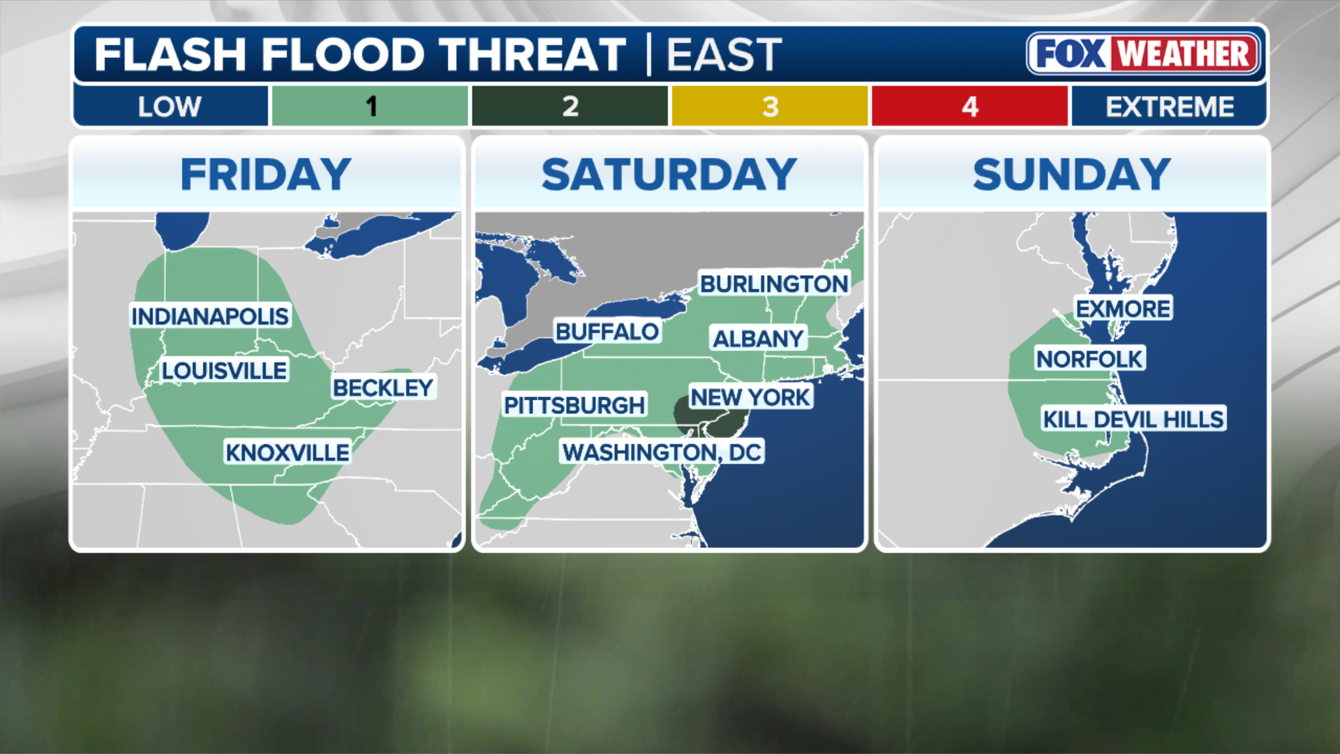
In addition to the storm threat, a flash flooding threat stretches across the Ohio Valley on Friday. On Saturday, the flood threat inlcudes a large portion of the Northeast, where a level 2 flood threat is in effect for New York City, parts of Pennsylvania and New Jersey.
On Sunday, a level 1 flash flood threat is in place for parts of Virginia and North Carolina.
For New York City, rainy weekends have become all too familiar this summer. Central Park has recorded measurable rain every single weekend since the beginning of June, and if the current forecast holds, that streak will likely continue.
Stay with FOX Weather for the latest on this weekend’s storms.