
Batting away snakes, Wilkie Declouet trudged through chest-deep water to reach his front door.
Hurricane Ida had flooded Ironton, a small historic Black community down the Mississippi River from New Orleans, only 10 miles outside the levee system that protects the city. Declouet, a 61-year-old father of four, was the first to return.
His house, raised on piers, had held. Almost nothing else had. A weathered white casket was stuck upright in the tangle the flood left behind. Inside it was a man Declouet had known. At least a dozen caskets lay scattered around Ironton for weeks after the storm.

Wilkie Declouet works on a home improvement project in his backyard in Ironton, La., Wednesday, June 24, 2026.
STAFF PHOTO BY SOPHIA GERMER
“Ida was a storm that came up fast,” Declouet said recently as he sat under his rehabbed house. “And it was one of these things where they couldn’t decide whether it was going to be a Category 3, 4 or 5. They couldn’t decide.”
Ida’s supercharged winds were not a fluke. The sudden force of the 2021 storm signaled much more.
The Gulf of Mexico, which the Trump administration has renamed the Gulf of America, is in the throes of a turbulent new era that holds enormous consequences for Louisiana and the other states along its coast.
It has become one of the fastest-warming bodies of water in the world, new research is showing. Human-caused climate change is fusing with cyclical weather patterns to create the new reality.
From sea levels to fisheries, deepwater drilling and storms, every vestige of life in the Gulf will change as the water heats.
Hot Gulf waters juiced Ida’s winds from 80 to 150 mph in the day before landfall, leaving people like Declouet and his neighbors less time to prepare. But the changes will not be limited to hurricanes.
“This is a dramatic wake-up call,” said Donald Boesch, a professor of marine science at the University of Maryland who previously served as the first director of the Louisiana Universities Marine Consortium.
A casket that floated from its tombs during flooding from Hurricane Ida sits in a lawn of a destroyed home in Ironton, La., Monday, Sept. 27, 2021. Hurricane Ida swept through Louisiana with furious winds that ripped roofs off buildings and storm surge so powerful it moved homes. And what it wrought on the living it also wrought on the dead, moving vaults and caskets and adding another layer of trauma on families and communities recovering from the powerful storm. (AP Photo/Gerald Herbert)
Gerald Herbert
“The people of the Gulf have long lived with the risks of living on this marginal ocean. But in recent years, it’s become obvious that it’s heating dramatically. That has huge implications for the rapid intensification of hurricanes as well as for accelerated sea-level rise.”
‘Real-world experiences’
Since 1970, the Gulf’s surface has warmed twice as quickly as the combined average of the rest of the world’s oceans, federal data shows, climbing nearly 2 degrees Fahrenheit. That might not seem like much, but it is already having wide-ranging effects.
Dolphins swim in Mobile Bay, Ala., Friday, April 24, 2026.
STAFF PHOTO BY SOPHIA GERMER
The changes are no longer projections. They are happening in real time, and they compound. Just this month, the Gulf hit a record high temperature for early July, driven by a recent heat wave.
As water warms, it expands, speeding sea level rise along the Louisiana coast that is already climbing six times faster than the global average, largely due to land subsidence. The heat is also spreading deeper as the climate gets hotter, with temperatures rising even at the very bottom of the Gulf.
Louisiana’s coastal marshes, already fading away, will drown faster, and high-tide flooding in coastal communities, once an occasional nuisance, will become chronic.
Scientists say, with a degree of confidence that’s uncommon among skeptical researchers, that a generation of sea level rise along the Gulf Coast is essentially guaranteed, no matter how aggressively the world cuts fossil fuel emissions.
Global weather is also intertwined with the Gulf. The warming currents that flow through it have reverberating effects on climate patterns far away from Louisiana.
At the same time, the problem is becoming more complicated to address.
Funding for the elaborate, networked systems that monitor the temperature of the Gulf is at risk due to cuts by the Trump administration, hampering scientists working to understand what is unfolding.
The federal government has also largely abandoned its fledgling attempts to address climate change, and governors across the Gulf Coast, including in Louisiana, have followed suit. Planet-heating carbon dioxide emissions, the result of burning fossil fuels, increased last year by an estimated 2.4%, according to the Rhodium Group, an independent global policy and economic research firm.
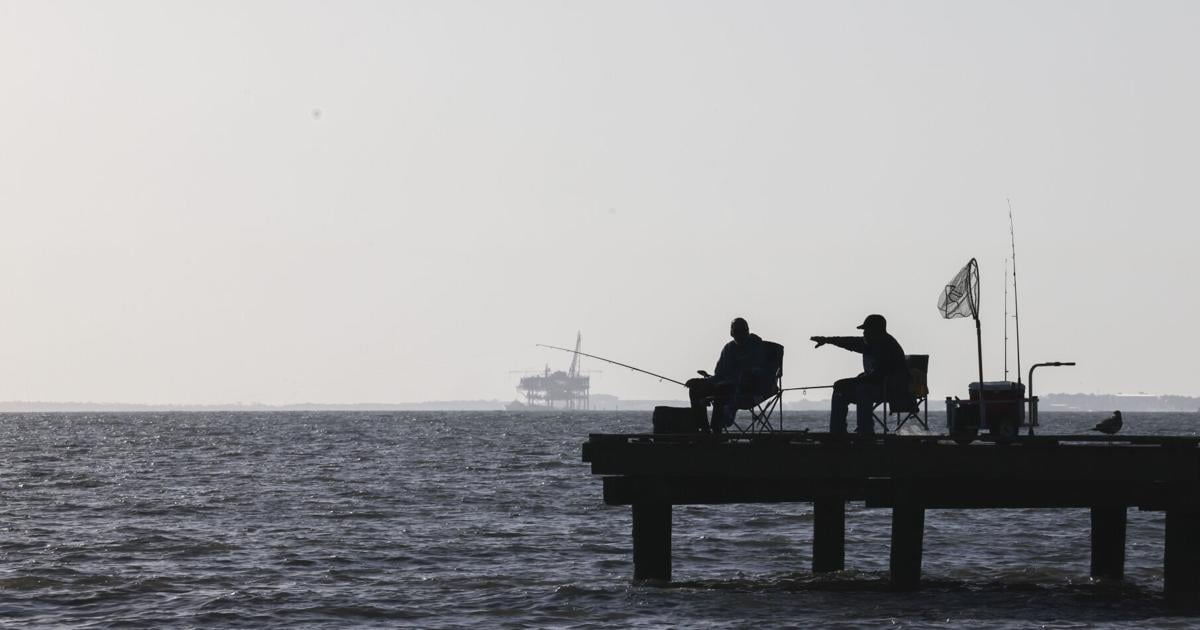
Oil platforms photographed off the coast of Dauphin Island, Ala., Friday, April 24, 2026.
STAFF PHOTO BY SOPHIA GERMER
“These are not theoretical concepts that people keep talking about. Your insurance increases, you have water damage, you have damage to your house,” said Sönke Dangendorf, a Tulane scientist considered one of the world’s preeminent experts on sea levels. “These are real-world experiences.”
The workshop
In the days before Ida, as Declouet was preparing to evacuate, Kevin Martin was on the water, deploying a buoy that would sit anchored in the Gulf, in the storm’s path.
“Ida ripped right over the buoy, ripped every solar panel off of it,” said Martin, who works out of NASA’s Stennis Space Center in a lab run by the University of Southern Mississippi, operating the buoys, gliders and other instruments that take the Gulf’s temperature.
Kevin Martin, an instrumentation specialist and ocean observing manager with the University of Southern Mississippi, poses with a glider used for ocean science, at John C. Stennis Space Center in Hancock County, Miss., Wednesday, April 22, 2026.
STAFF PHOTO BY SOPHIA GERMER
The buoy carried enough battery power to keep recording without the panels, capturing data straight through the storm.
It wasn’t the first time one of the program’s buoys rode out a hurricane. During Katrina, another gathered data continuously through that storm, even as the surge dragged it and its 5,000-pound anchor roughly nine miles.
While Martin’s instruments plumb the ocean depths, his desk rumbles as engine tests for the Artemis missions take place next door to his office at Stennis. The lab spills over into room after room filled with deep-water instruments, like Q’s workshop in a Bond film.
One device, called Eagle Ray, is a giant torpedo-shaped autonomous vessel that maps the bottom of the Gulf down to about 6,500 feet. Another, Mola Mola, the scientific name for the ocean sunfish with which it shares its shape, uses lasers to take hyper-detailed photographs of the seafloor.
Ocean science data collectors called Mola Mola and Eagle Ray photographed at the University of Southern Mississippi building, at John C. Stennis Space Center in Hancock County, Miss., Wednesday, April 22, 2026.
STAFF PHOTO BY SOPHIA GERMER
He also has spindle-shaped gliders that navigate the Gulf’s waters, taking measurements of temperature and salinity continuously over several months before they are retrieved. The intel his autonomous robots collect contributes to global datasets, collected from thousands of networked sensors across the world.
As the waters Martin studies heat up, he has had to recalibrate some sensors after they maxed out. The lab he works for even moved the servers that store the data he collects to Hattiesburg, Mississippi, some 60 miles north of the coast, to keep them farther from increasingly strong hurricanes.
Other changes, he says, are stranger and harder to explain, pointing to a tooth-shaped indentation in one of his gliders.
“I hadn’t had a shark strike in all the years I was operating gliders since 2007,” he said. “In 2024, I had two. And you have to ask yourself why.”
Martin stressed he doesn’t study sharks, but a recent study found that one species is spending more time in the Gulf as its waters warm.
Damage from shark teeth photographed on a glider used for collecting data in the Gulf at a University of Southern Mississippi building at John C. Stennis Space Center in Hancock County, Miss., Wednesday, April 22, 2026.
STAFF PHOTO BY SOPHIA GERMER
None of this work is cheap. Martin’s workhorse glider model costs $250,000. One glider, he said, can “run up a $1,000-a-month phone bill,” just to transmit its location and data.
A battery pack costs $22,000. And the lab operates on grant funding. Already, he can only afford to deploy gliders during hurricane season.
“These vehicles shouldn’t be sitting here. They should be in the water,” he said. “The funding’s not there.”
The Trump administration has repeatedly threatened to pull funding from long-running programs that allow scientists to take the temperature of the world’s oceans. The president’s latest budget request would have eliminated the federal program that funds the Gulf of America Coastal Ocean Observing System (GCOOS), the regional network to which Martin contributes, along with 10 sister networks around the country’s coasts.
Congress maintained funding for GCOOS this year. Whether it will do so again is unclear.
Three weeks after Hurricane Ida’s wind and storm surge destroyed most of the community Ironton, La., the historic African American community in Plaquemines Parish south of New Orleans as gotten little outside help Sunday, Sept. 19, 2021. (Photo by David Grunfeld, NOLA.com | The Times-Picayune | The New Orleans Advocate)
Following President Donald Trump’s lead, the National Science Foundation cut funding for a sophisticated $368 million observation network. It has begun pulling up deep-sea buoys off the coasts of Alaska, North Carolina, the state of Washington as well as in a crucial monitoring zone between Greenland and Iceland.
The amount of data collected to date is “a blip” on the timescales at which global systems change, said Renellys Perez, a deputy director of physical oceanography at the National Oceanic and Atmospheric Administration. “We really need many decades of data to better understand how the ocean is changing.”
While Trump has targeted the system because it contributes to the nation’s understanding of climate change, its primary role is to provide weather data, said Craig McLean, a former NOAA assistant administrator for research who oversaw it. The system is crucial, he argued, informing evacuations and storm preparations, information that he says pays for itself.
“It’s a fraction of a penny a day for what you’re getting,” he said. “It’s not even the shaving of the copper on the edge of the penny.”
The deep Gulf
While Martin’s gliders largely measure the temperature of the Gulf at its surface, something equally concerning is happening at its depths.
Scientists have long known that the oceans absorb most of the excess heat that’s getting trapped in the atmosphere due to human-caused emissions, but they once thought that warming was largely confined to the ocean’s top layer.
But when a team of researchers tethered deep-sea thermometers to the ocean floor in the western Gulf, they measured an alarming trend: Even at the bottom — at a depth of more than 11,000 feet — it is getting warmer, at a rate of about 0.15 degrees Fahrenheit per half-century.
The creatures that live at the bottom of the Gulf — the deep-sea corals and strange fishes — are precisely tuned animals, adapted to live in a high-pressure, low-temperature environment. Small changes there ripple. Many of those creatures form the basis of the food chain fueling the Gulf’s mega-fisheries that power the state’s coastal economy.
Corals at the bottom of the ocean are particularly vulnerable to temperature changes. Even a small rise can stress corals, causing them to expel the symbiotic algae that lives inside them — giving them their color and most of their nutrients — in a process called “coral bleaching.” These corals are crucial nurseries for dozens of critical species that coastal communities rely on.
“I was on a coral reef about 500 meters down and we saw groupers down there. We saw barrel fish. We saw alfonsino. We saw spot prawns,” said Erik Cordes, a biologist at Temple University who studies corals, often using remotely operated submarines. “These are all species that are fished in the Gulf of Mexico, that spend good parts of their lives way down deep on these coral reefs.”
What happens at depth doesn’t just affect the creatures that live near the seafloor. As hurricanes tear over the Gulf’s balmy waters, they draw heat from its surface. If those waters are hot enough, storms become rapidly supercharged — as Hurricane Ida did before it slammed into Ironton.
In previous decades, once that heat from the surface of the Gulf was sucked up by the storm, which churns the waters like a blender as it passes over, the cooler waters below tended to slow a hurricane down.
Kevin Martin, an instrumentation specialist and ocean observing manager with the University of Southern Mississippi, shows buoys used for ocean science, at John C. Stennis Space Center in Hancock County, Miss., Wednesday, April 22, 2026.
STAFF PHOTO BY SOPHIA GERMER
Now, even those deeper waters are warmer than they used to be.
“A hurricane can blow itself out by causing this deeper water to well up,” said Boesch. But if the Gulf’s deep waters are warm, “it just wells up more heat and intensifies.”
Ocean currents
The heat trapped in the Gulf’s depths doesn’t stay there. It is connected to a massive system of global ocean currents that help regulate the planet’s climate.
A monster current flows into the Gulf between the Yucatán Peninsula and Cuba, plodding north toward Louisiana before doubling back on itself and flowing out through the Florida Straits. That stream, called the Loop Current, is a key component of the global system of water flows that forms, as Texas A&M professor of oceanography Steven DiMarco put it, “the air-conditioning of the planet,” moving heat, through water, between the equator and the poles.
“Will that change?” DiMarco asks.
The question arises because, when the Loop Current flows out through the Florida Straits, it joins the Gulf Stream, the flow of warm water that brings heat from the tropics up toward northern Europe. Those currents, taken together, are part of what scientists call the Atlantic Meridional Overturning Circulation — a system of global ocean currents that plays a significant role in regulating the world’s climate.
Source: HYCOM via NOAA • Times-Picayune | The Advocate graphic.
All of those currents may be slowing. Scientists are now debating the possibility that the system of currents — the flows of water that have circled the globe for millennia — could collapse entirely due to climate change.
The likelihood of that happening is “still debated,” said Matthieu Le Hénaff, a NOAA oceanographer. “There is no certainty of a collapse. Some models show it. It’s highly discussed.”
If it were to collapse, the climate system would be thrown out of whack.
Parts of Europe could fluctuate between colder winters and hotter summers. Monsoons would be disrupted. Wildfire risk could increase. Sea level rise would accelerate — in the Gulf and globally — and agricultural systems could be upturned.
“Just because the Gulf is partially enclosed doesn’t mean we’re not connected to everything else,” Martin said.
Rising seas
While these shifting currents threaten to rewrite the global climate, the sheer volume of this warming is already threatening to redraw the map of the Gulf.
The contours of the Gulf 125,000 years ago may portend what is to come.
That was the last time global temperatures were comparable to what they are now, and the Gulf lapped against an ancient ridge that traverses the state from Mississippi to Texas, north of Lake Pontchartrain and Lake Maurepas. The line is roughly where wetlands and loose mud give way to pine forests and denser soil.
Generations into the future, the Gulf may eventually return there, a recent paper from researchers at Tulane University argued, though scientists and local leaders say there are options to adapt and stave off that prospect. In the meantime, extreme events will — and have already — become more frequent.
Dangendorf led a study, published in June, that found that globally since 1900, coastal extreme sea levels that used to happen once a century are occurring 12 times as often, with human-driven warming quadrupling their likelihood.
Audrey Trufant Salvant visits relatives at the Trufant cemetery in Ironton, La., Wednesday, June 24, 2026.
STAFF PHOTO BY SOPHIA GERMER
Communities like Ironton may bear the brunt of the extremes. But as the Gulf heats and seas rise, no communities along the coast will be spared the impacts of a changing climate.
Audrey Trufant Salvant, Declouet’s neighbor, said she has seen the changes play out. Many of her neighbors have left after they were unable to rebuild. The community has shrunk.
“They are getting worse,” she said of the storms. “We are ducks in the water. Every time June comes around, we wonder: Will we have to run again?”
Additional sources for graphics: Gulf and global ocean warming trends from “Upper-Oceanic Warming in the Gulf of Mexico between 1950 and 2020” by Zhankun Wang, et al. Gulf surface temperatures, ocean current and deep-water temperature data from NOAA. Seafloor warming rates from “Deep-Water Warming in the Gulf of Mexico from 2003 to 2019” by José Ochoa et al.