
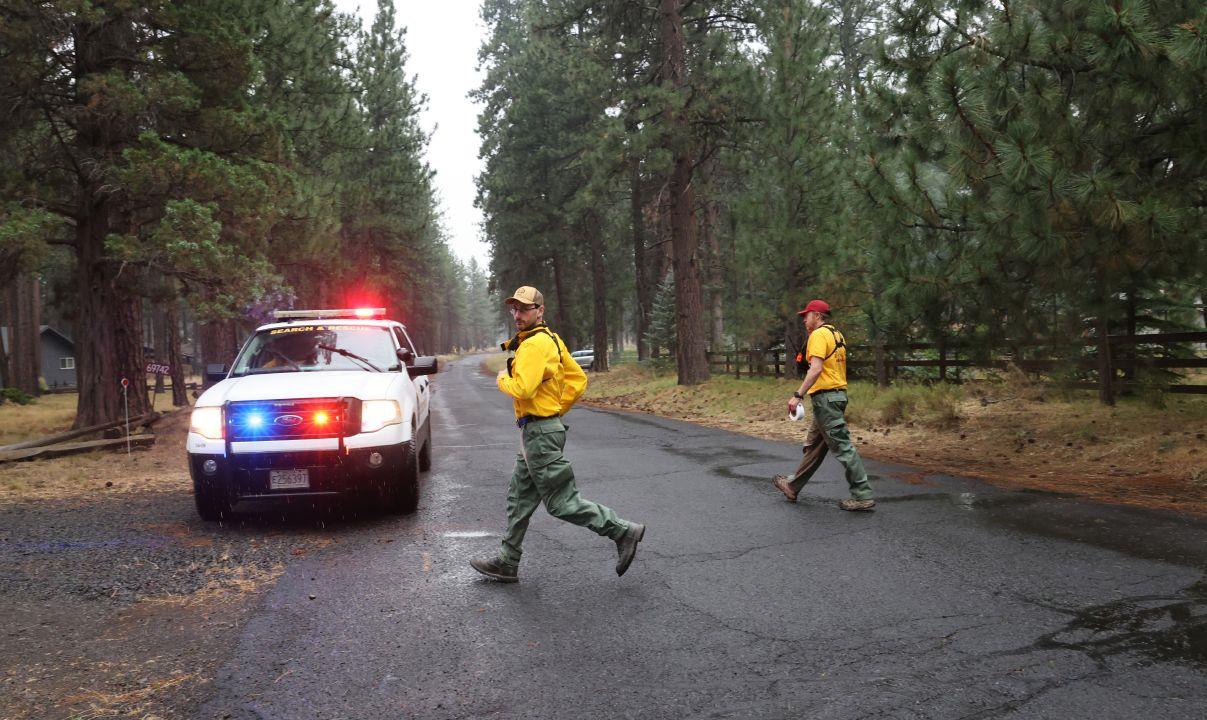
Several areas north of Sisters were upgraded to a “Go Now” evacuation level at 4 p.m. Wednesday as storms reached the Akawa Butte Fire. Weather conditions caused “violent shifts in wind and fire direction,” according to a Deschutes County Sheriff’s Office press release.
An interactive fire evacuation map is here.
Storms in the south of the county had been growing in strength and hit the fire site about 3:30 p.m. Wednesday.
The Red Cross continues to run a shelter as Sisters High School. Several hundred people live in the evacuation zones. “Be Ready” evacuation zones now touch Sisters’ northern city limits east of the Santiam Highway.
Latest evacuation information
New Level 3 (Go Now) evacuation notices
Areas between Indian Ford Creek and Camp Polk Road and Indian Ford Road from the 69600 Block of Camp Polk Road north to North Pine Street.
Squaw Creek Canyon Estates to include areas off Mt. View Road between Appaloosa Drive and Buffalo Drive
Henkle Butte area, Vista Ridge Drive, Stardust Lane, and Annie’s Drive
Area surrounding Camp Polk Cemetery
Fair Mile Road south of Wilt Road, including Suntree Lane
Area of Old Wagon Road, West Meadow Parkway, and Tumbleweed Turn
Cascade Meadow Ranch to include Windigo Trail Road
Meadow View Road area between Indian Ford Road and Indian Ford Creek
Northern end of Mt. View Road
Wilt Road north of Buffalo Drive to Big Buck Road
USFS lands north of Cascade Meadows Ranch to Indian Ford Creek and west of North Pine Street, including the Zimmerman Butte area.
Freemont Canyon area east of Wilt Road and north of Big Buck Road, to include Rimrock Ranch
Pine Ridge Road and Fox Ridge Circle off of Indian Ford Road
Forest land (USFS and private) east of Stevens Canyon Road and south of a line from Stevens Canyon Road and FS 2050/390 spur, east approximately 4 miles to the National Forest Boundary, and South to Wilt Rd. Commonly referred to as the southern portion of Sage Flat. Excluding Fox Ridge Circle and Pine Ridge Road
Private property on both sides of the northern portion of Indian Ford Road north of Indian Ford Creek to the Forest Boundary.

New Level 1 (Be Ready) evacuation notices:
South of Forest Service Road 600, east of Hwy 20, west of Pine Street, also known as Forest Service Road-2058, and north of Forest Service Road 100.
Area of Trapper Point Road and Crooked Horseshoe Road
Deer Ridge Road, Foothill Lane and Foothill Loop, and Big View Drive
The Hill Subdivision, Old Juniper Road, Cattle Drive, Sundown, Lower Cattle Drive and Omaha Drive.
USFS lands north of Hwy 20, west of FS Road 11, and south of the Deschutes/Jefferson County line.
Road closures
Indian Ford Road between Highway 20 and Meadow View Lane
Wilt Road north of Buffalo Drive
Wilt Road at Camp Polk
Camp Polk at Crooked Horseshoe
———-
New Wednesday fires
Firefighters responded to more than 35 reported wildfires across Central Oregon following significant thunderstorm activity around the region on Wednesday. Central Oregon received close to 2,000 lightning strikes by 8:30 p.m. Wednesday.
Notable incidents included a small fire burning three miles northeast of Terrebonne on the north side of the Crooked River east of Smith Rock State Park. As of Wednesday night, the fire was estimated at 20 acres and forward progress has been stopped.
The Dickerson Fire, located six miles southwest of Brothers, was estimated at 25 acres. Resources on scene include Brothers-Hampton Rangeland Fire Protection Association engines and federal engines and overhead.
Akawa Butte Fire
New evacuation zones were added in Deschutes County on Wednesday morning as crews continue to try to rein in the Akawa Butte Fire northwest of Sisters. It had grown to 19,000 acres as of Wednesday and it remains at 3% containment. About 90 people near Stevens Canyon Road were told to evacuate but thousands more are ready.
At noon Wednesday, new evacuation zones were added closer to Sisters and two roads were closed as a result of the fire. Indian Ford Road was closed between Highway 20 and Meadow View Lane, as well as Wilt Road north of Buffalo Drive.
“In light of the difficult weather and fire conditions, we encourage all residents to prepare and make plans for evacuation,” said Sisters mayor Jennifer Letz. “Firefighters are working tirelessly to protect our community. Let’s do our part by being prepared should areas of our community need to be safely evacuated. “Level 1 (Be Ready) is the first step in the evacuation warning system, and we encourage everyone to understand what the evacuation levels mean and to plan ahead.”
Crews were able to hold the line overnight on the fire’s north and east perimeters, but the blaze grew by 5,500 acres on its southwestern edge. A community meeting will be held in the Sisters High School auditorium at 6:30 p.m. on Thursday. The Metolius Preserve was also closed Tuesday as a result of the fire.
Brewer and Box Springs fires
Firefighters in Jefferson County brought the Brewer Fire’s containment up to 5% as growth on the two large fires slowed.
Together, the Brewer and Box Springs Fires have burned 45,000 acres. Roughly 200 people have been asked to evacuate, while more than a thousand others north of Prineville are on “Level 1” or “Level 2” notices.
Crews will continue to monitor the south and western edges of the Brewer Fire, which has strong control lines. They will also work to get the eastern edge of the fire under control.
Rowe Creek Complex
Firefighters continued to fend off the Rowe Creek Complex fires burning near the John Day River. Crews on Tuesday and Wednesday were building and reinforcing control lines. They are preparing for changes in fire behavior. Crews will also scout near the Box Springs Fire, which burns only 1.5 miles away.
The complex that was originally started by lighting on July 15 has scorched 150,000 acres in total and is 24% contained as of Wednesday morning.
The four fires include the Crosswhite Fire that has burned 132,746 acres and is 16% contained, the Deep Canyon Fire that has burned 8,089 acres and is 77% contained, the Camel Hump Fire that has burned 6,526 acres and is 0% contained, and the Parrish Fire that has burned 404 acres and is 43% contained.
The immediate area around the fire is under evacuation. Residents of Wheeler and Wasco counties are on notice, including several hundred to the south and west of the fire.