
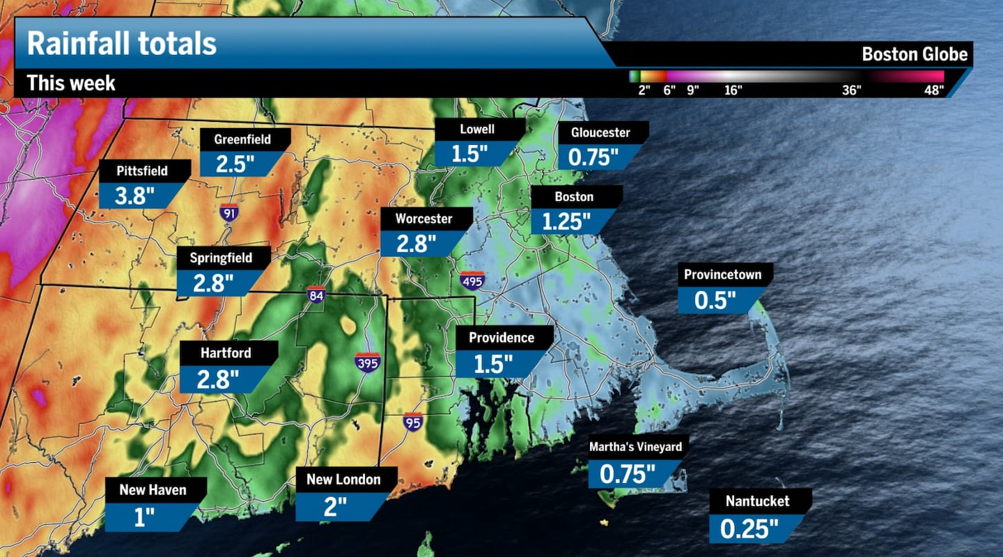
 Radar estimated rain totals across Southern New England this week.Boston Globe
We’ve seen extensive drought across Southern and Coastal New England, and in Maine and New Hampshire for over a year. This has stressed local ecology, lowered our water table, and led to many water restrictions across the region.
This has been particularly the case since late spring and summer, with temperatures well above average as weak systems passed through the region. So whatever rain did fall likely evaporated much faster before penetrating the soil. Just take a look below at how parched April through June was across Southern New England.
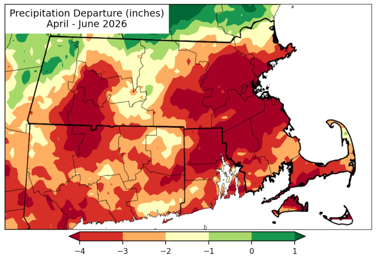 Almost all of Southern New England saw dramatically lower than average rain from April through June.NRCC
But then came July. Boston is set to finish the month wetter than average, the first time since October 2025. Communities like Worcester, Pittsfield, and many other towns and cities across Massachusetts will likely end the month with nearly double their normal July rainfall.
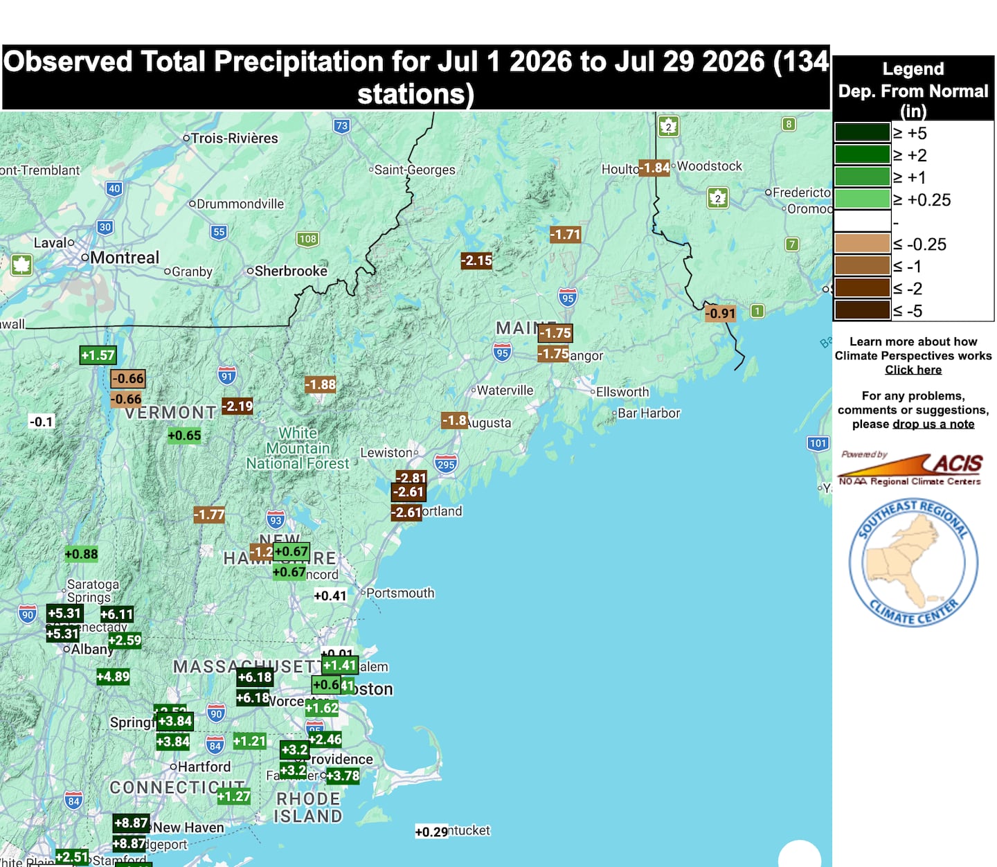 Rain totals for July compared to the monthly average through July 29.SRCC
For some locations across Southern New England, this July will rank among the 10 wettest on record — this is a welcome stat.
For the first time in roughly two months, less than 15 percent of Massachusetts is classified in a Level 2 or “severe” drought, according to the U.S. Drought Monitor. That’s an encouraging milestone and a sign that Mother Nature is finally beginning to chip away at one of the state’s longest dry stretches in recent memory.
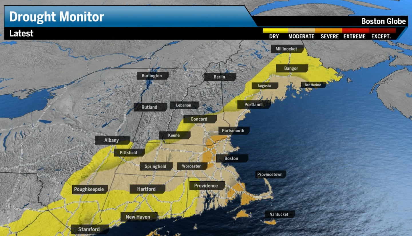 The drought has improved across portions of Eastern Mass. while expanding a bit across Maine.Boston Globe
But wait, we can’t claim victory just yet
Before we declare victory, though, there’s still plenty of work to do.
Even after this exceptionally wet July, Boston is experiencing one of its driest years and is on pace for one of its sixth driest years on record (through the first seven months of the year). The city’s rainfall deficit still sits roughly 8 inches below the year-to-date precipitation average. Similar long-term precipitation shortfalls continue across Cape Cod, Western Massachusetts, and the Berkshires. Nantucket is still holding onto a double-digit deficit, nearly 14 inches behind the average.
In other words, we’ve made meaningful progress, but we’ve got a lot of ground left to make up. One wet month can’t erase a prolonged drought, but it can change its trajectory. July finally brought the kind of widespread, persistent rainfall that droughts need for soil and groundwater levels to actually recharge. We don’t need to get back to zero or a near-normal threshold, but if we can continue to see warmer-than-average rain for August and September, that would essentially erase the drought.
This is also why many communities continue to have water restrictions in place. Reservoirs and groundwater don’t recover overnight, especially after more than a year of below-average precipitation. So, don’t expect your town to lift restrictions until we see a couple of wet months in a row.
Still, there’s reason for optimism. As El Niño continues to build, we should continue to see warmer temperatures with a bit more potency to the weather patterns that pass through. We’ve been waiting for the atmosphere to cooperate. This past week, New England finally found itself in a weather pattern capable of making a real dent in the drought.
Now, let’s hope the rain continues, preferably during the week, without damaging or disruptive flooding — so everyone wins.
Ken Mahan can be reached at ken.mahan@globe.com. Follow him on Instagram @kenmahantheweatherman.