
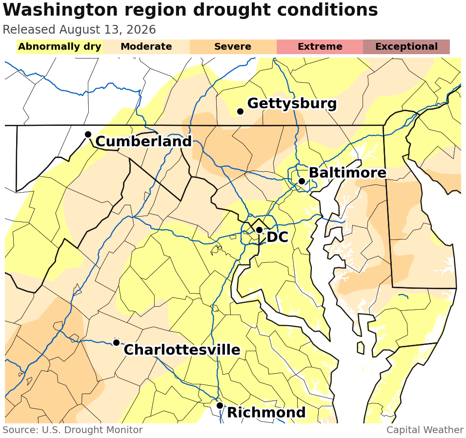
The latest U.S. Drought Monitor shows more of the DC area is no longer in drought thanks to additional rain over the last week.
Last week, the monitor removed DC and areas along the Interstate 95 corridor from drought. This week, the drought-free zone expanded to the south and east to include Southern Maryland and north-central Virginia.
Areas north and west of the I-95 corridor remain in moderate to severe drought, where rain has been more spotty.
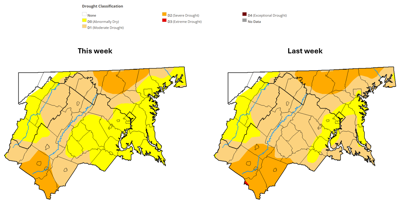 Drought maps over the last two weeks. (U.S. Drought Monitor)
Potomac River flows have increased enough that the Interstate Commission on the Potomac River Basin has suspended daily drought monitoring.
“At present, Potomac River flow is sufficient to meet metropolitan area water demands without upstream reservoir augmentation,” the commission wrote Thursday.
The commission added that groundwater conditions are generally close to normal, although “above- and below-normal readings occur at individual wells.”
Despite the recent rain, many areas still have precipitation deficits of 10 inches or more over the last 12 months and remain classified as “abnormally dry” by the monitor.
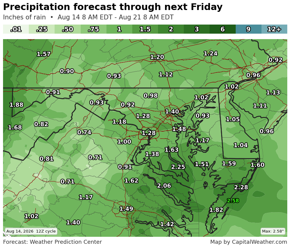
The precipitation outlook for the next week calls for around average rainfall, or roughly an inch. The best chance for substantial rain comes Sunday afternoon and night. After that, rain chances look rather spotty.
In the longer range, the development of a historically intense El Niño favors above-normal precipitation in late fall and winter.