
Severe thunderstorm watch issued in Western Pennsylvania on Wednesday
Stronger thunderstorms are possible north of Pittsburgh
 PITTSBURGH —
A severe thunderstorm watch is in effect for several counties in Western Pennsylvania on Wednesday.
The National Weather Service has issued the alert for Armstrong, Beaver, Butler, Clarion, Forest, Lawrence and Venango counties until 11 p.m.
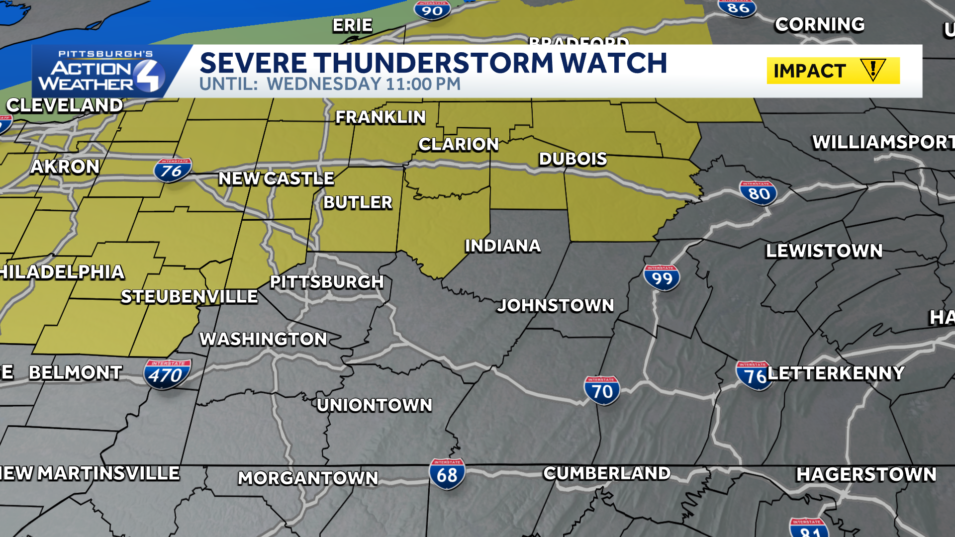
Storms will move southeast from Lake Erie in the evening. While they will be weakening as they arrive, a stronger storm could produce gusty winds. A band of rain with embedded strong thunderstorms shows up after dark for areas to the north.
A cold front will drop through the region Wednesday night and Thursday. The majority of the rain will likely hold off until closer to midnight. A few stronger thunderstorms are possible north of Pittsburgh.
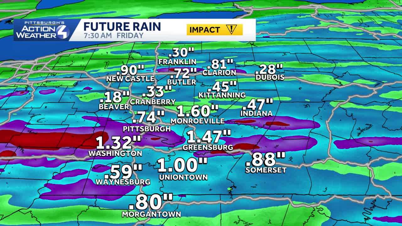 Impact Day Thursday
Thursday is an Impact Day with periods of rain and the potential for storms. At this point, no widespread severe weather is expected. Any storm that does develop will have the potential to produce gusty winds and heavy rain.
The front will slowly work from north to south, and will clear late Thursday into Friday morning. By the time we are done, many areas will see over an inch of rain, which could lead to flooding problems.