

Listen to this article
Estimated 4 minutes
The audio version of this article is generated by AI-based technology. Mispronunciations can occur. We are working with our partners to continually review and improve the results.
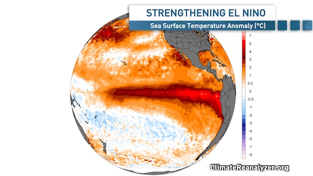
A so-called ‘super’ El Niño is now underway in the equatorial Pacific Ocean and it’s looking primed to become the strongest on record.
El Niño is a climate pattern officially declared when sea surface temperatures in the equatorial Pacific rise by 0.5 C or more above the long-term average.
Temperatures in that key monitoring region have now reached three degrees above average, breaking a daily record set back in 2015.
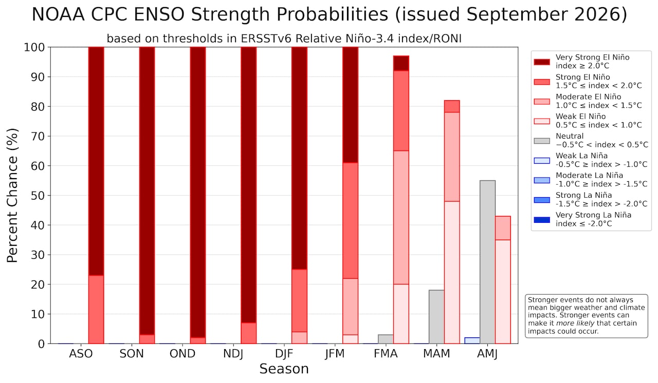 This chart shows a very strong El Niño is likely through the fall and winter months. (NOAA)
And it’s still warming.
Forecast models project this El Niño won’t peak until December, with more long-term, multi-month historical records set to fall in the coming months.
The National Oceanic and Atmospheric Administration (NOAA) says there’s now a 75 per cent chance this will be a long-term historic event for the modern era.
To give you a sense of where we are, there have been only four other super El Niño events on record, including the historic event of 1877, which caused massive drought and widespread crop failure and was devastating for the world at that time.
This current El Niño will also have far-reaching impacts around the globe in the coming months.
While every El Niño is different, 2027 now has a very good chance of being the warmest on record for the planet as a whole. This El Niño will also increase the chances for extreme conditions like heat waves, drought and wildfires for parts of the world, including Australia, Central America and, yes, here in Canada as well.
What can we expect from El Niño in Atlantic Canada?
For starters, El Niño is very likely to continue to keep a tight lid on the Atlantic hurricane season. It’s been an incredibly quiet season so far with no hurricanes through mid-September for the first time in the satellite era.
Warm temperatures in the Pacific are causing strong mid- to upper-level winds across the Caribbean and tropical Atlantic, which limits the strength and development of any brewing storms.
The one area we’ll need to watch for the rest of the fall will be the Gulf of Mexico and the waters off the southeast coast of the United States. Ocean temperatures are very warm here and this area is less susceptible to upper-level wind shear. Tropical storms can still develop in these areas, producing gusty winds and lots of rain.
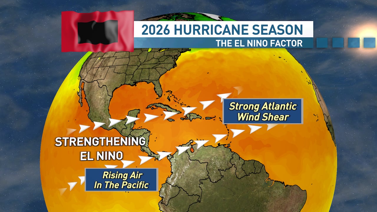 El Niño typically leads to a quieter than average Atlantic hurricane season. (Ryan Snoddon/CBC)What about the upcoming winter?
With the El Niño continuing to warm into December, it’s looking likely to have a large impact on the upcoming winter season across Canada.
During a typical El Niño event, Western Canada is warmer and drier than average.
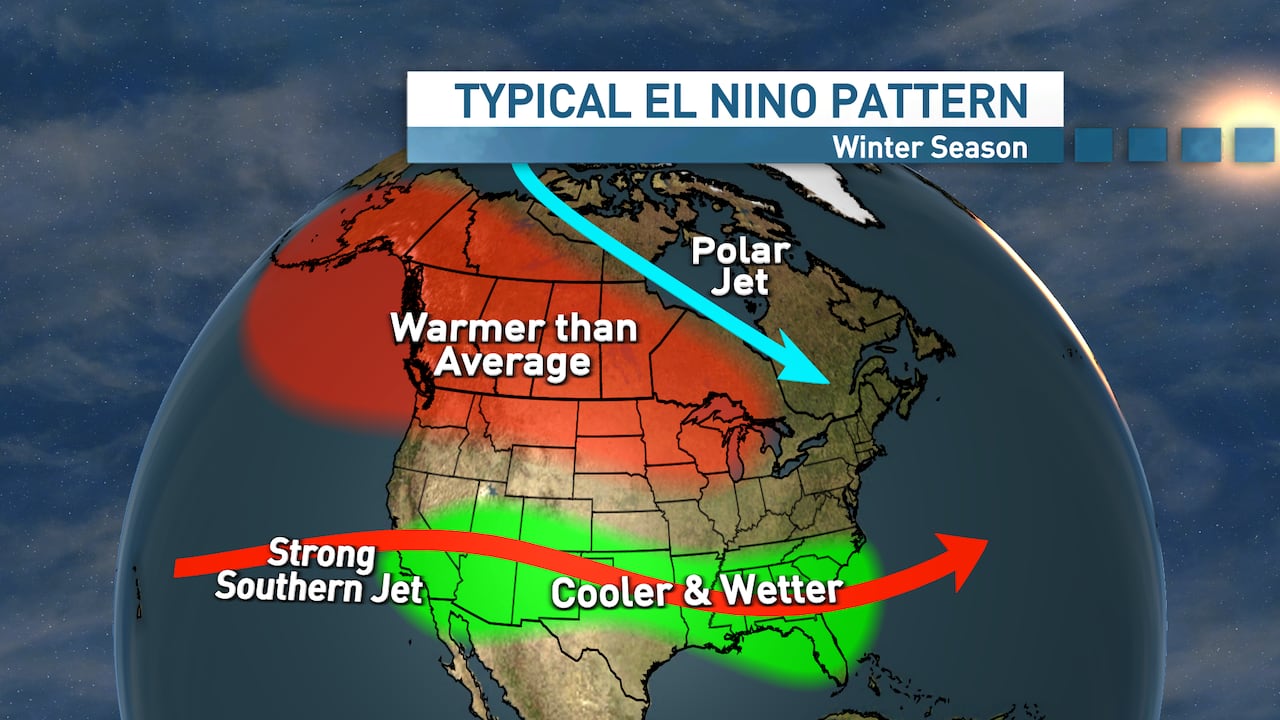 Typical climate conditions during an El Nino event in the winter season (Ryan Snoddon/CBC)
Meanwhile, here in Eastern Canada, it can be colder than average or warmer than average, with no strong historical signal either way.
However, with a super El Niño event, the chances of a warmer than average winter increase dramatically.
As mentioned, we have only a few other super El Niño winters to compare with, but 2015 into 2016, 1997 into 1998 and 1982 into 1983 were all far warmer than average across Atlantic Canada and, in fact, most of Canada.
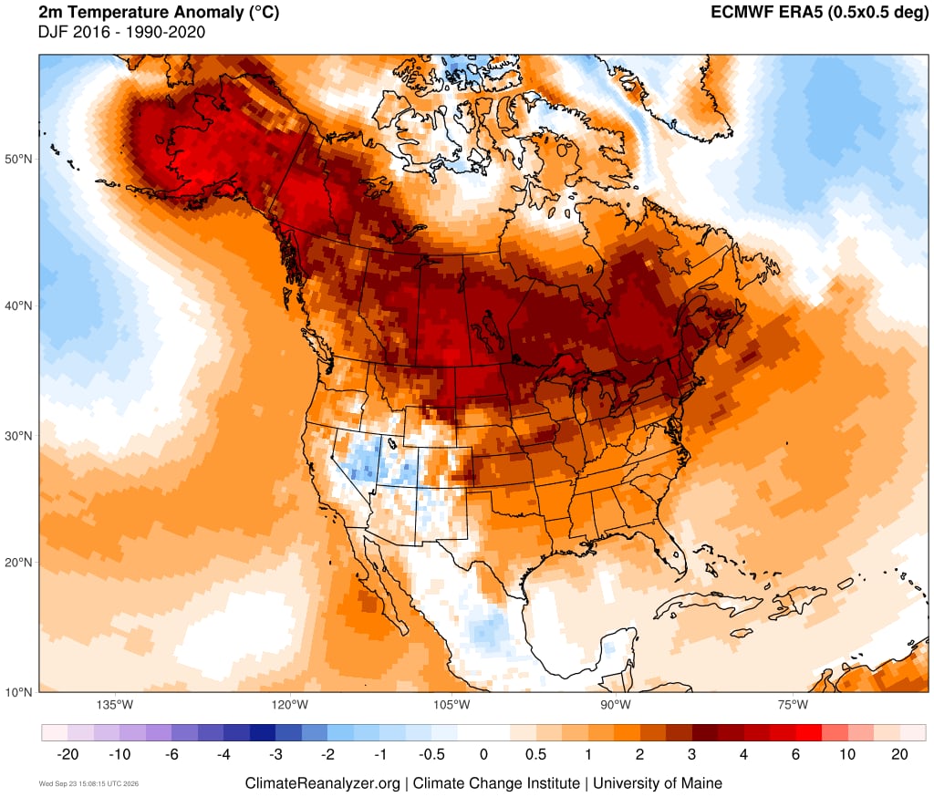 The winter of 2015-16 is the most recent example of a ‘super’ El Niño which turned into a warmer than average season across Canada. (University of Maine)
And if we look back all the way to the El Niño of 1877-78, it brought what is now known as “the year without a winter in North America.”
Now before we write off Old Man Winter, we should point out a couple of things.
First, even a warmer than average winter will still bring cold and snowy weather through the months of December, January, February, March … and April.
Second, it’s a big planet with multiple factors influencing the jet stream, the polar vortex and weather patterns, and ultimately only time will tell for sure how this El Niño will impact the upcoming winter.
MORE TOP STORIES