
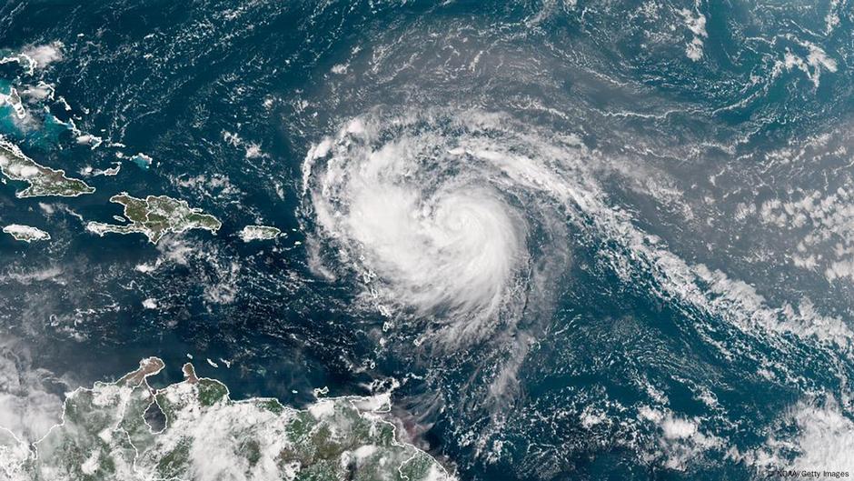
Hurricane Erin strengthened into a category 4 hurricane, the US National Hurricane Center (NHC) said on Saturdauy.
Erin is about 150 miles (240 kilometers) northeast of Anguilla with maximum sustained winds of 130 mph (215 kmph), as the NHC warned of possible flooding and landslides.
Tropical storm watches have been issued for Anguilla, Barbuda, St. Martin, St. Barts, Saba, St. Eustatius and St. Maarten while heavy rains are expected in Antigua and Barbuda, the US and British Virgin Islands and southern and eastern Puerto Rico. Up to 4 inches (10 centimeters) of rain is anticipated, with isolated totals of up to 6 inches (15 centimeters), according to the NHC.
The NHC also highlighted the threat of dangerous swells but said the possibility of direct impacts in the Bahamas and along the east coast of the United States “appears to be gradually decreasing.”
In which direction is Hurricane Erin headed?
Hurricane expert Michael Lowry said Erin is forecast to eventually take a sharp turn northeast that would put it on a route between the US and Bermuda.
“All of our best consensus aids show Erin turning safely east of the United States next week, but it’ll be a much closer call for Bermuda, which could land on the stronger eastern side of Erin,” he said.
Erin is the Atlantic season’s first hurricane and is expected to become a major Category 3 storm late this weekend, passing around 200 miles north of Puerto Rico.
Are natural disasters driving up the price of insurance?
To view this video please enable JavaScript, and consider upgrading to a web browser that supports HTML5 video
Edited by: Jenipher Camino Gonzalez