
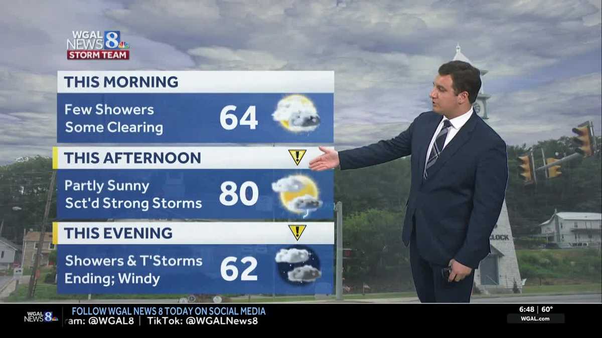
Strong to severe thunderstorms are possible mainly between 2 p.m. and 8 p.m. on Friday. Main concerns are damaging winds. There is a low chance of a brief, spin-up tornado.

Good morning,
IMPACT FRIDAY & SATURDAY:
We’ll start Friday with light showers, mist, & drizzle across parts of the Susquehanna Valley, along with fog in some areas. Once the sun comes up, showers will end, then we’ll see partial clearing. Highs will reach the upper 70s to lower 80s, and it will feel muggy again.
As a strong cold front approaches, scattered showers will develop again in the afternoon and evening. The extent of the clearing will affect the afternoon showers and thunderstorms. The more sunshine an area receives, the more likely the atmosphere will “charge up” and be able to produce severe thunderstorms as the cold front approaches.
The Storm Prediction Center has placed the Susquehanna Valley in a “slight risk” of severe weather, a level 2 out of 5. The main concern is damaging wind gusts from thunderstorms. There is a very low tornado threat, mainly in areas along and east of US-15. The severe weather threat partly depends on how much clearing we get after the morning showers.
The best chance for these strong thunderstorms is between 2 p.m. and 8 p.m.
Once the front passes after dark, it will turn windy. Expect sustained northwesterly winds 15-25 mph, with gusts to 40 mph Friday night through early Saturday evening.
Widespread frost or a hard freeze is possible Saturday night, and frost will be possible again Sunday night.
Saturday will feature morning clouds, then clearing. Winds will be gusty in the morning, then relax by evening, as high pressure moves overhead. Lows will fall to the low-to-mid-30s Saturday night, leading to our first frost and freeze of the season.
After a cold start, Sunday will feature abundant sunshine and crisp highs in the upper 50s. Another round of frost is possible Sunday night.
Next week, temperatures return to seasonable averages, in the mid-to-upper 60s during the day, and 40s overnight. The forecast looks mostly sunny, dry, and pleasant. As of right now, next weekend looks to remain dry with highs near 70 degrees.
Have a great day!