Erin becomes the first major hurricane of the season
The first hurricane and the first major hurricane of the 2025 Atlantic hurricane season
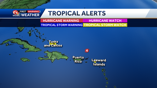
NORTH SHORE, BUT THAT’S ABOUT IT. REST OF US WERE PRETTY DRY. LOOK AT THIS POWERFUL SYSTEM. IT IS A CATEGORY FIVE HURRICANE. ITS NAME IS ERIN. JUST NORTH OF THE LEEWARD ISLANDS. AND THERE’S THAT VERY SMALL PINHOLE LOOKING EYE. THERE’S A ZOOM UP CLOSE IMAGE OF THAT, AND YOU CAN SEE IT HAS SHRUNK OVER THE LAST FEW HOURS. NOW IT’S GOING THROUGH AN EYEWALL REPLACEMENT CYCLE, WHICH MEANS THAT THE INNER EYEWALL IS CONTRACTING. IT’S SHRINKING. THE OUTER EYEWALL IS BEGINNING TO TAKE OVER. THIS USUALLY HAPPENS WITH BIG, POWERFUL HURRICANES LIKE THAT. AND WHAT HAPPENS DURING AN EYEWALL REPLACEMENT CYCLE IS TYPICALLY THE HURRICANE WILL REDUCE IN INTENSITY. IT GETS WEAKER HERE A LITTLE BIT, BUT WE WILL BE WATCHING THIS CLOSELY FOR TRENDS HERE GOING FORWARD. BUT YOU CAN SEE WHAT’S HAPPENING HERE ON THE SATELLITE AND RADAR WISE. LOTS OF RAIN BANDS HERE HEADING OR HITTING THE NORTHERN LEEWARD ISLANDS. THEY’VE BEEN GETTING SOME HEAVY RAIN, SOME GUSTY WINDS ALL DAY TODAY. GOT SOME STRONG RAIN BANDS NOW BEGINNING TO SPREAD THEIR WAY INTO PUERTO RICO. SO THEY’LL BE HAVING HAVING TO WATCH OUT FOR SOME RAIN AND SOME GUSTY WINDS THERE. SO THERE ARE THERE’S A LOOK AT SOME OF THE WATCHES AND WARNINGS. A TROPICAL STORM WATCH REMAINS IN EFFECT FOR THE NORTHERN LEEWARD ISLANDS, AND THAT MEANS THAT THEY COULD BE LOOKING AT SOME GUSTY WINDS AND SOME RAINS. THERE. ALSO NEW HERE AT THIS HOUR IS A TROPICAL STORM. WATCH FOR THE TURKS AND CAICOS BECAUSE AS THE SYSTEM PASSES JUST OFF TO THE EAST OF THEM FOR SUNDAY AND MONDAY, THEY COULD BE LOOKING AT SOME HEAVY RAIN GUSTS UP TO TROPICAL STORM FORCE. ALSO A POSSIBILITY IN SOME OF THOSE STRONGER BANDS. HERE TO THE LATEST UPDATE FROM THE HURRICANE CENTER. IT’S MOVING WEST AT 15. THE WINDS 160 MILES AN HOUR. PRESSURE IS 915 MILLIBARS. IT’S VERY LOW AND THE SYSTEM WILL CONTINUE TO MOVE TOWARDS THE WEST NORTHWEST. WE WE EXPECT TO TURN TOWARDS THE NORTH AND EVENTUALLY NORTHEAST, AS IT WILL FIND A WEAKNESS BETWEEN THE HIGH TO THE EAST AND THIS JET STREAM JUST OFF TO THE NORTH. SO THAT SHOULD TURN IT AWAY FROM THE UNITED STATES COASTLINE. BUT BESIDES AARON, THERE’S TWO OTHER SYSTEMS THAT WE’RE CLOSELY MONITORING. WE’RE WATCHING FOR WHAT COULD BE AN AREA OF LOW PRESSURE DEVELOPING HERE IN THE CENTRAL TROPICAL ATLANTIC FROM A TROPICAL WAVE OFF AFRICA OVER THE NEXT SEVEN DAYS, IT HAS A LOW CHANCE OF 20% PROBABILITIES OF DEVELOPING. WE’LL KEEP AN EYE ON IT, BUT YOU CAN SEE ANOTHER AREA HERE JUST OFF THE EAST COAST, HAS A LOW CHANCE OF DEVELO
Erin becomes the first major hurricane of the season
The first hurricane and the first major hurricane of the 2025 Atlantic hurricane season

Updated: 7:33 PM CDT Aug 16, 2025
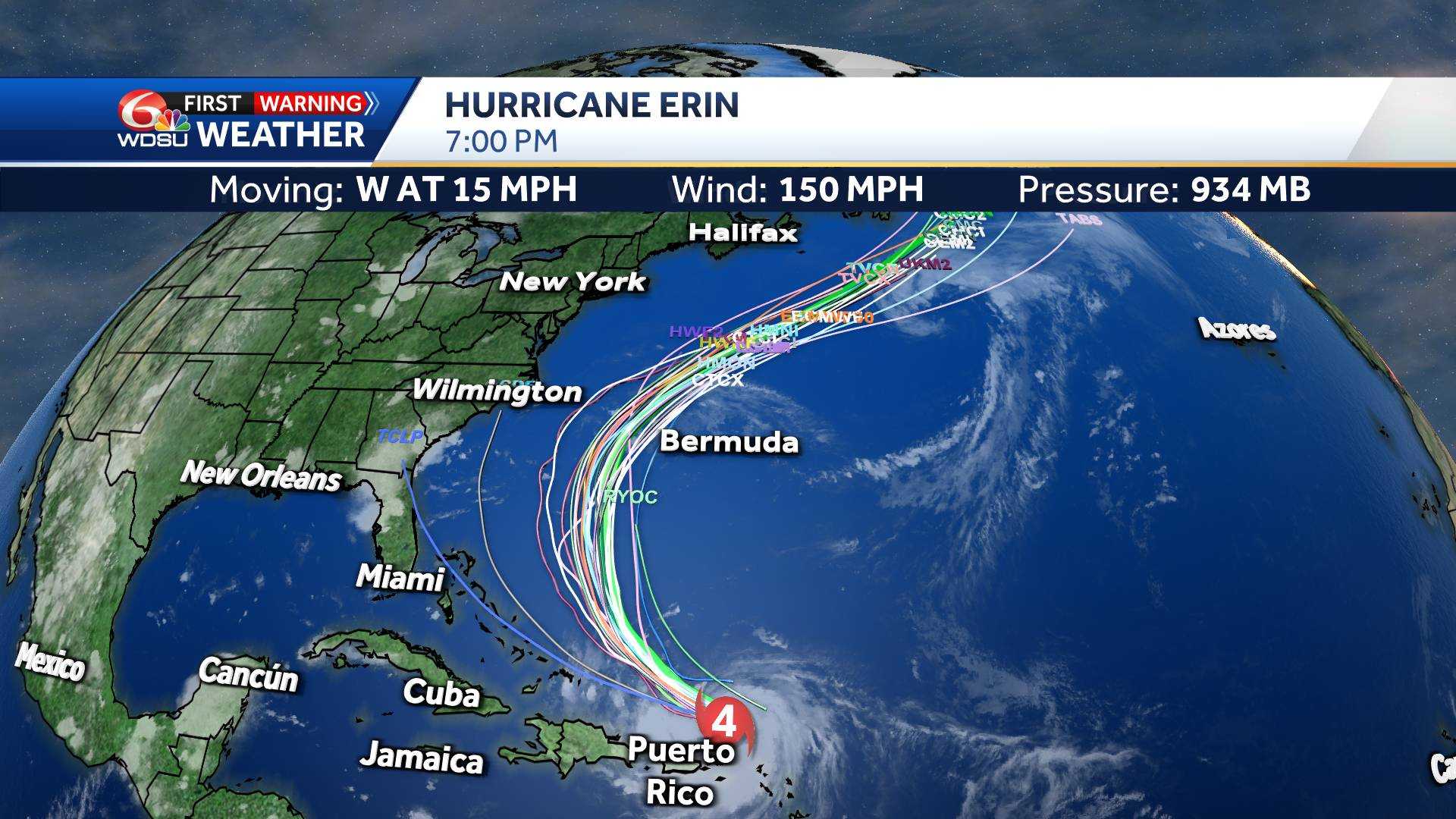
Erin has weakened to a category 4 hurricane and moving quickly west at 15 mph with winds up to 150 mph.Erin has undergone rapid intensification. It went from a tropical storm on Friday morning to a major category 5 hurricane north of the Leeward Islands on Saturday morning. Forecast data show Hurricane Erin will be a very large storm too. We measured the diameter of the storm to be over 650 miles according to this data.Track guidance is now very consistent in keeping Erin over open water. Tropical Storm Watches remain in effect for some of the most northern Leeward Islands. Tropical Storm Watches are now in effect for There could also be concerns along the East Coast of the U.S. dealing with dangerous rip currents and swells.IMPACTS TO SOUTHEAST LOUISIANA:None.
Erin has weakened to a category 4 hurricane and moving quickly west at 15 mph with winds up to 150 mph.
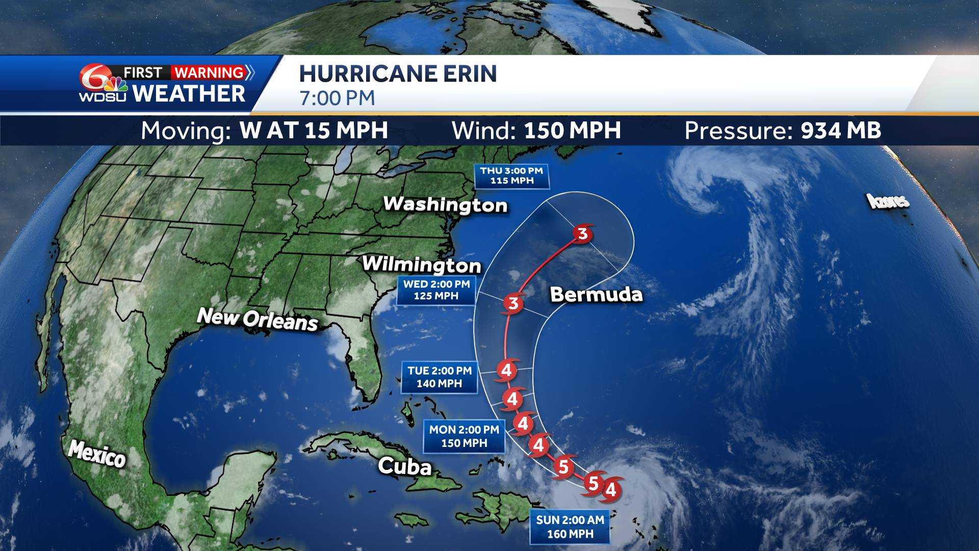
Erin has undergone rapid intensification. It went from a tropical storm on Friday morning to a major category 5 hurricane north of the Leeward Islands on Saturday morning.
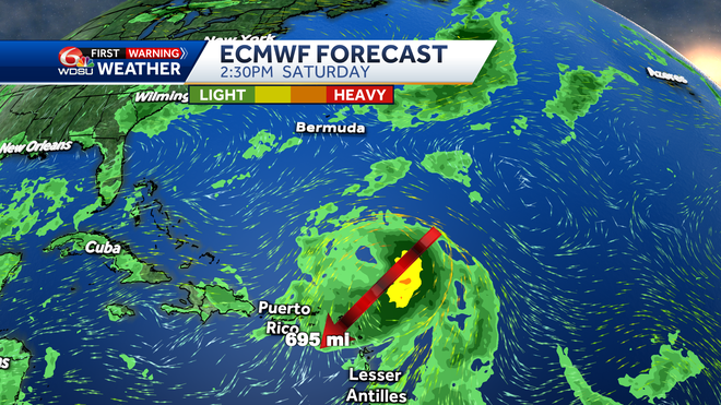
Forecast data show Hurricane Erin will be a very large storm too. We measured the diameter of the storm to be over 650 miles according to this data.
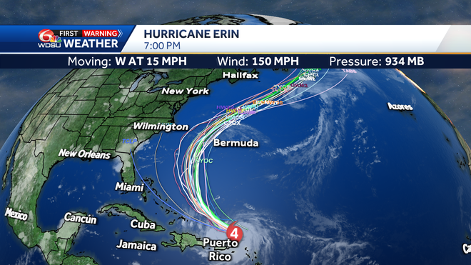
Track guidance is now very consistent in keeping Erin over open water.
Tropical Storm Watches remain in effect for some of the most northern Leeward Islands. Tropical Storm Watches are now in effect for There could also be concerns along the East Coast of the U.S. dealing with dangerous rip currents and swells.
IMPACTS TO SOUTHEAST LOUISIANA:
None.
