

For most of the Hawaiian Islands, clouds and showers are expected through Wednesday night as a trough moves across the state from the west, according to the National Weather Service.
An accompanying upper-level disturbance will create instability and the potential for thunderstorms and locally heavy rainfall.
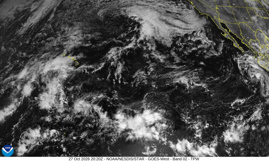
A satellite image via the National Weather Service from Tuesday, Oct. 27, 2026, shows the weather disturbance coming toward Hawaiʻi.
A flood watch is in effect for all the islands through Wednesday night, with shower activity expected to increase Tuesday. By Tuesday night, rain is expected across the state, with the heaviest rainfall forecast for Oʻahu and Maui Nui. But all islands remain under the flood watch because slow-moving cells could become anchored along island terrain, bringing the potential for flash flooding anywhere.
Winds over the Hawaiʻi Island summits are also expected to increase Tuesday night to high wind warning levels.
Conditions are expected to improve Thursday or Friday, with trade winds returning this weekend.
The Oʻahu Emergency Operations Center will partially activate at 7 p.m. Tuesday, according to a news release. Ahead of the storm, City and County of Honolulu departments are taking proactive steps, including clearing streams, opening stream mouths and monitoring areas prone to flooding.
People on Oʻahu seeking shelter should check the current list of shelter locations and assembly areas, which will be updated throughout the storm. The city will also provide updates through HNL Alert. People who feel unsafe are encouraged to leave early rather than wait for conditions to worsen.