
A coastal flood warning is now in effect for the Jersey Shore and New York’s south-facing beaches, as Hurricane Erin brings high surf and dangerous rip currents to beaches along the East Coast.
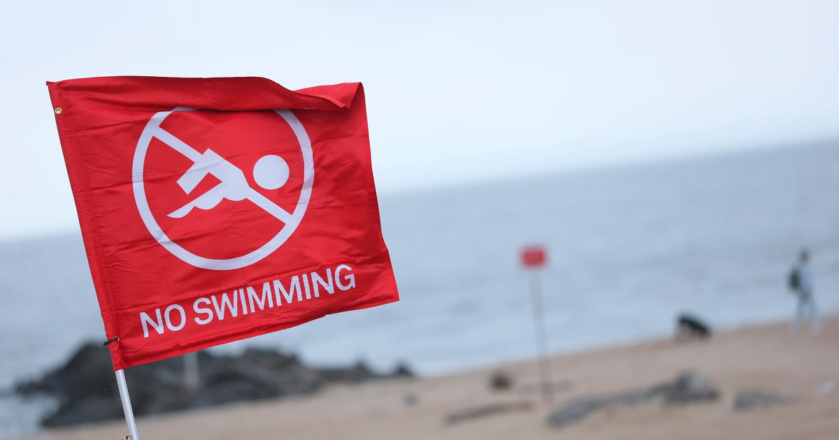
Many beaches are closed to swimming, and officials are urging people to avoid the water. The flood risk increases Thursday into Friday, when high waves coincide with high tide.
Thursday is a First Alert Weather Day as CBS New York keeps a close eye on the storm and its track.
Coastal flood warning for much of Tri-State Area
While Hurricane Erin is forecast to stay hundreds of miles offshore, the East Coast is still feeling its indirect impacts.
Towns along the Jersey Shore have been preparing for the storm, telling people to move their cars to higher ground before the water levels rise.
Residents have also been asked to secure their outdoor furniture and check on their boats, docks and slips to make sure they are tied up tight.
In Sea Bright, which sits between the Atlantic Ocean and two rivers, residents say they’re hopeful rock barriers along the ocean and metal bulkheads placed along the Shrewsbury River after Superstorm Sandy will help keep them safe.
Waves are expected to reach 7 to 12 feet, and flooding is most likely around high tide which is expected between 6 p.m and 7 p.m. Swimming is not allowed, but lifeguards will be patrolling to make sure people don’t take any chances. The concern is about possible coastal flooding.

Waves at Manasquan Inlet Beach on Aug. 21, 2025.
CBS News New York
At Manasquan Inlet Beach, waves crashing against the rocks were massive. Winds form Hurricane Erin were also kicking up the sand, and beachgoers could feel it hitting them in the face. Streets around Watson Creek could also be inundated with water.
A lot of people came to the beach to watch the power of mother nature in the churning ocean.
“The wind is very strong. We’re, like, both falling over, and the sand is, like, hitting us,” Savannah Gill said.
Earlier this week, New Jersey Gov. Phil Murphy told beachgoers, “don’t go in the water.” Thursday. He said the worst impacts of the storm on the Garden State are expected Thursday into Friday. Coastal flood warning are in effect from Monmouth to Cape May counties.
Rip currents and red flags along East Coast
Erin has also prompted New York officials to shut down beaches in New York City and some on Long Island.
Long Island officials discussed their emergency preparedness for the hurricane season in a rare joint appearance. The two gave a unified message about the importance of hurricane preparedness as they ready for beach erosion and possible flooding. In Nassau County, nuisance flooding may take place in areas like Long Beach and Freeport. In Suffolk, Fire Island and Mantauk are being closely watched.
Nassau County Executive Bruce Blakeman and Suffolk County Executive Ed Romaine said, with Erin being the first hurricane of the season, it’s important that all Long Islanders have a plan.
“Just in case, if you live along the shore or in a low-lying area, please make sure that you have water. Have a plan to leave, God forbid we should have to make that determination. Have a place to go. Keep non-perishable food and manual can openers available. In case there’s a power outage, make sure you have flashlights and batteries. Do not, do not use candles,” Blakeman said.
“We’re prepared for this hurricane as best we can. It’s not going to do a lot of damage, but it will create erosion. It will create flooding,” Romaine said.
They emphasized pet preparedness too.
The island is expecting even bigger waves — up to 16 feet in some areas — and water levels will be 2 to 2.5 feet above normal.
Towns like Southampton and Quogue have declared states of emergency. Crews have been using truckloads of sand to reinforce dunes, fearing the heavy surf will erode beaches and damage shoreline properties.
Wind gusts up to 30-40 mph along the coast could also bring down trees or power lines, especially with the ground saturated from recent rain.
Neither county is declaring a state of emergency or any kind of evacuations, but it’s Mother Nature, so things could change.
Click here for the latest forecast, live radar and weather alerts from our First Alert Weather team.
Justin Lewis
contributed to this report.
More from CBS News