
The odds of Imelda forming and impacting South Carolina by early next week continue to increase.
It is currently sitting over Hispaniola, which is hindering development at this time.
By this evening and into tonight, we are expecting this system to work north over the Bahamas, allowing tropical development to take place by this weekend.
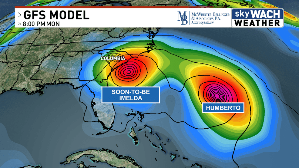
Models overnight and this morning are coming into better agreement on the upper-level low across the southeast pulling in soon-to-be Imelda, and bringing impacts to the Carolinas.
With that said, what does this mean for us in South Carolina and the Midlands?
The biggest concern at this point in time is flooding rain. Models are spitting out 4-8 inches of rain across the Midlands.
However, those totals need to be taken with a grain of salt because the track of Imelda will make or break those numbers.
As far as other tropical impacts, it is too early to tell who sees what. Winds will depend on how strong the storm is at potential landfall.
Tornadoes will depend on where it makes landfall. Even rainfall amounts are questionable.
Anything from a tropical storm to a major hurricane is still on the table at this point.
That’s why it is important to stay up-to-date with every forecast into the weekend.