
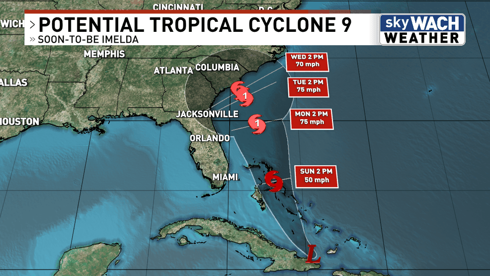
We now have Potential Tropical Cyclone 9 (PTC 9), which is a fancy way of saying a tropical disturbance that is not fully organized.
PTC 9 is forecast to push over the Bahamas this weekend, before making its way toward the South Carolina coastline by early next week.
It is currently sitting just north of Cuba, and is starting to get its act together as it works back into the hot Caribbean waters.
We are expecting PTC 9 to officially become Tropical Storm Imelda by this weekend.
With that said, what does this mean for us in South Carolina and the Midlands?
The biggest concern at this point in time is flooding rain. Models are spitting out 4-8 inches of rain across the Midlands.
However, those totals need to be taken with a grain of salt because the track of Imelda will make or break those numbers.
As far as other tropical impacts, it is too early to tell who sees what. Winds will depend on how strong the storm is at potential landfall.
Tornadoes will depend on where it makes landfall. Even rainfall amounts are questionable.
Anything from a tropical storm to a major hurricane is still on the table at this point.
That’s why it is important to stay up-to-date with every forecast into the weekend.