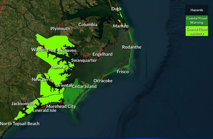
A Coastal Flood Warning is in effect as Hurricane Humberto and strengthening Tropical Storm Imelda combine to generate a long-duration swell event that is expected to impact Hatteras and Ocracoke Islands through the end of the week.
Tight pressure gradients between the two offshore systems and high pressure building in from the north are bringing strong northeast winds across the region today, resulting in multiple coastal and marine hazards.
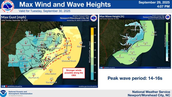
 NWS image
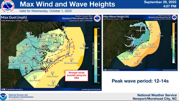
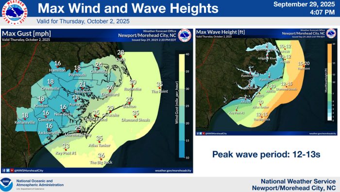
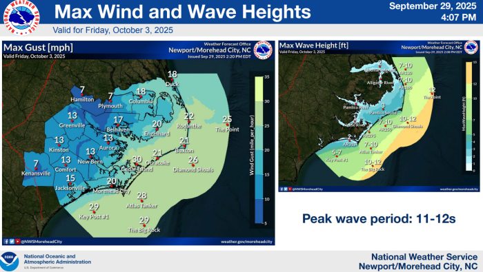
These include a Coastal Flood Warning, a High Rip Current Risk and High Surf Advisory along eastern North Carolina beaches, Gale Warnings across most waters, and a Wind Advisory for Hatteras and Ocracoke Islands.
The latest forecast from the National Weather Service Newport/Morehead City office reports that confidence remains high regarding a significant swell event from Humberto, with additional impacts expected as Imelda intensifies offshore.
Peak impacts are forecast from Tuesday through Thursday, though dangerous surf and minor to moderate coastal flooding may persist through Friday
“Ocean conditions will become hazardous as the impacts from the two distant tropical systems start to be realized,” said Drew Pearson, Director of Dare County Emergency Management.
“The long-period swells are likely to cause ocean overwash in areas with vulnerable dune structures. The ocean will bring large breaking waves of 6 to 8 feet, building to 10 to 12 feet peaking on Wednesday and Thursday, and begin to subside by Friday. Travel on NC12 could see challenges especially at high tide. Our NCDOT Road Pros will be working hard to keep conditions safe—please give them a ‘brake’ if you need to travel, and always be ready to turn around should you encounter flood waters.”
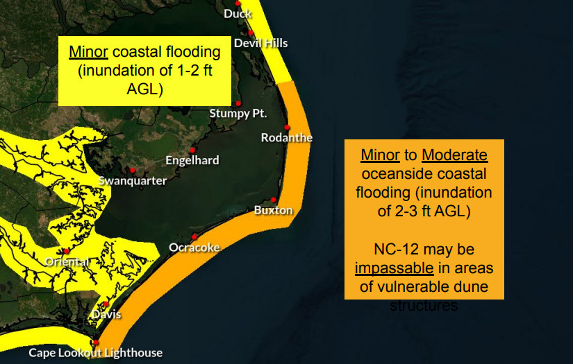
Minor to moderate oceanside flooding is expected, with inundation of 2–3 feet above ground level possible in vulnerable locations.
N.C. Highway 12 may become impassable in areas with vulnerable dune structures, and minor soundside flooding is also possible along the southern Pamlico Sound due to strong, persistent northeast winds.
Dangerous rip currents are expected all week due to the combination of large breaking waves and strong longshore currents. Swimmers are advised to stay out of the ocean during this event.
Residents and visitors are urged to monitor forecasts closely, avoid flooded roadways, and use extreme caution near the surf. Drivers should be prepared for flooding-related travel disruptions on NC12, especially on Ocracoke and Hatteras Islands.
For information on the local forecast, visit weather.gov/mhx for general weather information, or the National Weather Service office in Newport/Morehead City’s Facebook page at https://www.facebook.com/NWSMoreheadCity/.