
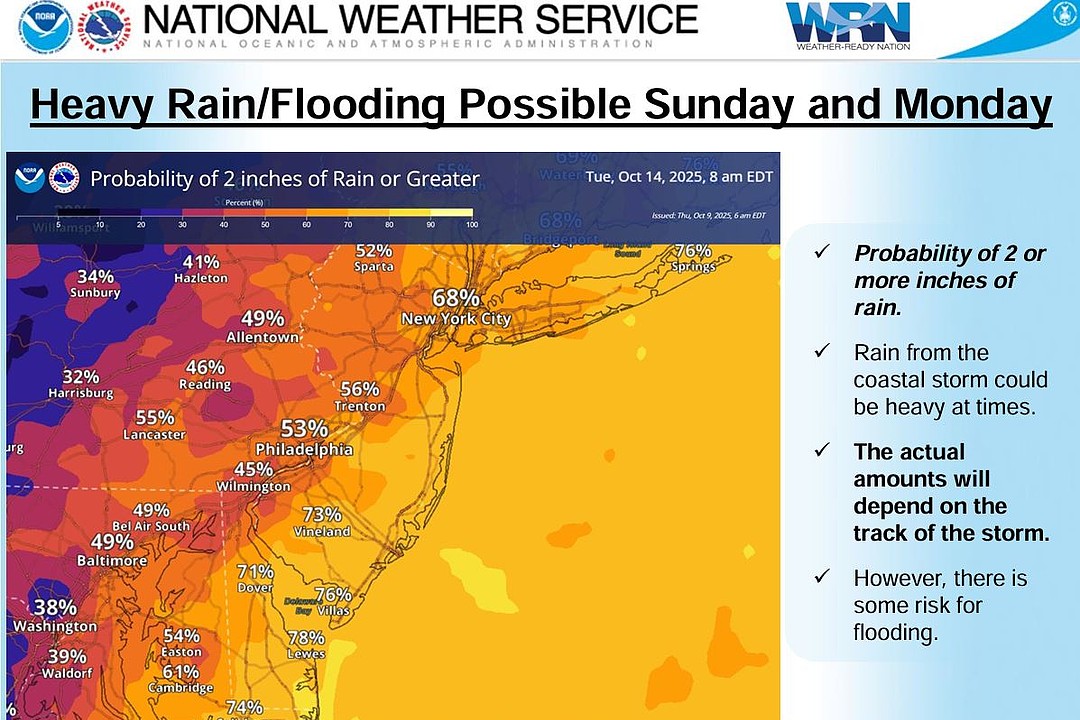

Heavy rain will combine with flooding at the shore.
(Courtesy of National Weather Service)
The National Weather Service has extended a Coastal Flood Advisory for the South Jersey shore communities through 3 p.m.
The NWS also issued a Coastal Flood Watch that warns of much more severe flooding from Sunday morning through Monday evening.
Strong northeast winds combined with an exceptionally high tide from a recent full moon will cause “minor” coastal flooding conditions on Friday morning. A powerful nor’easter will move up the coast and bring “moderate” to “major” flooding on Sunday and Monday, according to the forecast.
The forecast calls for a coastal storm to move through the region Sunday through Monday with wind gusts up to 60 mph and heavy rainfall both possible.
The Atlantic County Office of Emergency Management said it could be a “significant” coastal storm.
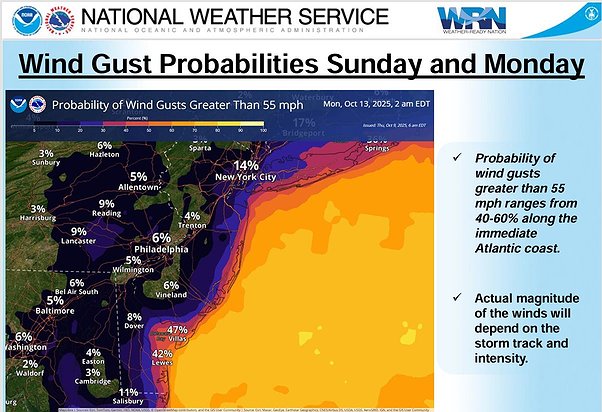 Winds gusts could hit 55 mph or higher on Sunday and Monday at the coast.
(Courtesy of National Weather Service)
Everyone is urged to continue to follow updates to this forecast as the storm approaches.
Residents should be prepared to monitor conditions and to move vehicles to safe places well in advance of these high tides. They should also take the time to secure loose items and furniture on their properties.
Contractors should make sure job sites are secure. Boat owners along exposed bayfront should consider taking their boats out of the water or checking lines and bilge pumps.
For your safety and the protection of your vehicle and neighboring properties, never drive on any street covered by water. Please do not disregard barricades on flooded streets.
If voluntary or mandatory evacuations are ordered, residents are encouraged to heed the call.
For Police and Fire Department emergencies, call 911. For non-emergencies, call the local police department.
Ventnor is advising residents to sign up for Code Red and Register Ready notifications.
Nor’easters can be as dangerous as hurricanes.