
PORTLAND, Ore. (KATU) — A rainy and windy weekend is on the way to the Pacific Northwest as a moderate atmospheric river takes aim.
WEATHER | Latest Storm Tracker 2 Forecast
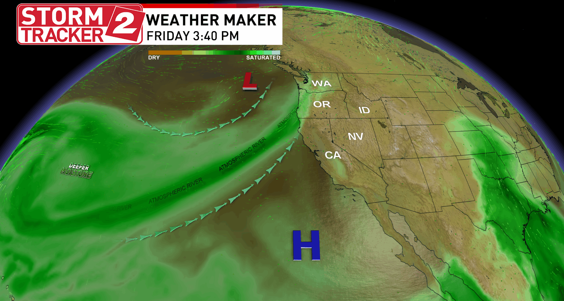
“Recent runs of computer models that predict total rainfall are trending very wet, now suggesting around 1 to 2 inches of rain could fall across the valleys northwest Oregon and southwest Washington between Friday and Saturday, double that amount for the coast range and cascades,” Storm Tracker 2 Meteorologist Rhonda Shelby said.
Any rain that does fall will help to reduce drought across Oregon and Washington. According to the last U.S. Drought Monitor map released on October 16, the entirety of the Willamette Valley is in a severe drought. Since January 1, the Portland area has seen a nearly four-inch deficit.
After the cold front passes through the area, cold air will come rushing in, lowering the snow levels. Snow will quickly pile up near the higher elevation passes, including Willamette and Santiam pass. At Government Camp, forecasters are calling for rain and snow showers, but only minor accumulations.
READ MORE | Atmospheric river to bring wind and rain to Willamette Valley this weekend
“Make sure your Halloween decorations are secured, gusty winds are expected statewide as this system moves in Friday,” Shelby added.
Windy conditions will arrive with the rain on Friday and stick around on Saturday. Sustained winds along the Oregon and Washington coastlines are forecast to get up to 55 mph or higher. Gusts could push to nearly 70 mph. In the Willamette Valley, sustained winds of up to 30 mph are expected, with gusts near 50 mph.
“Make sure your Halloween decorations are secured, gusty winds are expected statewide as this system moves in Friday,” Shelby added.
Download the Storm Tracker 2 Weather App