
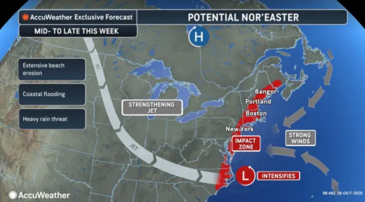
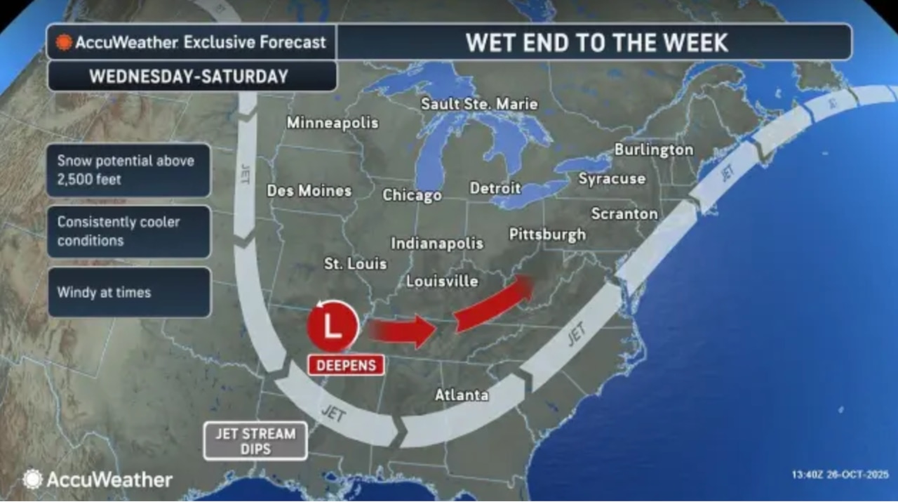
A brewing nor’easter is expected to bring wet and windy weather to New Jersey for few days starting mid-week along with the threat of beach erosion at the Jersey Shore.
The National Weather Service notes uncertainty about the timing and rainfall totals from the storm still a few days away.
“The setup favors a storm, however the details regarding its strength and exact track remain uncertain,” the National Weather Service said Sunday afternoon. “While timing still needs to be settled on, the main focus for rain and stronger winds looks to be late Wednesday night through Thursday night.”
 A nor’easter storm could bring a combination of gusty winds, rain and beach erosion to New Jersey starting Wednesday.AccuWeather.com
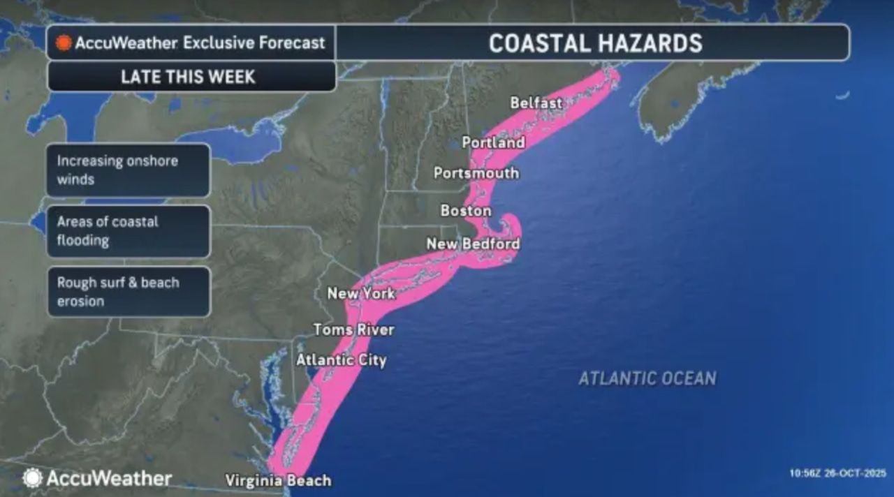
This system could also bring an extended period of gusty winds from Wednesday through Saturday, which would include Halloween trick-or-treating on Friday night.
Multiple days of gusty winds could cause some concerns at the Jersey Shore.
“Given the onshore flow which increases to gale force for a period of time, already sensitive coastal/back bay communities due to the coastal storm a few weeks ago may experience strong winds, coastal flooding and potentially significant beach erosion,” the weather service said.
 A nor’easter storm could bring a combination of gusty winds, rain and beach erosion to New Jersey starting Wednesday.AccuWeather.com
High temperatures will remain in the 50s throughout the week for much of the state.
Sunday night will see clear skies with light north winds, allowing temperatures to fall significantly
Frost advisories have been issued for tonight through 9 a.m. Monday for Atlantic, Burlington, Camden, Cape May, Cumberland, Gloucester, Mercer, Middlesex, Ocean, Salem, western Bergen, western Essex, eastern Passaic and western Union counties.
A freeze warning is in effect for western Passaic County.
Lows will range from around freezing in northern interior sections to low 40s along the coast.
Monday will remain cool with highs only reaching the lower to mid-50s, about 5 degrees below normal for late October, with northeast winds generally less than 10 mph.
Tuesday will continue the cool pattern with highs remaining in the 50s under increasing cloud cover as a low pressure system passes well south of the region.
No precipitation is expected through Tuesday, though some coastal areas might see a slight chance of light rain Tuesday into Tuesday night.
Current weather radar
If you purchase a product or register for an account through a link on our site, we may receive compensation. By using this site, you consent to our User Agreement and agree that your clicks, interactions, and personal information may be collected, recorded, and/or stored by us and social media and other third-party partners in accordance with our Privacy Policy.