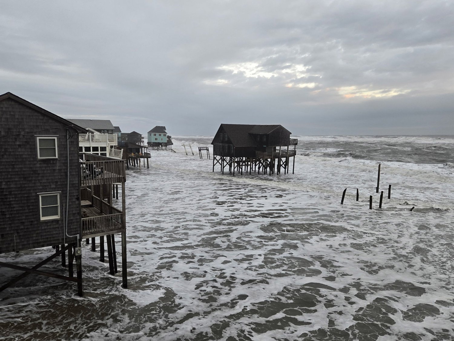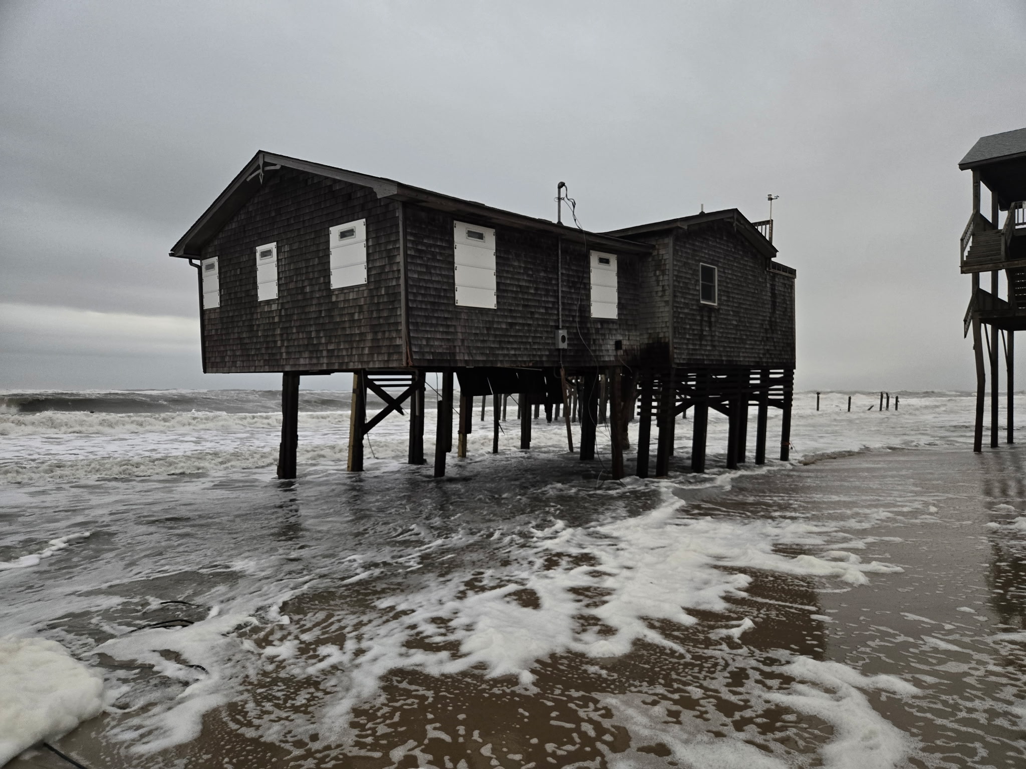
Minor to moderate coastal flooding and ocean overwash will continue along portions of the Outer Banks on Wednesday as large waves and elevated water levels persist, according to the latest update from the National Weather Service (NWS) Newport/Morehead City office.
Northeast winds will continue to ease on Wednesday, but strong surf and elevated wave heights will keep vulnerable areas—especially along Hatteras and Ocracoke Islands—at risk for additional overwash and flooding through the next several high-tide cycles.
N.C. Highway 12 remains closed between Rodanthe and Oregon Inlet and on northern Ocracoke Island due to ocean overwash that occurred on Tuesday, however, Ocracoke-Cedar Island and Ocracoke-Swan Quarter ferry service resumed operations on Wednesday morning.
South of Rodanthe, N.C. Highway 12 is open as of 7:00 a.m., but standing saltwater and sand remain on the roadway in multiple locales.
Coastal flooding is forecasted up to three hours before and after each high tide, with the next high tides expected around 1:30 p.m. on Wednesday, at 2 a.m. and at 2:30 p.m. Thursday, and 3:30 a.m. and 3:30 p.m. Friday.
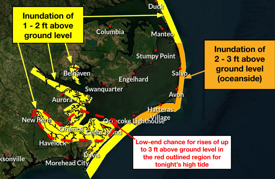
Oceanside inundation of 2 to 3 feet above ground level is likely in low-lying oceanfront areas, while 1 to 2 feet of flooding may occur along the southern Pamlico Sound and nearby rivers, including the Neuse, Bay, Pamlico, and Pungo Rivers.
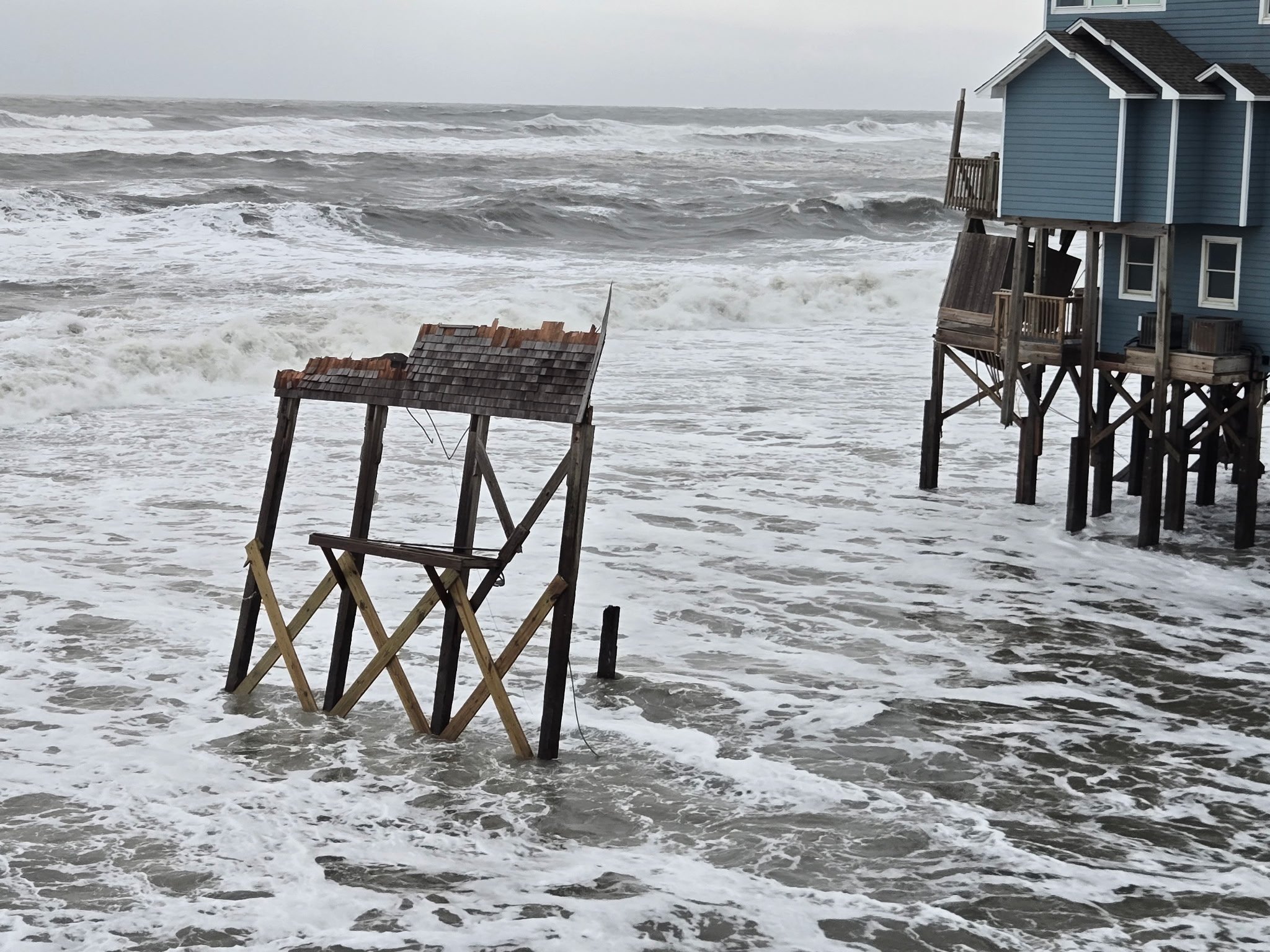
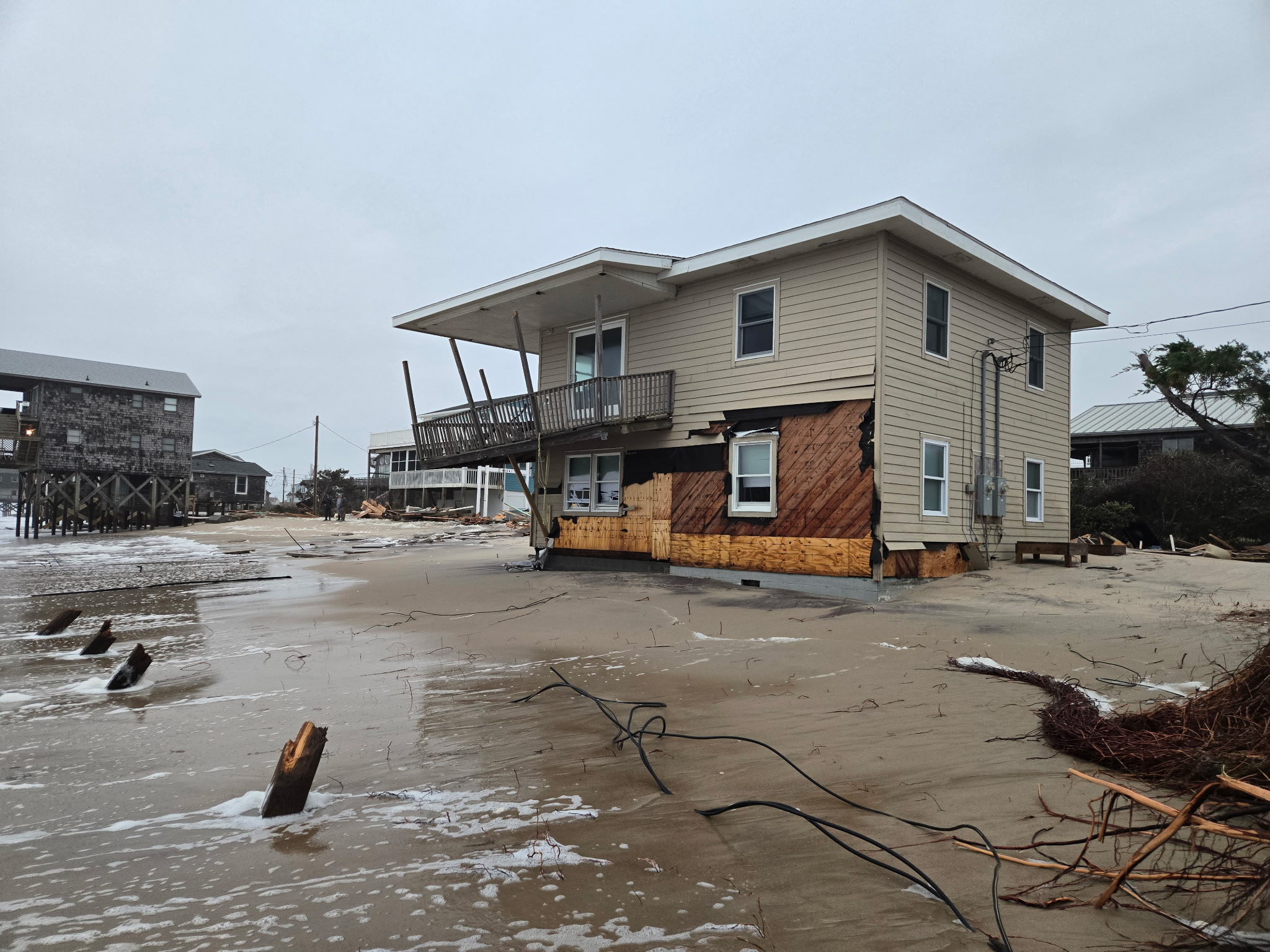
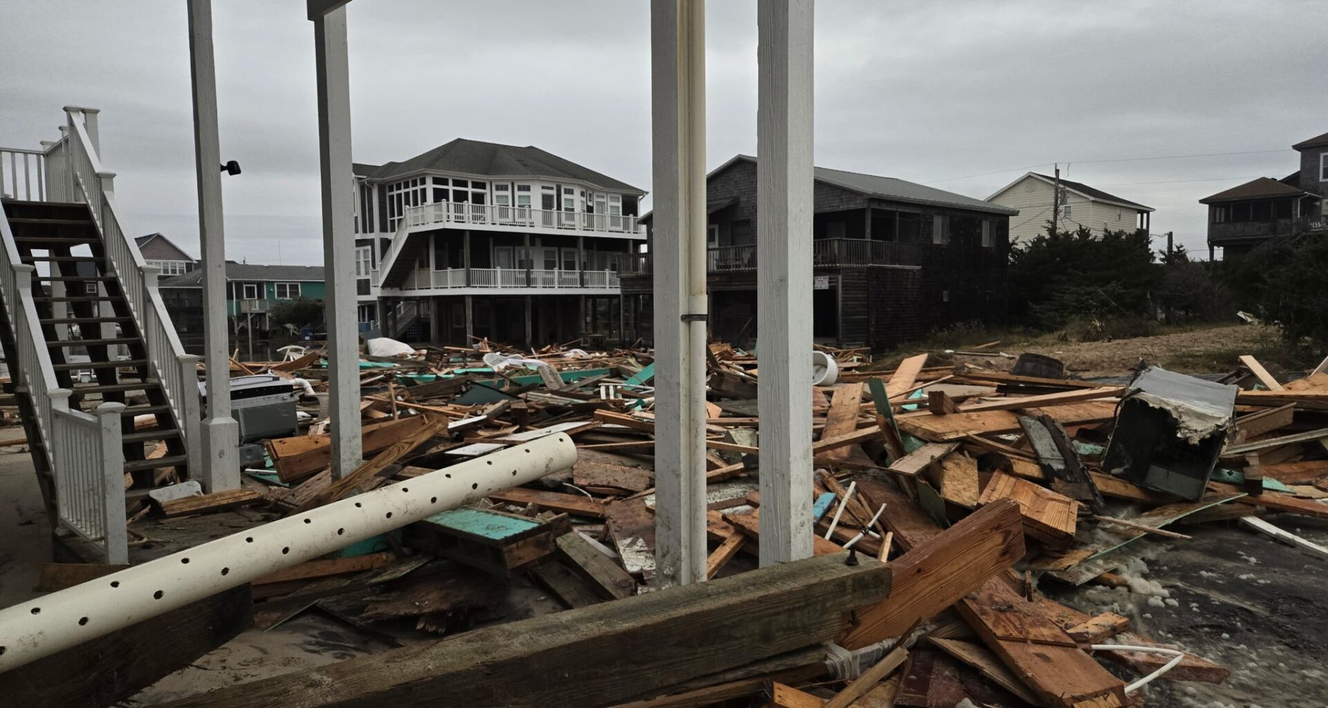
While five homes collapsed in Buxton on Tuesday, no additional collapses were reported overnight. Dangerous debris and hazards remain on the shoreline, however, and the public is advised to avoid the area.
In addition to the ongoing coastal impacts, the NWS is monitoring a separate low-pressure system that could bring a low-end severe weather threat Wednesday night into Thursday and cause minor additional coastal impacts across eastern North Carolina later in the week.
For local weather advisories and updates, visit weather.gov/mhx.
Buxton on Wednesday morning. Photos by Don Bowers.