
The next storm system is already becoming fairly consistent in all of the weather data. Here’s an early look at the timing and potential snow.
The next storm system is on the West Coast now, will drop down into the central Plains Friday and head toward the Great Lakes region for Saturday into Sunday.
This next storm system appears to likely take a track that puts all of Lower Michigan in the steady snow area on the north, cold side of a storm system.
It’s not going to be a mega-storm, but I’d call it a solid swath of snow.
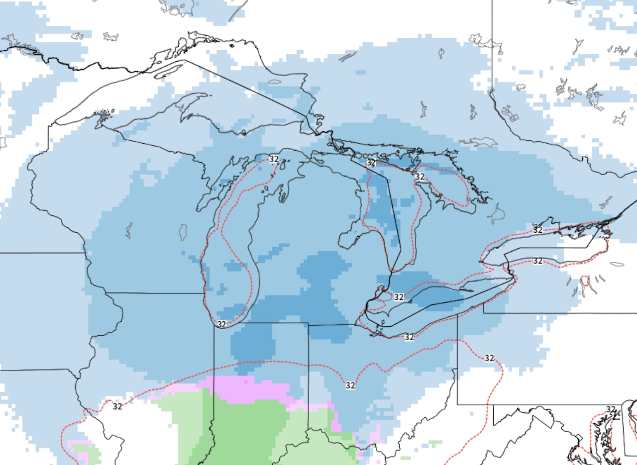
Here’s the radar forecast from early Saturday to Sunday morning. This is as far out as I would trust now, but it covers over half of the snowy period. At this pace, the snow would end by early Sunday afternoon.
 Radar forecast of the next snowstorm from 7 a.m. Saturday to 7 a.m. Sunday.NOAA
I’d call it about an 18-hour snowy period anywhere in Lower Michigan, and maybe the far southern Upper Peninsula.
This type of storm is usually a four inch to eight inch snow. Again- I wouldn’t call it a big snowstorm for the middle of winter, but for late November it’s a notable snow.
For now we only want to look at two snow forecasts to give you the idea of the scope of the snow.
Let’s start with the U.S. model as a low-end forecast. This model puts out a general four inches to six inches of snow across all of Lower Michigan. It indicates maybe a few inches more snow in the far southwest corner of Michigan, due to a short period of lake-effect snow after the storm passes.
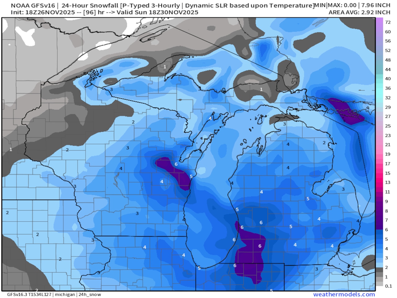 Total snowfall forecast for Saturday and Sunday, November 29-30 from the GFS Model.NOAA
The European Model looks a little heavy, but is only a few inches different from the U.S. Model.
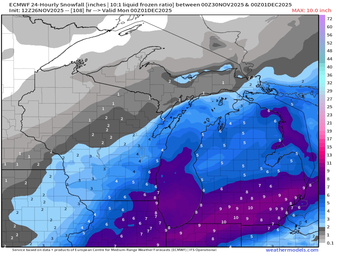 Total snowfall forecast for Saturday and Sunday, November 29-30 from the European ModelNOAA
Those two models, and the general weather pattern is why I would very early call it a four to eight inch snow over most of Lower Michigan. North of Traverse City it may be only two or three inches.
There is also the chance a touch warmer air could keep the snow amounts down in the very southeast corner of Lower Michigan, at Monroe, Lambertville, Detroit and St. Clair Shores.
It’s too early to really fine tune any snow forecast. I just wanted to give you a heads up for holiday travel plans.
For travel plans, try to do your driving Saturday morning and early Saturday afternoon. The snow may end by noonish Sunday, but it will be cold after the storm. Roads will probably not improve quickly Sunday afternoon.
This is a first look at the details of the next storm. Stay updated at MLive.com/weather.