
CLEVELAND, Ohio — A powerful lake-effect snowstorm is hitting Northeast Ohio on Thanksgiving, threatening holiday travel with whiteout conditions, wind gusts up to 50 mph and more than a foot of snow across the region’s snowbelt.
Snowfall rates up to 1 inch per hour are possible, the National Weather Service said Thursday morning.
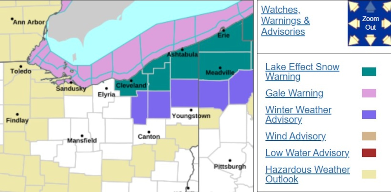
Heavy lake-effect bands fueled by a strong low-pressure system over the northern Great Lakes are dropping 12 to 15 inches of snow in Lake County south of I-90, far eastern Cuyahoga County and northern Geauga County through Friday evening, National Weather Service forecasters say Thursday morning.
Across the broader snowbelt — including inland Erie County, Pennsylvania — totals of 8 to 15 inches are occurring, with some areas potentially exceeding 18 inches.
“Motorists should use extreme caution,” forecasters write, noting the heaviest and most hazardous conditions are hitting Thursday, coinciding with Thanksgiving travel.
Wind gusts of 45 to 50 mph along the lakeshore are creating blowing and drifting snow through Thursday night, drastically reducing visibility. A Wind Advisory is in effect for parts of Northeast Ohio through late Thursday night.
A Lake Effect Snow Warning remains in effect through 7 p.m. Friday for Lake, Geauga and eastern Cuyahoga counties, with a Winter Weather Advisory in place for adjacent areas.
Forecasters say snow bands are pushing inland as winds shift from southwest to a more west-northwest flow later Thursday, spreading scattered snow showers to areas including Cleveland and Youngstown.
Highs Thursday and Friday reach only the low to mid-30s, with overnight lows in the low to mid-20s. Wind chills fall into the teens at times because of the strong winds. Temperatures along the lakeshore run slightly warmer.
Areas west and south of the snowbelt remain mostly dry, though scattered lake-effect snow showers from Lake Michigan could briefly reach northwest and central Ohio Thursday into Thursday night. Gusty winds up to 40-45 mph persist across the region.
Lake-effect snow tapers Friday night as high pressure briefly moves in. But another low-pressure system is expected to bring 1 to 2 inches of snow to much of northern Ohio on Saturday night into Sunday, with up to 4 inches around Toledo. Rain is expected to mix in or take over Sunday as temperatures climb into the upper 30s and low 40s.