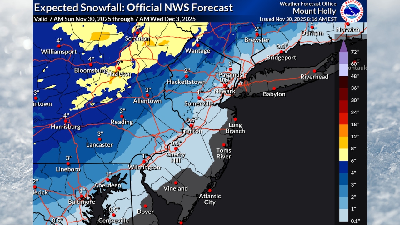
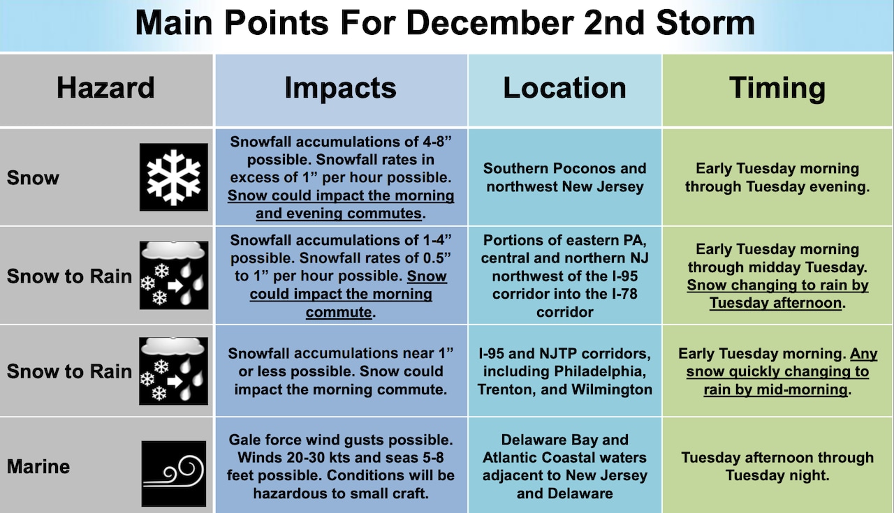
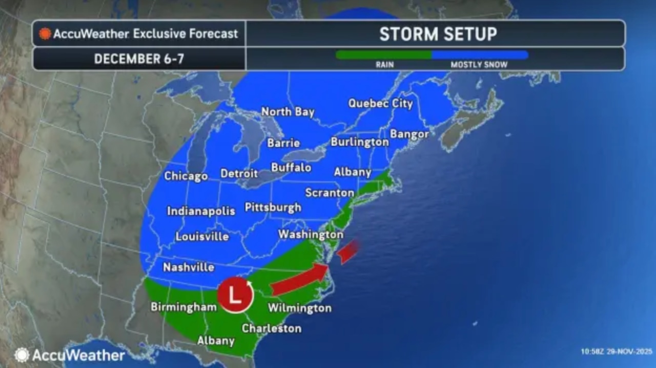
A winter storm expected to hit New Jersey on Tuesday could drop 1 to 4 inches of snow across the northern half of the state and heavy rain to southern counties.
The storm is likely to start as snow early Tuesday and switch to rain for central New Jersey, making for a messy morning commute, the National Weather Service said.
A subtle shift in the storm’s track or timing could affect the snowfall amounts, the weather service said.
“Confidence in the snowfall forecast remains low due to uncertainty in the track of the storm,” the weather service said. “Greatest impacts from snow will be most likely near/north of I-78.”
 Parts of New Jersey could get 1 to 4 inches of snow on Tuesday in a messy winter storm.National Weather Service and AccuWeather
Some spots in higher elevations of northwestern New Jersey could get 4 to 8 inches of snow, the weather service said. Snowfall rates of 1 inch per hour are possible in those locations.
Areas south and west of the I-95 corridor are expected to get less than 1 inch of snow.
 Parts of New Jersey could get 1 to 4 inches of snow on Tuesday in a messy winter storm.National Weather Service and AccuWeather
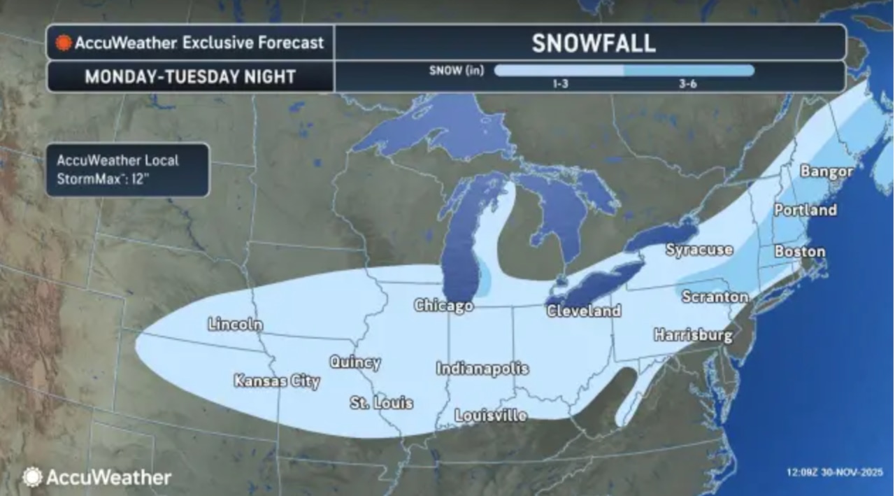
AccuWeather’s forecast calls for 1 to 3 inches of snow across northwestern New Jersey.
All precipitation should end by midnight Tuesday night.
For Sunday, rain should begin developing across the state during the late morning and early afternoon hours, with eastern areas more likely to see steadier rainfall into the evening.
Rainfall amounts will generally be light, with a tenth to two-tenths of an inch expected across western New Jersey and up to half an inch possible in eastern sections.
Temperatures will reach the upper 40s to low 50s across most of the state before dropping into the upper 20s to low 30s tonight.
High pressure will bring dry conditions Monday with temperatures in the upper 30s to low 40s ahead of Tuesday’s winter storm.
Wednesday will be dry as high pressure builds back in, with temperatures remaining about 10 degrees below normal.
A dry cold front will pass through Thursday, ushering in a frigid airmass Thursday night into Friday.
High temperatures will stay in the upper 30s to low 40s through the end of the week.
Another storm system may impact New Jersey next weekend, though forecasters say there is too much uncertainty at this time for specifics on potential rain or snow from that system.
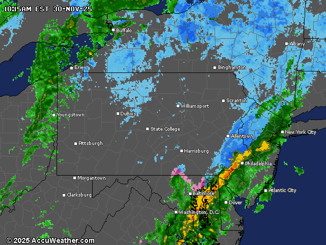
 Northern New Jersey could get hit with 1 to 4 inches of snow on Tuesday, with a transition to rain in central parts of the state and all rain for southern counties.AccuWeather.com and National Weather ServiceCurrent weather radar