
Boston has seen just one day this month where the average temperature was above the seasonal norm, daring me to ask a question that might be a touch too soon, but nevertheless warranted — are you over the cold yet? And astronomical winter hasn’t even arrived yet.
Cold temperatures are set to continue into the weekend, but New England will feel another icy blast of Arctic air Sunday night that will last through Monday, linked once again to the polar vortex.
Areas like the Upper Midwest and Great Lakes will feel the brunt of the cold, but New England will still see the mercury drop as low as 20 degrees below normal, with deep subfreezing temperatures forecast.
Boston may wake up to frigid temps in the teens early Monday morning, and even colder temperatures north and west, while highs regionwide struggle to budge out of the 20s. Temperatures should slowly rebound on Tuesday.
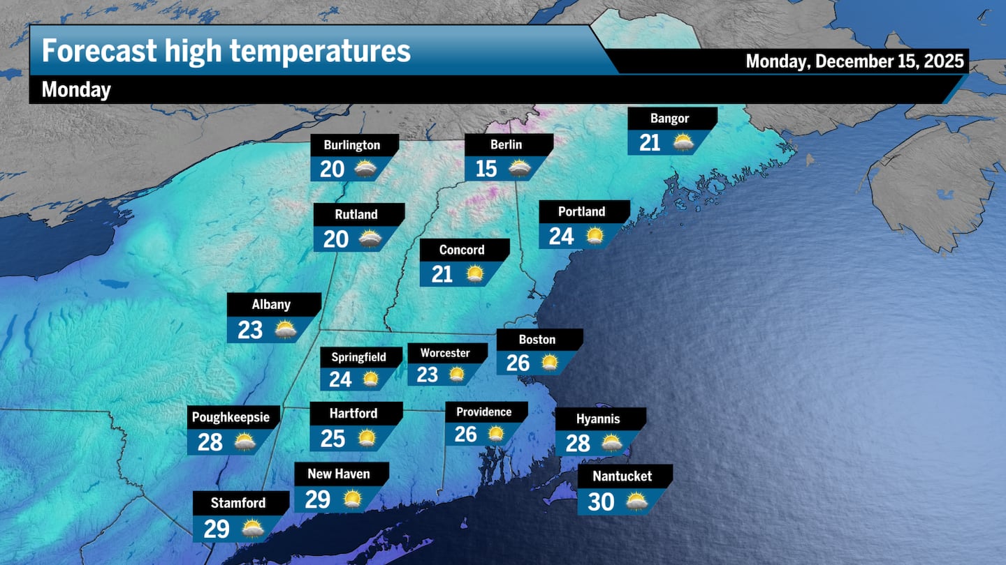 Highs on Monday will likely stall in the low to mid-20s across most of New England.Boston Globe
 Frigid air will migrate out of Northern Canada and Alaska and pour into the Northeast by the end of the weekend.Pivotal Weather
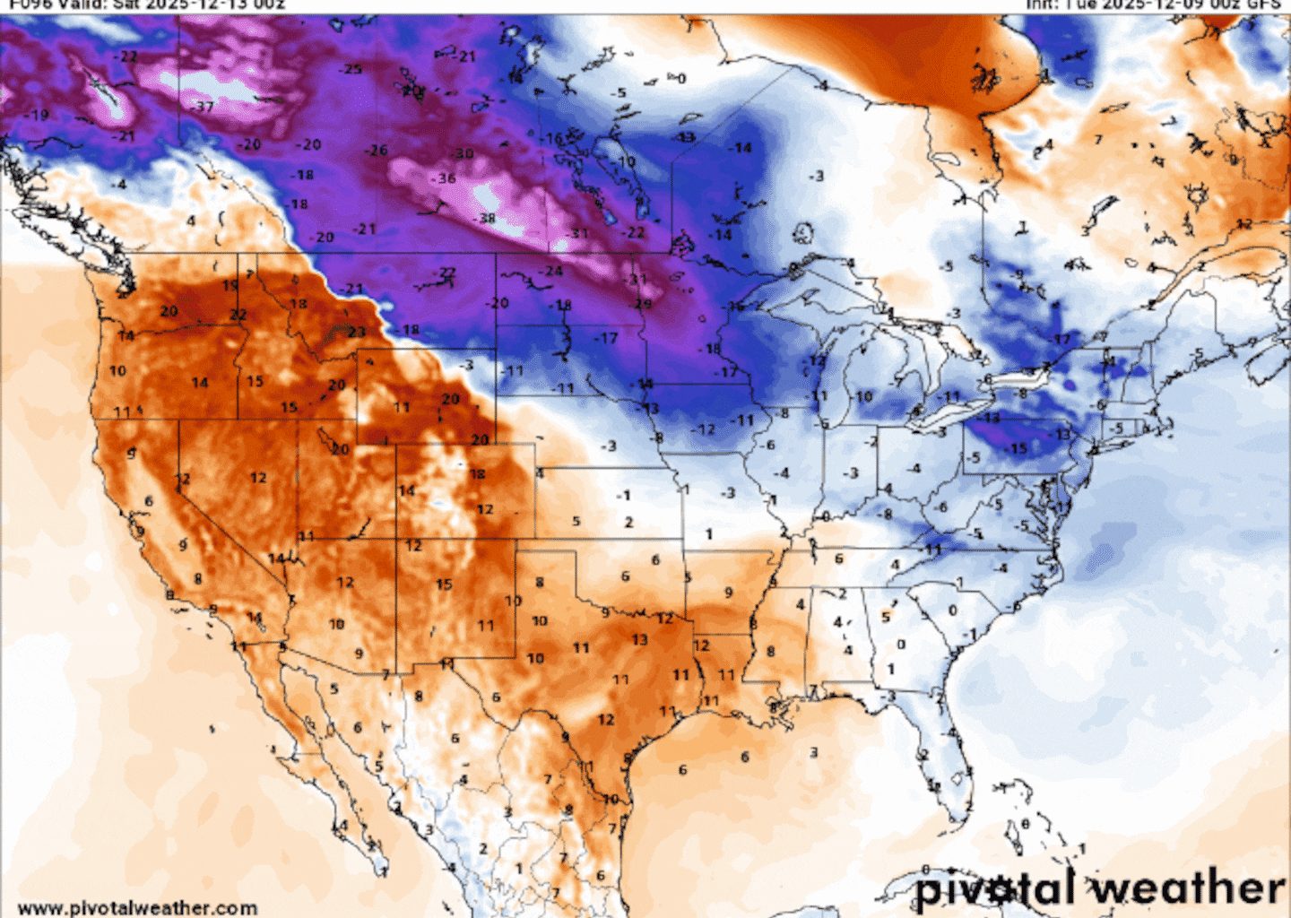
In the map below, you can see the cold core drift across the Midwest and through New England, illustrating the sinking air in the mid-level atmosphere, which means colder air at the surface.
 The core of the cold mass will reach New England late Sunday into Monday.Pivotal Weather
How is this blast of cold air linked to the polar vortex?
The icy cold air we expect to see by the end of the weekend is linked to the polar vortex, a tight band of wind that holds exceptionally frigid air high in the atmosphere above the Earth’s poles, in the stratosphere, the layer of the atmosphere above the troposphere, where weather occurs.
Occasionally, a piece of the vortex can splinter off, rushing pockets of bone-chilling air farther south. That’s what happened shortly after Thanksgiving and earlier this month as these vortex winds slowed substantially, allowing the polar vortex to stretch southward, dislodging pieces of bitterly cold air.
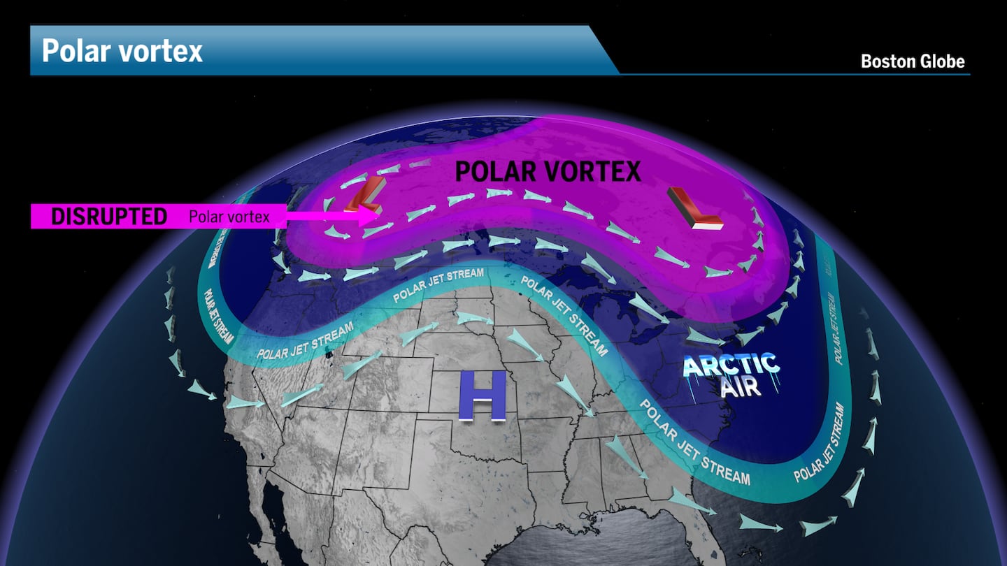 A disrupted polar vortex will send pockets of Arctic air south into the United States.Boston Globe
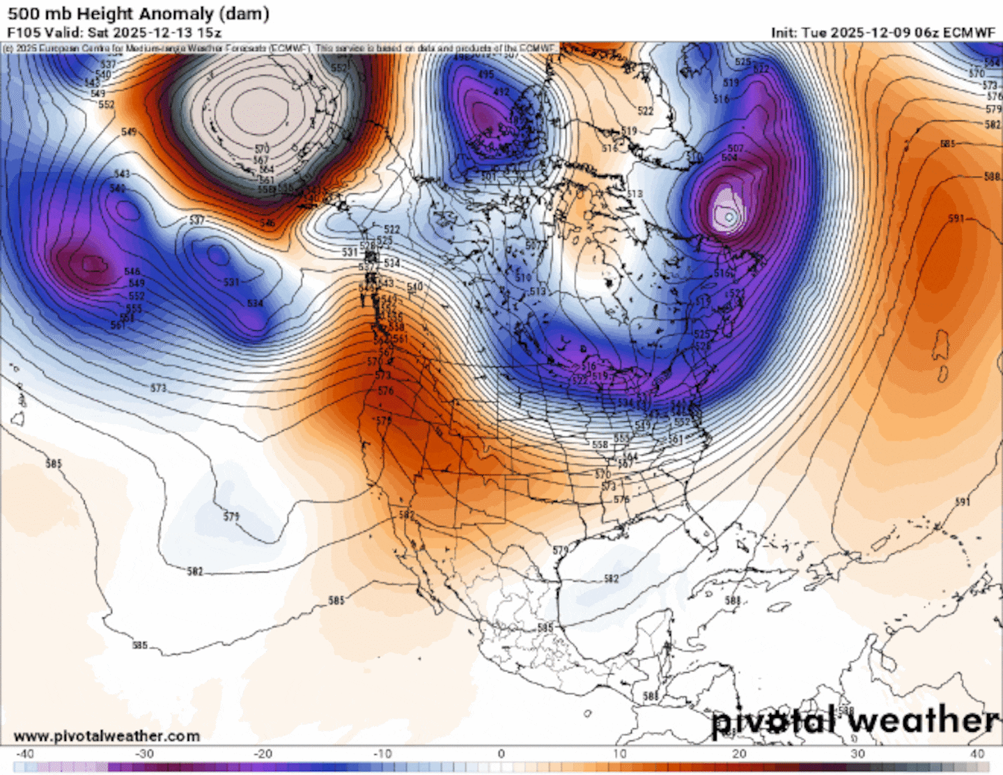
This time around, the air will begin migrating south from Alaska and Northern Canada within a large area of high pressure. This area of strong pressure will then pull some of the polar vortex air along with it as it flows south into the United States.
You can see the forecast polar vortex, below, displaced largely to the south, with much of the vortex slipping into the US. Remember, the polar vortex air remains high in the atmosphere, but sags to lower levels. This means that the bottom layer of the bowing polar vortex can slip into the sinking air of the surface high pressure.
You can think of it this way: Have you ever closed a garage door or a storage room? Think of yourself as the surface high pressure, reaching up to pull the garage door handle — the bottom of the polar vortex — down to the ground. That is how the atmosphere behaves with a disrupted polar vortex.
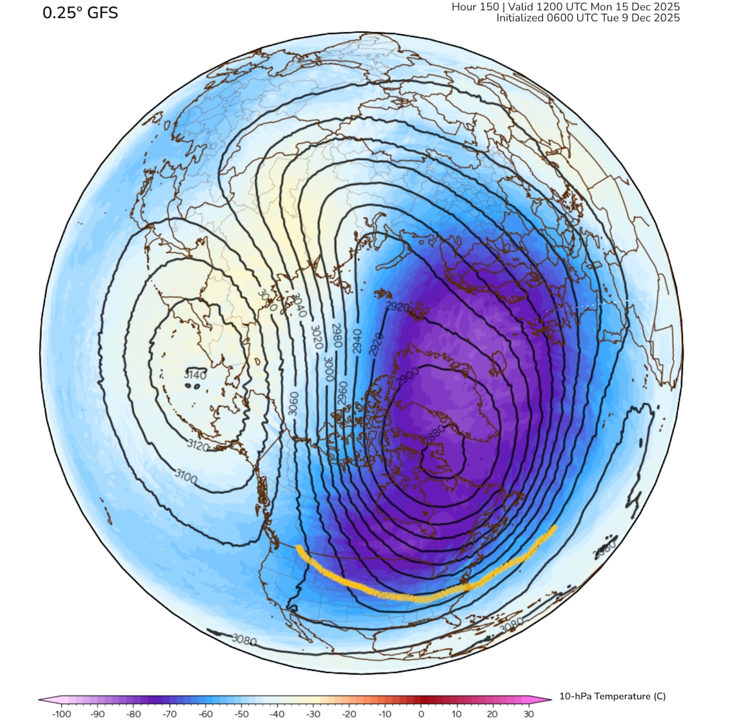 The GFS model shows the polar vortex slipping into the northern US by Monday morning.Polar Wx
Sign up here for our daily Globe Weather Forecast that will arrive straight into your inbox bright and early each weekday morning.
Ken Mahan can be reached at ken.mahan@globe.com. Follow him on Instagram @kenmahantheweatherman.