
It’s not often that the arid expanse of Cooper Creek in Australia becomes a vibrant oasis, but that’s exactly what happened after a deluge of rain swept through the area in 2025. Floodwaters, some of the worst in the region’s history, have transformed the normally brown, cracked desert into a burst of green. NASA satellites captured this rare moment, showcasing the astonishing, short-lived ecological bloom in a place typically known for its dryness and desolation. NASA’s Earth Observatory team, using their satellite technology, tracked the dramatic changes.
Floods Create an Unlikely Green Paradise
The flooding, which was triggered by a record-breaking rainfall that dumped more than a year’s worth of water in just one week, turned parts of western Queensland into a temporary watery wonderland. While this event disrupted lives, flooding entire towns and forcing evacuations, it also unleashed a wave of new life across the landscape.
As stated by the NASA’s Earth Observatory, floodwaters inundated Cooper Creek, transforming it from its typical dry state into a fast-flowing river system. The floods were so significant that they shattered previous records, leaving entire towns submerged underwater. For the first time in many years, the parched land began to show signs of life.
The massive amount of rain also spurred a rare transformation in the ecosystem. As floodwaters began to recede, lush vegetation started to emerge in areas that had been dry for years. This sudden explosion of green was a critical event for the local biodiversity.
“The silver lining of this flooding is a massive boost to the longer-term biodiversity,” says Geoff Penton, an operations manager working in the region. Though the damage to farmland and infrastructure was severe, the longer-term effects could revitalize the area’s ecosystems in ways that are hard to predict.
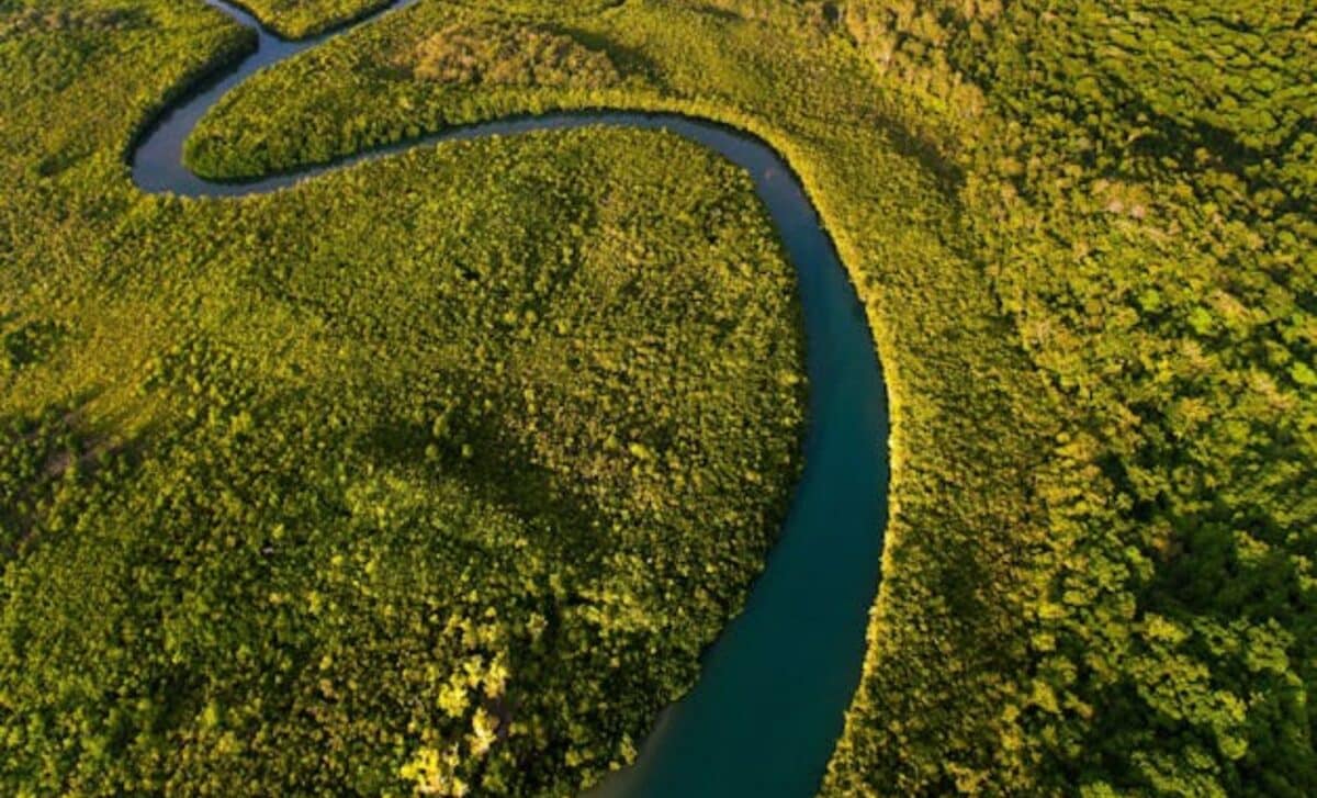
 Satellite image capturing the stunning transformation of Cooper Creek in Queensland, Australia. Credit: NASA’s Earth Observatory
Cooper Creek: The Heartbeat of Local Ecosystems
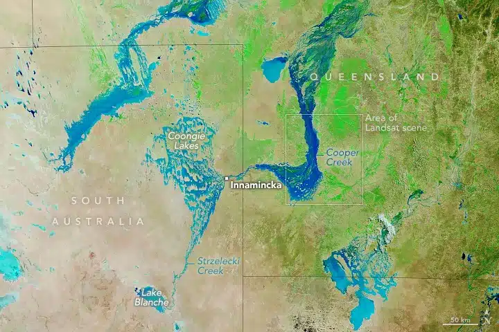
What makes Cooper Creek so fascinating is its role within the larger Lake Eyre Basin, a vast inland system where water doesn’t flow to the ocean, but instead evaporates or drains into salt pans. This means that floods like the one in 2025 are rare and precious, breathing new life into an otherwise dry and unforgiving landscape. According to NASA, these inland floods can trigger a cascade of events that help maintain the region’s fragile ecosystems.
During a flood like this, thousands of dormant eggs from tiny crustaceans and other invertebrates are suddenly brought to life. These creatures, often overlooked, form the foundation of a food chain that supports a variety of species, from fish to migratory birds.
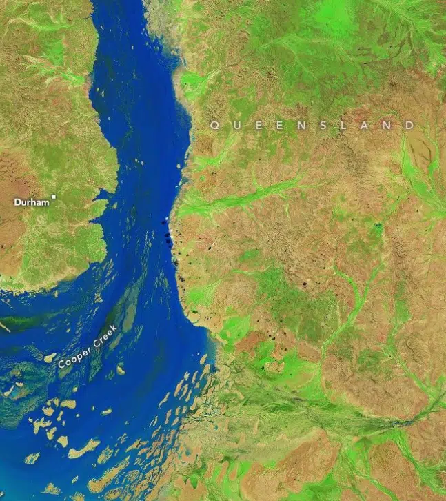
 The Landsat scene highlights the extensive flooding across Cooper Creek and nearby regions. Credit: NASA
Satellite Technology Brings Desert Life into Focus
NASA’s ability to monitor such a dramatic environmental shift is a testament to the power of modern satellite technology. Using sensors like Landsat and the Moderate Resolution Imaging Spectroradiometer (MODIS), NASA captured false-color images that highlight changes in the land.
“The images were acquired with the OLI-2 (Operational Land Imager-2) on Landsat 9. The band combination (6-5-4) helps distinguish where water and vegetation are present,” noted the statement from the American space agency.
This data is really helpful for conservationists, hydrologists, and even tour guides who need accurate info to plan for the impact of these floods.