
By Meteorologist Dan Brown, WBZ-TV
A storm could bring freezing rain to parts of Massachusetts Sunday night overnight into Monday, causing icy conditions.
After a frigid start Sunday morning, temperatures moderated in the afternoon. Highs topped off in the lower and middle 30s.
The area started with sunshine however clouds increased ahead of our next storm system.
This storm is a much milder system compared to the one Friday night that brought us the snow.

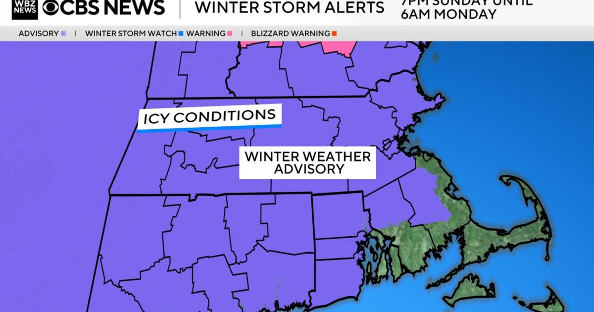
CBS Boston Graphic
However, with cold air at the surface, freezing rain has the potential to cause icy surfaces including walks ways, driveways and untreated roads.
In some areas in southern New Hampshire there might be enough ice accretion to cause power outages. That will not be the case in the Boston area.
Cold air continues to retreat, but as the precipitation arrives Sunday evening it will be cold enough at ground level for freezing rain, rain that freezes on contact.

CBS Boston Graphic
Temperatures along the shoreline will inch above freezing fairly quickly, however cold air will linger and will be last to leave north and west of Interstate 495 and into southern New Hampshire where icy conditions may last into the start of Monday morning’s commute.
For greater Boston and points south, temperatures should be safely above freezing for the morning commute. Freezing rain will go over to all rain everywhere by mid-morning.
Monday will be rainy and mild as the warmer air busts into southern New England. Highs will top off in the 40s to near 50 with periods of rain.
A cold front will move through late in the day with much colder air mass moving Monday night into Tuesday.
Tuesday will feature dry, windy conditions with wind chills in the single digits.
The cold and wind ease a bit for the New Year’s Eve before another blast of cold and wind to start 2026.
More from CBS News