
Europe’s Copernicus program has secured funding for six new satellite missions aimed at tracking vital environmental parameters. This commitment will significantly boost global efforts to monitor climate change, ice cover, agricultural health, and greenhouse gas emissions. The Copernicus satellites will not only provide crucial data for climate research but also support policy decisions critical for the future of the planet. The initiative, spearheaded by the European Space Agency (ESA), comes as part of a broader effort to improve environmental sustainability and response strategies on a global scale.
The Role of Copernicus Satellites in Monitoring Climate and Ice
Copernicus satellites have already played an instrumental role in Earth observation, offering a comprehensive look at our planet’s atmosphere, oceans, and landmasses. With the expansion of the Copernicus mission, the new satellite systems will be equipped with state-of-the-art sensors designed to track even more nuanced changes, including greenhouse gas emissions and the precise movements of ice sheets. As part of the Copernicus Imaging Microwave Radiometer Mission, the satellites will gather data on the polar seas and ice thickness, which are essential for understanding the dynamics of Earth’s frozen systems.
Simonetta Cheli, the director of Earth observation programs at ESA, emphasized the importance of these advancements, stating, “The decision by the UK Government to participate in the EU Copernicus Programme has been essential.” This re-engagement by the UK in 2024 is a significant development, restoring its role in space missions that will help provide more accurate data to track climate change. The data provided by these satellites will be invaluable not only for scientific communities but also for policymakers striving to meet global climate targets.
New Copernicus Satellites Will Enhance Greenhouse Gas Monitoring
One of the most exciting developments in this new Copernicus expansion is the launch of the Copernicus Anthropogenic Carbon Dioxide Monitoring Mission. The primary goal of this mission is to enhance the monitoring of greenhouse gases, including carbon dioxide and methane, which are crucial for tracking global warming. These gases are major contributors to climate change, and accurate, real-time monitoring is essential for setting and achieving national emission reduction targets, especially in light of the Paris Agreement.
The satellites in this mission will be positioned approximately 457 miles above Earth, using spectrometers to detect even the slightest changes in sunlight, which can indicate the presence of these gases. This technology will allow scientists to monitor emissions from cities, industrial activities, and other human sources. However, measuring emissions from such a high altitude is challenging, as cloud cover and weak winds can distort measurements. Despite these challenges, the mission is designed to provide highly detailed data that will help countries meet their climate goals more effectively.
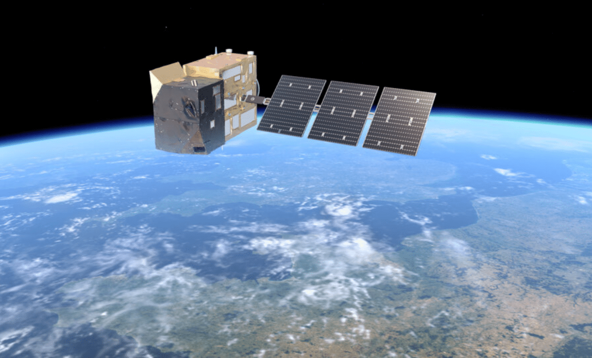
 Copernicus Carbon Dioxide Monitoring mission. Credit: ESA
Enhancing Agricultural Practices Through Copernicus Technology
Another remarkable feature of the new Copernicus satellite expansion is the Copernicus Hyperspectral Imaging Mission for the Environment. This mission will use hyperspectral imaging to collect highly detailed data on agricultural land, which will be invaluable for improving farming practices and increasing crop yield. Hyperspectral imaging captures information across hundreds of narrow spectral bands, allowing for a deep analysis of soil composition, water stress, and overall crop health.
With this data, farmers can make better decisions regarding irrigation, fertilization, and crop management. By identifying issues like nutrient deficiencies or water scarcity before they become visible to the naked eye, these satellites will enable farmers to optimize their land use and reduce waste. This mission will help bridge the gap between agriculture and technology, providing a vital tool for the future of global food security.
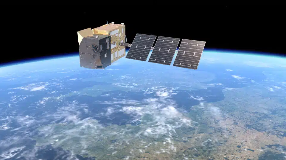
 LSTM: Copernicus Land Surface Temperature Monitoring. Credit: ESA
Copernicus Satellites Provide Critical Data for Climate Adaptation Strategies
The new Copernicus missions are not only about gathering data, they are about creating actionable insights for governments, businesses, and individuals to adapt to climate change. The Copernicus Land Surface Temperature Monitoring Mission is an example of this forward-thinking approach. By measuring the thermal infrared radiation emitted by Earth’s surface, the satellites will be able to detect temperature anomalies that can indicate heat stress in crops or urban heat islands.
Temperature data plays a pivotal role in understanding regional climate patterns, and these satellites will help scientists predict extreme weather events like droughts, heatwaves, and floods. This mission will also be invaluable for urban planners, who can use the temperature data to design cities that are more resilient to the impacts of climate change.
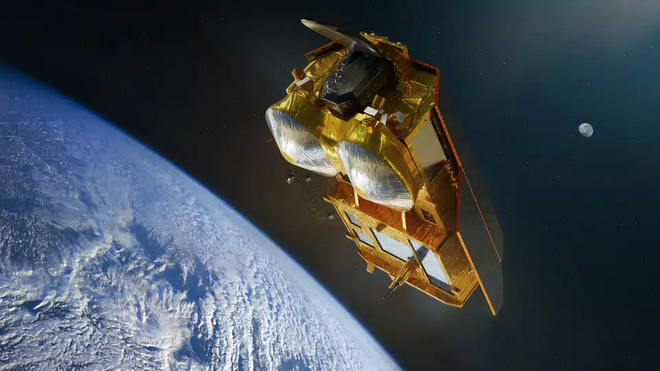 CRISTAL: Copernicus Polar Ice and Snow Topography Altimeter. Credit: ESA
Tracking Emissions and Pollution with Precision
In the fight against climate change, accurate emissions tracking is key. The Copernicus Anthropogenic Carbon Dioxide Monitoring Mission will provide unprecedented precision in measuring pollutants. Using advanced spectrometers, these satellites will track not just carbon dioxide, but also methane, nitrogen dioxide, and aerosols. These pollutants are critical to monitor, as they play a significant role in the warming of our planet.
While it’s important to measure the overall emissions of a country, understanding the source and specific location of these emissions is equally crucial. By identifying emission hotspots, governments and organizations can implement targeted policies that address pollution more effectively. This satellite network will also provide independent verification of emissions, offering transparency and accountability, which are vital for global climate agreements.
Copernicus Satellites and Their Impact on Polar Research
The polar regions of Earth are experiencing some of the most rapid and dramatic changes in climate. Copernicus Polar Ice and Snow Topography Altimeter Mission is designed to monitor these regions with extreme precision. This mission will use radar altimetry to measure the thickness of sea ice and snow, crucial data for understanding the rate at which polar ice sheets are melting.
The data from these satellites will inform climate models and help scientists predict how rising sea levels will affect coastal populations. Polar ice is a sensitive indicator of climate change, and its rapid melting is contributing to global sea level rise. By monitoring these changes in real-time, Copernicus satellites will provide invaluable information for future climate adaptation strategies.